Maps of Lübeck

Ostsee
1 : 50000 Lübeck (Německo : oblast) Reichs-Marine-Amt
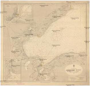
Meßtischblatt 662 : Travemünde, 1879
1 : 250000 Travemünde. - Aufn. 1877. - 1:25000. - [Berlin]: Reichsamt für Landesaufnahme, 1879. - 1 Kt.
Meßtischblatt 661 : Schwartau, 1900
1 : 250000 Schwartau. - Aufn. 1877, hrsg. 1879, einz. Nachtr. 1900. - 1:25000. - [Berlin]: Reichsamt für Landesaufnahme, 1900. - 1 Kt.
Meßtischblatt 578 : Rettin, 1879
1 : 250000 Rettin. - Aufn. 1877. - 1:25000. - [Berlin]: Reichsamt für Landesaufnahme, 1879. - 1 Kt.
Meßtischblatt 577 : Süsel, 1886
1 : 250000 Süsel. - Aufn. 1877, hrsg. 1879, einz. Nachtr. 1886. - 1:25000. - [Berlin]: Reichsamt für Landesaufnahme, 1886. - 1 Kt.
Meßtischblatt 2032 : Kalkhorst, 1912
1 : 250000 Kalkhorst. - Hrsg. 1879, bericht. 1904, letzte Nachtr. 1912. - 1:25000. - [Berlin]: Reichsamt für Landesaufnahme, 1912. - 1 Kt.
Meßtischblatt 579 : Warnkenhagen, 1934
1 : 250000 Warnkenhagen. - Hrsg. 1879, bericht. 1904, einz. Nachtr. 1910. - 1:25000. - [Berlin]: Reichsamt für Landesaufnahme, 1934. - 1 Kt.
Meßtischblatt 500 : Neustadt (i. Holstein), 1928
1 : 250000 Neustadt (i. Holstein). - Hrsg. 1879, einz. Nachtr. 1928. - 1:25000. - [Berlin]: Reichsamt für Landesaufnahme, 1928. - 1 Kt.
Meßtischblatt 501 : Grömitz, 1889
1 : 250000 Grömitz. - Aufn. 1877, hrsg. 1879, einz. Nachtr. 1889. - 1:25000. - [Berlin]: Reichsamt für Landesaufnahme, 1889. - 1 Kt.
Meßtischblatt502 : Klostersee, 1930
1 : 250000 Klostersee. - Hrsg. 1879, einz. Nachtr. 1930. - 1:25000. - [Berlin]: Reichsamt für Landesaufnahme, 1930. - 1 Kt.
Stralsund
Stralsund (Německo)
Stralsund
Stralsund (Německo)
Stralsund
Stralsund (Německo)
Stralsund
Stralsund (Německo)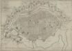
Plan der Stadt Lübeck: neu berichtigt und herausge
Saltzenberg, J. F.
Grund-Riß der Kayserlichen und des Heil. Röm. Reichs Freyen Stadt Lübeck
1 : 5400 Mollova mapová sbírka Seutter, Matthäus Seutter, Matthäus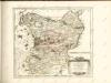

Wagria quae est Pars Orientalis Holsatiae
1 : 190000 Mollova mapová sbírka Janssonius, Johannes Schenk, Peter I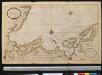
Nieuwe afteekening van een gedeelte van de Belt Zee daer in het in koomen van Wismar en de rivier van Lübeck geleegen aen de kust van Meekelen Burgh
Germany Johannes van Keulen
Composite: 115. Schonberg in Mecklenbg. (Germany)
1 : 100000 Reichsamt fur Landesaufnahme
Composite: 84. Gromitz. (Germany)
1 : 100000 Reichsamt fur Landesaufnahme

84. Gromitz. (Germany)
1 : 100000 Reichsamt fur Landesaufnahme
Composite: 83. Eutin. (Germany)
1 : 100000 Reichsamt fur Landesaufnahme
83. Eutin. (Germany)
1 : 100000 Reichsamt fur Landesaufnahme
114. Lubeck. (Germany)
1 : 100000 Reichsamt fur Landesaufnahme
Composite: 114. Lubeck. (Germany)
1 : 100000 Reichsamt fur Landesaufnahme
Meßtischblatt 660 : Curau, 1879
1 : 250000 Curau. - Aufn. 1877. - 1:25000. - [Berlin]: Reichsamt für Landesaufnahme, 1879. - 1 Kt.
Meßtischblatt 576 : Ahrensbök, 1888
1 : 250000 Ahrensbök. - Aufn. 1877, hrsg. 1879, einz. Nachtr. 1888. - 1:25000. - [Berlin]: Reichsamt für Landesaufnahme, 1888. - 1 Kt.