编目地图
Řiditelství [sic] státních lesů Rachovo


完整标题:Řiditelství [sic] státních lesů Rachovo
描述:1918 - 1938
发布日期:1918 - 1938
出版商:Voj. zeměpisný ústav
物理尺寸:20 x 30 cm
地图比例尺:1:75 000

Brusztura.
1914
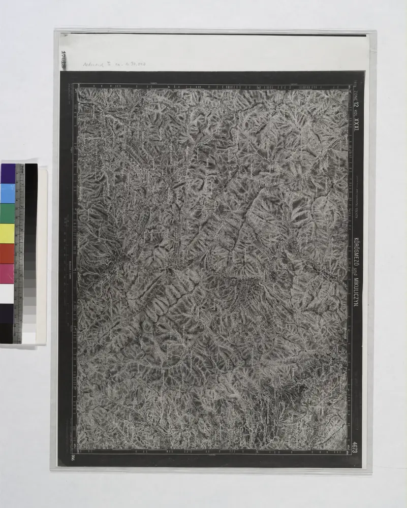
Korosmezo und Mikuliczyn.
1914
Řiditelství [sic] státních lesů Rachovo
1938
Voj. zeměpisný ústav
1:75k
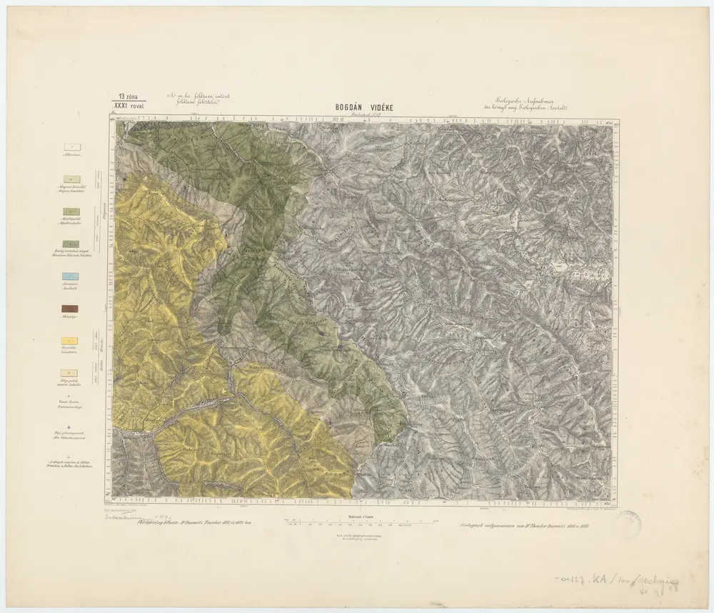
13 zóna, XXXI rovat, Bogdán Vidéke, uit: [Geologische Specialkarte der im Reichsrathe vertretenen Königreiche und Länder der österreichisch-ungarischen Monarchie] / geologische Aufnahmen der königl. ung. Geologischen Anstalt
1889
Königliche Ungarische Geologische Reichsanstalt; Königliche Ungarische Geologische Anstalt
1:75k
n/a
1800
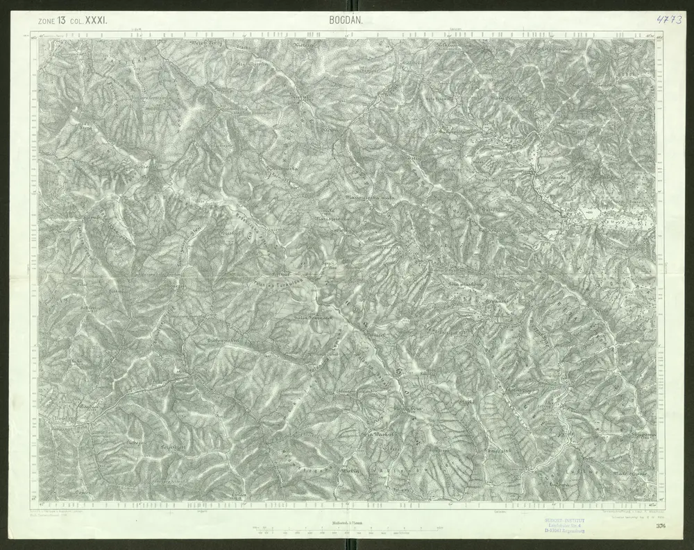
Bogdán
1914
Schrift und Gerippe v. Assistent Leitner. Terrainschraffirung v. Lieut. R. Meschede
1:75k
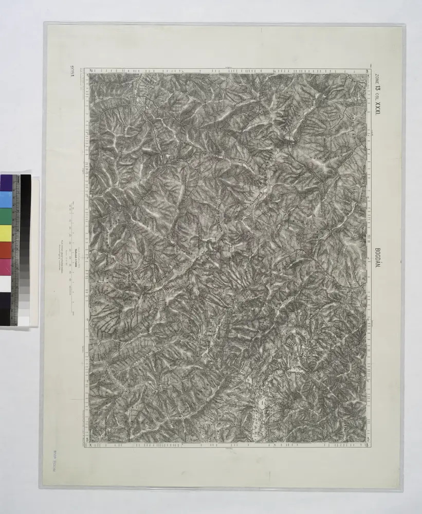
Bogdan.; Spezialkarte der osterreichisch-ungarischen Monarchie.
1907
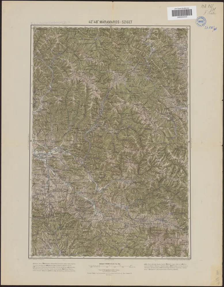
42°48° Máramaros-Sziget / K.u.k. militär-geographisches Institut
1889
K.u.k. militär-geographisches Institut
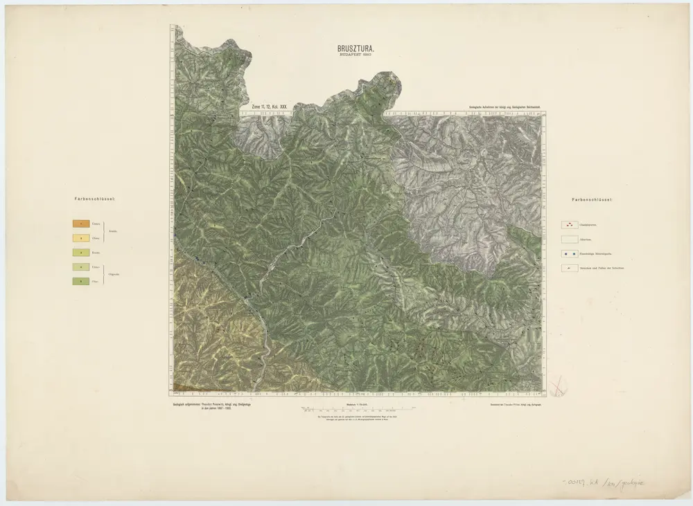
Zone 11, 12, Kol. XXX, Brusztura, uit: [Geologische Specialkarte der im Reichsrathe vertretenen Königreiche und Länder der österreichisch-ungarischen Monarchie] / geologische Aufnahmen der königl. ung. Geologischen Anstalt
1889
Königliche Ungarische Geologische Reichsanstalt; Königliche Ungarische Geologische Anstalt
1:75k
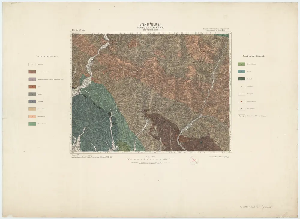
Zone 13, Kol. XXX, Gyertyánliget (Kabolapolyána), uit: [Geologische Specialkarte der im Reichsrathe vertretenen Königreiche und Länder der österreichisch-ungarischen Monarchie] / geologische Aufnahmen der königl. ung. Geologischen Anstalt
1889
Königliche Ungarische Geologische Reichsanstalt; Königliche Ungarische Geologische Anstalt
1:75k