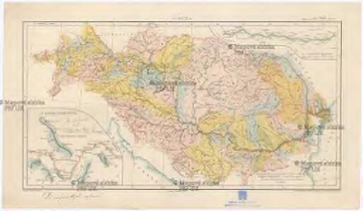
Maps of Romania
A Duna
1 : 4500000 Dunaj (řeka) Homolka, Josef Posner Károly Lajos és fia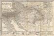
Das Österreichisch-Ungarische Reich
1 : 1850000 Rakousko-Uhersko Berghaus, Hermann Eulenstein, F. Justus Perthes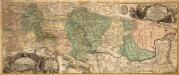
Danubius Fluviorum Europae Princeps
1 : 1600000 Mollova mapová sbírka Sandrart, Jakob von Sandrart, Jacob von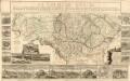
Le Cours Du Danube
Mollova mapová sbírka Fer, Nicolas de Fer, Nicolas de
Exactissima totius Danubii fluvii tabula et minores in eum influentes fluvii
1 : 2000000 1 Karte in 2 Teilen auf 1 Blatt : Kupferdruck ; 24 x 112 cm, auf Blatt 53 x 61 cm Danckerts, Theodorus [Danckerts]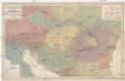
Völker und Sprachen Karte von Österreich und den Unter-Donau-Ländern
1 : 3000000 Rakousko-Uhersko Kiepert, Heinrich Dietrich Reimer
Völker und Sprachen Karte von Österreich und den Unter-Donau-Ländern
1 : 3000000 Evropa střední Kiepert, Heinrich D. Reimer
Völker und Sprachen Karte von Österreich und den Unter-Donau-Ländern
Rakousko-Uhersko Kiepert, Heinrich Riegel, Christoph Dietrich Reimer
Exactissima Totius Danubii Fluvii Tabula et minores in eum influentes Fluvii cum Omnibus adjantibus Regionibus
1 : 2000000 Mollova mapová sbírka Danckerts, Theodorus Danckerts, Theodor
Fluminum Princeps Danubius
1 : 1900000 Mollova mapová sbírka Valk, Gerhard Valck, Gerard
Fluminum princeps Danubius
1 : 1900000 Dunaj (řeka : oblast) Valk, Gerhard Gerardo Valk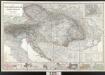
Der österreichische Kaiserstaat
Berghaus, Hermann; Stülpnagel, Friedrich von; Petermann, August; Habenicht, Hermann Perthes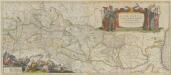
Danubius, Fluvius Europae Maximus, A Fontibus Ad Ostia. Cum omnibus Fluminibus, ab utroque latere, in illum defluentibus. [Karte], in: Theatrum orbis terrarum, sive, Atlas novus, Bd. 1, S. 310.
1 Karte aus Atlas Blaeu, Joan Blaeu, Willem Janszoon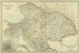
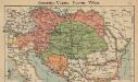
Composite: Austro-Hungarian Monarchy.
1 : 1642000 Johnston, W. & A.K.
Danubius, Fluvius Europae Maximus. A Fontibus Ad Ostia, Cum omnibus Fluminis, ab utroque latere, in illum fluentibus. [Karte], in: Gerardi Mercatoris et I. Hondii Newer Atlas, oder, Grosses Weltbuch, Bd. 1, S. 233.
1 Karte aus Atlas Mercator, Gerhard und Hondius, Jodocus Jansson, Jan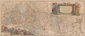
Danubius. Fluvius Europae Maximus. A Fontibus Ad Ostia. Cum omnibus Fluminib. ab utroque latere, in illum fluentibus. [Karte], in: Novus atlas absolutissimus, Bd. 2, S. 238.
1 Karte aus Atlas Janssonius Offizin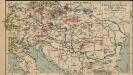
Österreich-Ungarn. Industrie und Verkehrswege
1 : 9000000 Österreich-Ungarn Industrie, Verkehrsnetz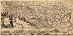
Le Cours du Danvbe depuis sa Source Iusqu'a ses Embouchures
1 : 1900000 Mollova mapová sbírka Sanson, Guillaume Jaillot, Alexis Hubert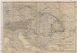
Oesterreichisch-ungarische Monarchie
1 : 2500000 Rakousko-Uhersko Geographisches Institut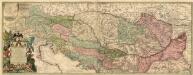
Cours Du Danvbe
1 : 1900000 Mollova mapová sbírka Nolin, Jean-Baptiste Nolin, Jean Baptiste II.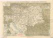
Eisenbahnkarte der österreichisch-ungarischen Monarchie
Österreich-Ungarn. Staaten
1 : 9000000 Österreich-Ungarn Politische Geografie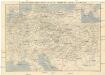
Eisenbahn-Routen-Karte von Mittel-Europa
Budapešť (Maďarsko) Ritter, Julius Broditzky, Joseph R. v. Waldheim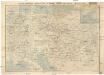
Eisenbahn-Routen-Karte von Mittel-Europa
Budapešť (Maďarsko) Ritter, Julius Broditzky, Joseph R. v. Waldheim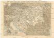
Eisenbahn-Routen-Karte von Mittel-Europa
Budapešť (Maďarsko) Ritter, Julius Broditzky, Joseph R. v. Waldheim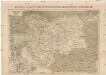
Eisenbahn-Karte der Österreichisch-Ungarischen Monarchie
Rakousko-Uhersko Broditzky, Joseph R. v. Waldheim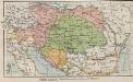
Österreich-Ungarn. Staaten
1 : 9000000 Österreich-Ungarn Verwaltungsgliederung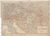
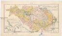
Karta Avstro-Vengrii
1 : 520000 Rakousko-Uhersko Il'jin, A.
Austria.
1 : 5000000 Finley, Anthony