Mappa catalogata
Sectional map indicating main automobile roads between Canada and United States


Titolo completo:Sectional map indicating main automobile roads between Canada and United States
Anno di illustrazione:1931
Data di pubblicazione:1931
Editore:National Development Bureau
Dimensione fisica:20 x 30 cm
Scala della mappa:1:2 534 400
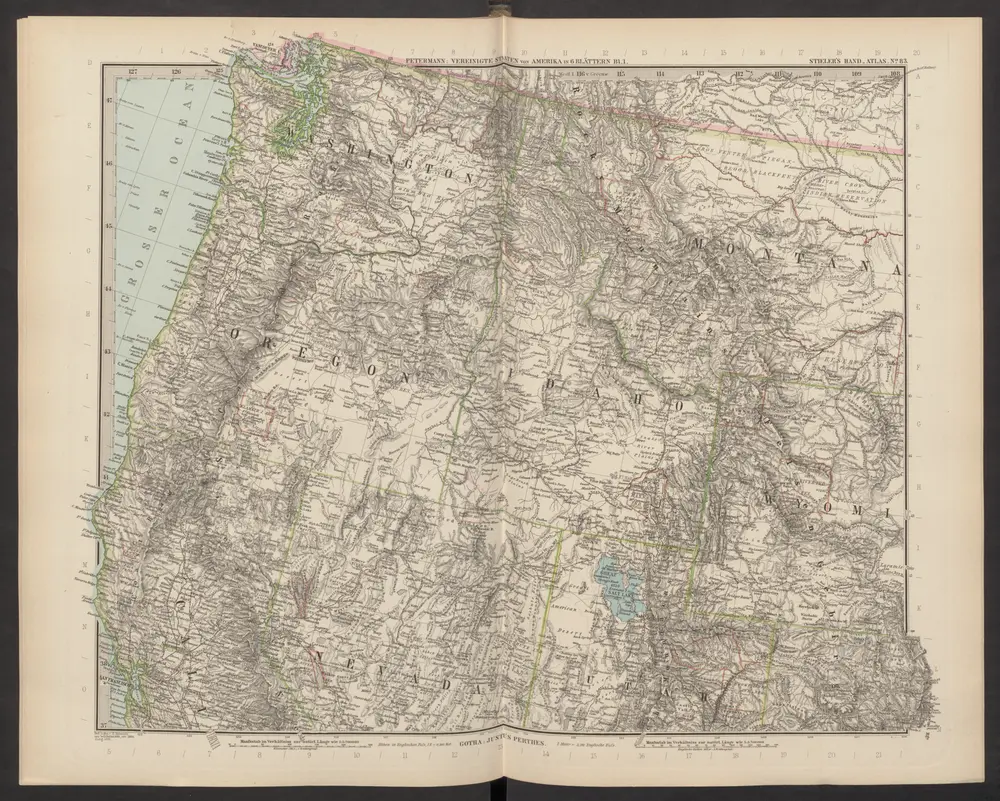
[Die Vereinigten Staaten von Amerika in 6 Blättern, Blatt 1]
1892
Stieler, Adolf

[Die Vereinigten Staaten von Nord-Amerika, Blatt 1]
1876
Stieler, Adolf
Sectional map indicating main automobile roads between Canada and United States
1931
National Development Bureau
1:3m
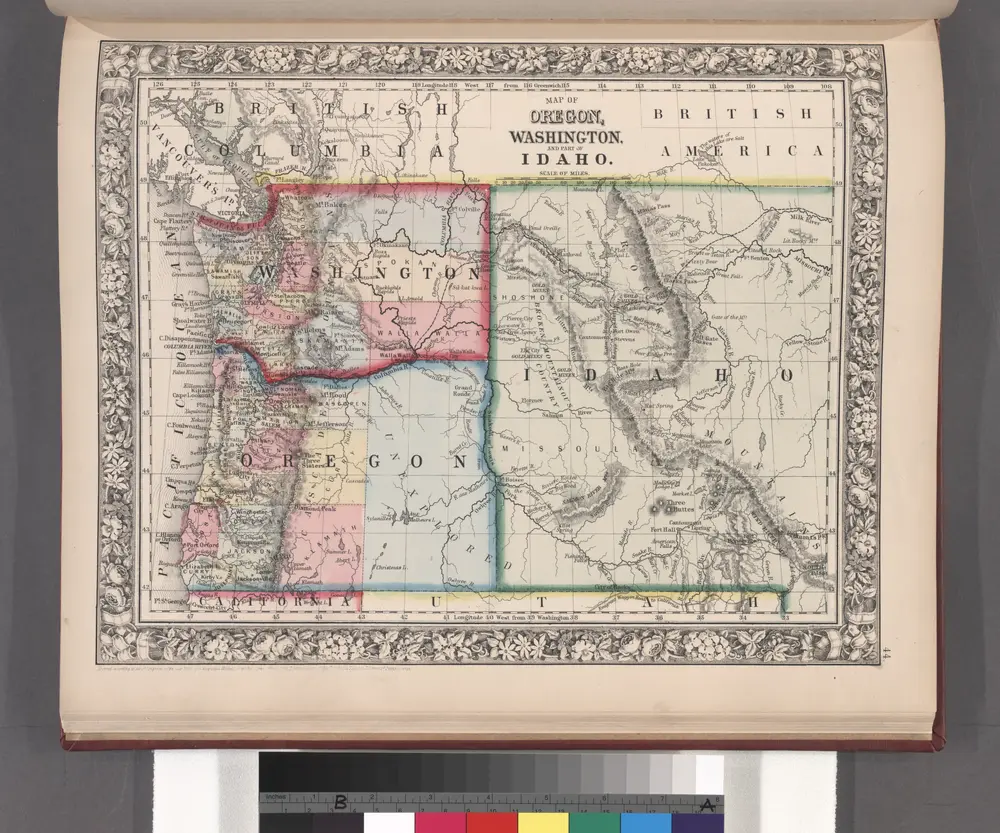
Map of Oregon, Washington and part of Idaho.
1860
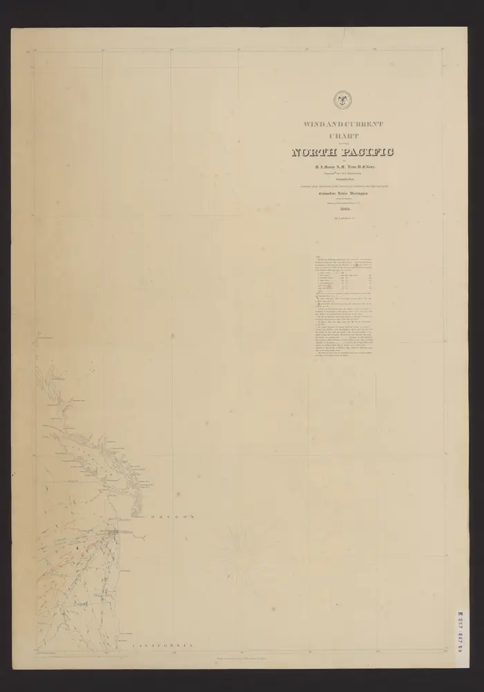
Wind and current chart of the North-Pacific
1849
Maury, Matthew Fontaine
1:4m
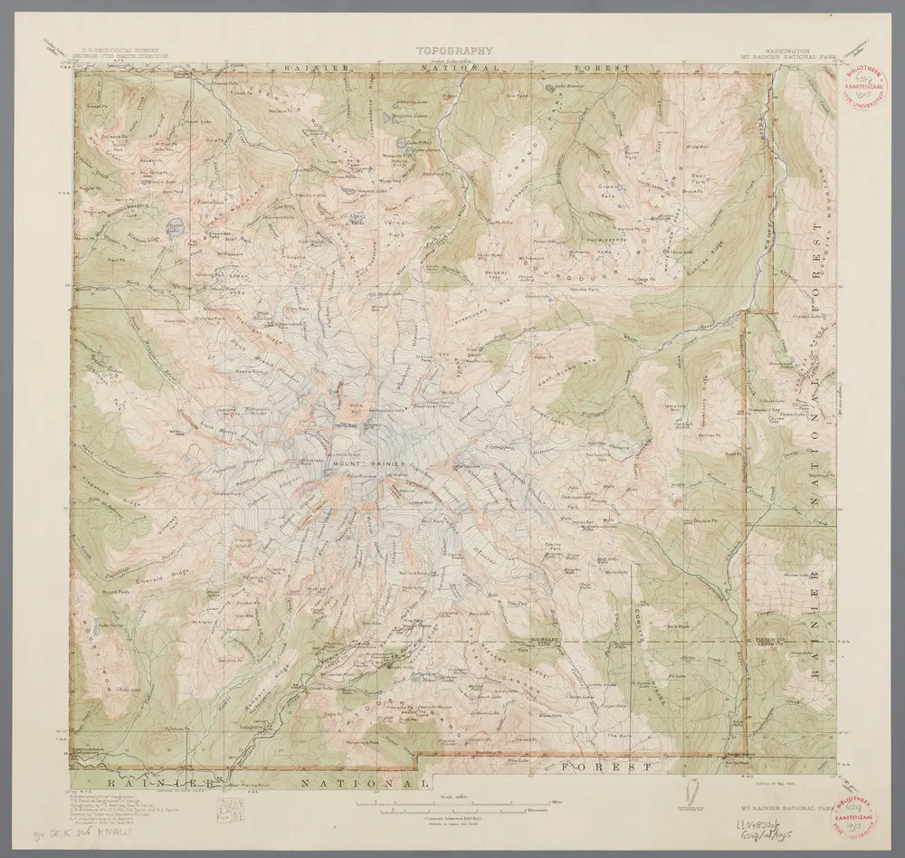
Washington, Mt. Rainier National Park : topography / R.B. Marshall, chief geographer ; T.G. Gerdine, geographer in charge ; topography by F.E. Matthes ... [et al.] ; engraved by U.S.G.S.
1915
Marshall, R. B.; Gerdine, T. G.; Matthes, François E.; United States Geological Survey
1:63k
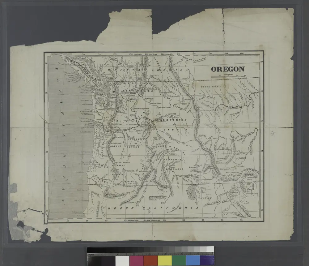
Oregon.
1842
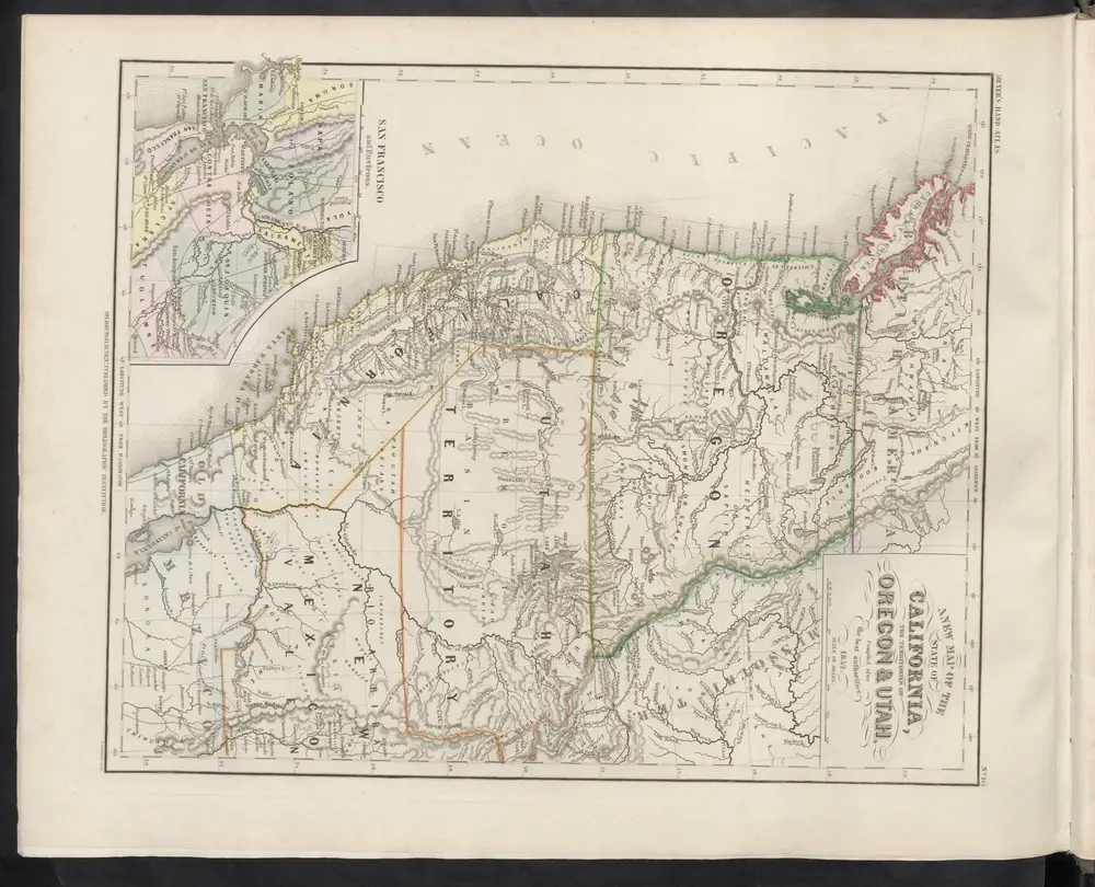
A new Map of the State of California, the Territoties of Oregon & Utah
1860
Meyer, J.
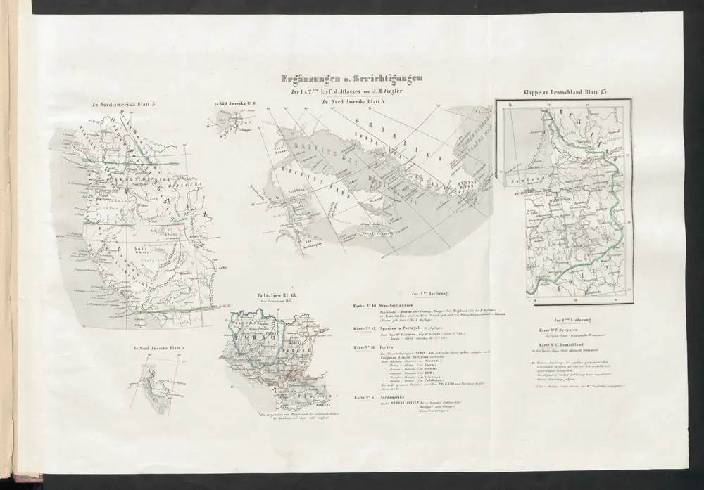
[Ergänzungen und Berichtigungen]
1851
Ziegler, Jakob Melchior
Map of an exploring expedition to the Rocky Mountains in the year 1842 and to Oregon & north California in the years 1843-44
1845
Frémont, John Charles
1:2m