Maps of Metro Vancouver Regional District

Alluette and Stave Lake, Brit. Columbia
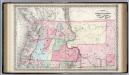
Britská Kolumbie
Thomas Bros. Highway Map, State of Washington.
1 : 1360009 Thomas Brothers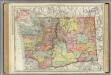
Washington.
1 : 1014000 Rand McNally and Company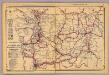
Washington.
1 : 1500000 Rand McNally and Company
Map of the Gold Regions of the Frazer River and the Washington Territory on the Western Coast of America. By J. Wyld
Map of the Gold Regions of the Frazer River and the Washington Territory on the Western Coast of America. By J. Wyld. London
Carta Esferica de los Reconocimientos hechos en la Costa N.O.
1 : 1800000 Espinosa y Tello, J.
Cote NO, l'Amerique 3.
1 : 1500000 Vancouver, George, 1757-1798
The Coast of N.W. America.
1 : 1030000 Vancouver, George, 1757-1798
Rand McNally Official 1925 Auto Trails Map British Colombia.
1 : 1077120 Rand McNally and Company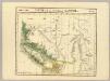
Partie, Nouvelle Hanovre. Amer. Sep. 31.
1 : 1641836 Vandermaelen, Philippe, 1795-1869
Oregon and Washington.
1 : 2550000 Johnson, A.J.
Oregon and Washington.
1 : 2550000 Johnson, A.J.
Map Of The Grand Trunk Pacific Railway In British Columbia.
1 : 1250000 Grand Trunk Pacific Railway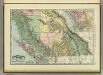
British Columbia.
1 : 2400000 Rand McNally and Company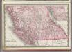
British Columbia.
1 : 2400000 Rand McNally and Company
Map Of Oregon, Washington, And Part Of British Columbia.
1 : 4000000 Mitchell, Samuel Augustus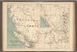
No.13, Telegraphs : British Columbia, Yukon and Alberta
1 : 2217600 Canada. Department of Interior
Washington and Oregon (and Idaho and Montana)
1 : 3500000 Colton, G.W.
Washington And Oregon.
1 : 3500000 Colton, G.W.
British Columbia. Historical Maps.
1 : 3787000 Hammond, C.S.
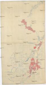
Washington, Mt. Rainier National Park : topography / R.B. Marshall, chief geographer ; T.G. Gerdine, geographer in charge ; topography by F.E. Matthes ... [et al.] ; engraved by U.S.G.S.
1 : 62500 Annotatie geografische gegevens: Opname: 1910-1911, 1913 Marshall, R. B.; Gerdine, T. G.; Matthes, François E.; United States Geological Survey [Washington, D.C. : U.S. Geological Survey]
Bancroft's Map Of Oregon, Washington, Idaho, Montana And British Columbia.
1 : 1520640 Bancroft, H.H.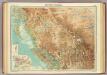
British Columbia.
1 : 2500000 John Bartholomew and Son
U.S. West of Mississippi R. 1.
1 : 2000000 Freyhold, Edward; Warren, Gouverneur Kemble, 1830-1882; United States. Army. Corps of Engineers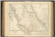
British North America. Sheet III. Pacific Coast.
1 : 2407680 Fullarton, A. & Co.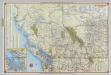
Shell British Columbia - Alberta.
1 : 2471040 Shell Oil Company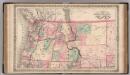
Oregon, and Washington Territory.
1 : 3000000 Colton, G.W.
Philip’s Map of British Columbia and Vancouver Island
Philip's Map of British Columbia and Vancouver Island.
138-39. Wash., Ore., Ida.
1 : 3000000 Touring club italiano