Maps of powiat pajęczański

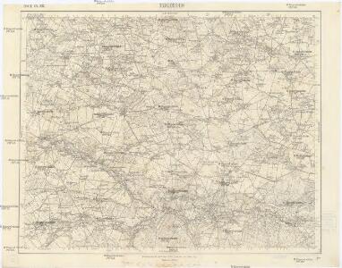
Dsjaloschin
1 : 75000 K. u. k. Militärgeographisches Institut
121. Landsberg i. O. Sch., uit: Topographische Uebersichtskarte des Deutschen Reiches / herausgegeben v. d. Kartogr. Abt. d. Königl. Preuß. Landesaufnahme
1 : 200000 titelvariant: Topogr. Übersichtskarte des Deutschen Reiches; Annotatie: Titel boven bladen ook: Topogr. Übersichtskarte des Deutschen Reiches; Annotatie geografische gegevens: Op elk blad twee maatstokken: 10 Kilometer = 5,5 cm; 1 geogr. Meile = 3,6 cm; Legenda onder op elk blad Königlich Preußische Landesaufnahme. Kartographische Abtheilung [S.l : Königlich Preußische Landesaufnahme, Kartographische Abtheilung]
Wielun 78, uit: Special-Karte von Mittel-Europa / nach amtlichen Quellen bearbeitet von W. Liebenow
1 : 300000 titelvariant: W. Liebenow's Mittel-Europa; Annotatie: Titel boven de bladen: W. Liebenow's Mittel-Europa Johannes Wilhelm Liebenow 1822-1897 Frankfurt a. M. : Ludwig Ravenstein
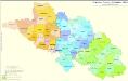
Kartographische Darstellung der Abstimmungs-Ergebnisse von Oberschlesien
1 : 100000 [im Auftrag des Auswärtigen Amtes bearb. in der Plankammer des Preußisch-Statistischen Landesamtes vom Gerke] ; mit Genehmigung der Landesaufnahme, Berlin Berlin : Berliner Lithographisches Institut
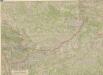
Situations Plan der trokenen Landesgraenze zwischen dem Weichsel und Pietruvka Flus von kais. koen. Oesterreich. Schlesien und koen. Preussisch Schlesien
1 : 10000 Visla-oblast (Polsko) Kuffay, Franz Engel
Sect. 21: Breslau, uit: Geologische Karte des Deutschen Reichs in 27 Blaettern / [von] Richard Lepsius ; Red. von C. Vogel
1 : 500000 Annotatie: Blad 18 ontbreekt; Een aantal bladen op linnen; Een aantal bladen gereviseerd 1913-1914; Annotatie geografische gegevens: Met schaalstokken o.a. in kilometers; Legenda Carl Vogel 1828-1897 Gotha : Justus Perthes
Kolonie założone za panowania Fryderyka Wielkiego na Śląsku pruskim
Polen Schlesien Preußen Stadtgründung Friedrich II.

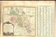
Amplissimi Episcopatvs Wratislaviensis primum in suos IV Archidiaconatus deinde in Circulos Archipresbyteriales divisi Tabula Geographica :
1 : 730000 Mollova mapová sbírka Felbiger, Johann Ignaz Homann, Johann Baptista - dědici
Bez titulu: Přehledná mapa střední Evropy

Militair- Commerzial- und Post-Strassen von Dresden nach Warschau
Drážďany (Německo)
Militair- Commerzial- und Post-Strassen von Dresden nach Warschau
Drážďany (Německo)
Strategische Übersichts-Karte des polnisch-litaurischen Armee-Bewegungraumes
Galizien, Karpathen, Bukowina nebst anschließendem Ungarn, Russland u. s. w.
Ravenstein, Hans
Karte der Provinz Schlesien
1 : 520000 Slezsko Handtke, Friedrich C. Flemming
Československá republika země Česká a Moravskoslezská
Kreise der Provinz Schlesien 1864
Preußen, Schlesien, Verwaltungsgliederung Kunz, Andreas ; Moeschl, Joachim Robert
Strassen- und Eisenbahnkarte des oesterreichischen Kaiserthumes
1 : 864000 Blatt 3 Schaller, G. K.K. Militärisch-Geografisches Institut, Karten-Evidenthaltungs-Abteilung
Silesia.
1 : 1700000 Bowen, Frances
Preussische Provinz Schlessien
1 : 600000 Prusko Gräf, Adolf Geographisches Institut
Preussische Provinz Schlessien
1 : 550000 Slezsko (Polsko) Gräf, Adolf Biedermann, E. Geographisches Institut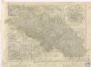
Provinz Schlesien

Ducatus Silesiae Tabula
1 : 1430000 Mollova mapová sbírka Pfeffel, Johann Andreas Engelbrecht, Christian
Ducatus Silesiae Tabula.
1 : 1430000 Mollova mapová sbírka Pfeffel, Johann Andreas Engelbrecht, Christian
Ducatus Silesiae tabula Accuratissima
1 : 1450000 Mollova mapová sbírka Pfeffel, Johann Andreas
Die Preussische Provinz Posen, bestehend aus den Regierungs-Bezirken: Posen & Bromberg
1 : 1850000 Provinz Posen
Schlesien.
1 : 730000 Weiland, C. F. (Carl Ferdinand), d. 1847
Reverendissimo et Celsissimo Principi et Domino Domino Philippo Gotthardo Principi de Schaffgotsch...