Maps of powiat białostocki

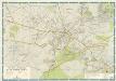
[Tykotzin, Białystok, Zabłudowo, Mazowieck, Bielsk, Narew, Ciechanowiec, Bócki, Orla]
1 : 100000 Białystok-oblast (Polsko)
Bialystok 41, uit: Special-Karte von Mittel-Europa / nach amtlichen Quellen bearbeitet von W. Liebenow
1 : 300000 titelvariant: W. Liebenow's Mittel-Europa; Annotatie: Titel boven de bladen: W. Liebenow's Mittel-Europa Johannes Wilhelm Liebenow 1822-1897 Frankfurt a. M. : Ludwig Ravenstein
Bez titulu: Staroselcy
Plan Bialegostoku

Obwod Białostocki
Białystok-oblast (Polsko)
Brzesc nad Bugiem

Topographische Karte der Gegend um Warschau
Varšava-oblast (Polsko) Artaria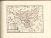


Übersichtskarte von Mittel - Europa

Übersichtskarte von Mittel - Europa

Königsberg, Guttstadt, Biełostok, Suwałki
1 : 750000 Białystok (Polsko : oblast) Konrad, Adalbert K. u. k. Militärgeographisches Institut
Königsberg, Guttstadt, Bielostok, Suwalki
1 : 750000 Białystok (Polsko : oblast) K. k. militär-geographisches Institut
Plan einer trigonometrischen Ausmessung welche in den Jahren 1796 und 1797 in Ostpreussen und Lithauen ausgeführt worden
1 : 800000 Landes-Industrie-Comptoir
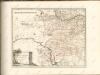
West-Galizien
Chełm-oblast (Polsko) Müller, Karl Benedict, Ant. im Verlage des Kunst und Industrie Comptoirs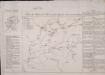
Feldzug der Russen und Polen zwischen Bug und Narew vom 13ten bis 26sten Mai 1831

West Galizien
Chełm-oblast (Polsko) Müller, Karl Benedict, Ant. Kunst und Industrie Comptoirs
West Galizien
Halič (Polsko a Ukrajina) Müller, Karl Benedict, Ant. im Verlage des Kunst und Industrie Comptoirs
Sect. 11: Allenstein, uit: Geologische Karte des Deutschen Reichs in 27 Blaettern / [von] Richard Lepsius ; Red. von C. Vogel
1 : 500000 Annotatie: Blad 18 ontbreekt; Een aantal bladen op linnen; Een aantal bladen gereviseerd 1913-1914; Annotatie geografische gegevens: Met schaalstokken o.a. in kilometers; Legenda Carl Vogel 1828-1897 Gotha : Justus Perthes
Siedlee 53, uit: Special-Karte von Mittel-Europa / nach amtlichen Quellen bearbeitet von W. Liebenow
1 : 300000 titelvariant: W. Liebenow's Mittel-Europa; Annotatie: Titel boven de bladen: W. Liebenow's Mittel-Europa Johannes Wilhelm Liebenow 1822-1897 Frankfurt a. M. : Ludwig Ravenstein
Die Einnahme von Brest-Litowsk. (26. August 1915.)
Brest-Litowsk Weltkrieg <1914-1918>, Eroberung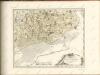

Drogiczyn
1 : 75000 Drohiczyn-oblast (Polsko) Herwegg, J. K. u. k. Militärgeographisches Institut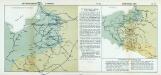
Nr. 18a. Die Winterschlacht in Masuren
Masuren Weltkrieg <1914-1918>, Ostfront
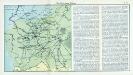
Erste Offensive in Polen
1 : 4000000 Polen Feldzug, Weltkrieg <1914-1918>
Li palatinati di Nowogrodek Podlachia e Brzesk Littew / tratta dall'atlante polacco del Sig.r Rizzi
1 : 1300000 1 Karte : Kupferdruck ; 31 x 40 cm Zuliani, Giuliano presso Antonio Zatta
(La Prusse)
1 : 4000000 Bruyset, Jean-Marie; Schneider, J. H.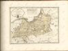
![[Tykotzin, Białystok, Zabłudowo, Mazowieck, Bielsk, Narew, Ciechanowiec, Bócki, Orla]](https://images-2.georeferencer.com/images/iiif/835790946779/full/,300/0/native.jpg)

