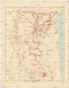
Maps of South Sinai Governorate

Die südliche Galala mit dem nördlichen Theil der krystallinische Küstengebirge am Rothen Meer
1 : 200000 Schweinfurth, Georg Dietrich Reimer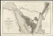
Carte de l'Arabie pétrée
1 : 500000 levée et dressée par Léon de Laborde, en 1828 rectifiée sur les observations astronomiques et les cartes de Niebuhr, Larochette, la Commission d'Egypte, Home, Popham, Valentia, Burckhardt, Erhenberg et Rüppel, et gravée par Collin, pour accompagner le voyage de l'Arabie Petrée Paris : Giard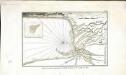
Plan de la partie septentrionale du golfe arabique et de la ville de Suès
1 Karte : Kupferdruck ; 18 x 29 cm Nyon
Carte de la presqu'ile de Sinai
1 : 1000000 Sinajský poloostrov (Egypt) Service géographique de l'Armée
Aegypti Recentio Descriptio. [Karte], in: Theatrum orbis terrarum, S. 120.
1 Karte aus Atlas Ortelius, Abraham
Red Sea (1917)
[The Red Sea, in five sheets. Sheet 1. Surveyed ... 1830-4. The Gulf of Suez and Coast to Kosaïr ... 1871-2. (Sherm Joobbah.--Sherm Yahar.--Tór Harbour)]
Land zwischen den kleinen und grossen Kataracten des Nil
1 : 288000 Egypt Prokesch, A. von Wöber, J.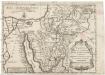
Tabula itineris, et stationum Israelitarum in deserto
1 : 950000 Palestina Starckman, P.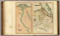
Egypt, Abyssinia.
Thomson, John
Die Nilländer...

Voyage des Israelites depuis leur sortie d'Egypte.
1 : 3000000 Houze, Antoine Philippe
Palestine, l'Arabie Petree.
1 : 1370000 Andriveau-Goujon, J.
Egypt.
1 : 1584000 Burr, David H., 1803-1875
Synoptische tafel der H. Geschiedenis : van Mozes tot aan den tempel van Salomon (1491-1005 vóór Christus) / door H. Lambrecht
Annotatie: Hierop afgebeeld: Kaart voor de geschiedenis der reis van de Joden uit Egypte naar het land van belofte en hunner intrede in dat land. - Schaal: [1:3.000.000]. Palestina tusschen de 12 stammen verdeeld. - Schaal: [1:1.875.000] [S.l. : s.n.] / (Gent : Poelman)
Polostrov [sic] Sinajský s naznačeným pochodem Israelitův přes poušť k vydobytí země Kanaan
1 : 1900000 Izrael Uměl. závod Ed. Hölzela
Mansionum populi Israelitici in deserto.
Sinajský poloostrov (Egypt) Grasmüller, E. Demeuse, Laurent
Terra Promissionis
Sinajský poloostrov (Egypt) Dalrymple, Alexander Berra, Marco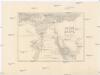
Dolní Egypt
1 : 1000000 Egypt Král z Dobré Vody, Vojtěch Fr. Šimáček
Egypt.
1 : 1950000 Greenleaf, Jeremiah
Egypt.
1 : 1950000 Greenleaf, Jeremiah
Historický atlas revolučního hnutí
Egypte geog. 3.
1 : 1000000 France. Armee. Genie; Jacotin, Pierre, 1765-1827
Afbeelding van Egypte, de woestyne der Schelfzee, en 't Land Kanaan : strekkende tot opheldering der bybelsche geschiedenis, dewelke begint van Jakobs vertrek naar Egypte, en eindigt met de verwinning van 't Land Kanaan
1 : 1400000 ontworpen door W.A. Bachiene J. van Jagen mapp. sculpsit, et figur. apposit. sculpturam curavit ; J.C. Philips fecit. te Gorinchem : by Nicolaas Goetzee
Palestine.
1 : 1027000 Colton, G. Woolworth
Historische Karte von Palestinae und Arabia Petraea mit einen grossen Theil von AEgypten
1 : 1100000 Egypt Mayr, Georg Wilkendorf, Fr. Mey & Widmayer
[Recto], uit: Terra Sancta qua in Sacris Terra Promissionis olim Palestina / [Willem Jansz. Blaeu]
1 : 1000000 Annotatie: Uit: Tweede deel van 't Toonneel des Aerdriicx, ofte Nieuwe atlas. - Amsterdami : apud Guiljelmum et Iohannem Blaeu, 1635 [of latere editie]; Annotatie geografische gegevens: Noordwest boven Blaeu, Willem Jansz. Amstelodami : ex officina Guiljelmi Blaeu
Nvova, et copiosa, descrittione di tutto l'Egitto
Egypt Forlani, Paolo da Paulo Forlani Veronese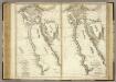
Ancient and Modern Egypt.
1 : 1950000 Playfair, Principal
Palestine - Physical Geography.
Milner, Thomas