Maps of Turkey
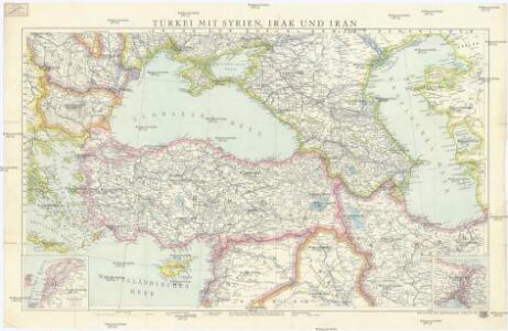
Türkei mit Syrien, Irak und Iran
1 : 3000000 Bospor (Turecko : průliv) Kartogr. Anstalt Freytag-Berndt und Artaria
Asie-Mineure, Armenie, Syrie, Mesopotamie, Caucase.
1 : 5400000 Picquet, C.
Asie Mineure, Armenie, Syrie, Mesopotamie.
1 : 5400000 Levasseur, E.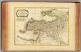
Turquie d'Asie.
1 : 7100000 Bonne, Rigobert, 1727-1794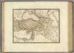
Asie-Mineure, Armenie, Syrie, Mesopotamie, Caucase.
1 : 5400000 Brue, Adrien Hubert, 1786-1832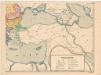
Evropa XIX. století: od vídeňského kongresu r. 1815, do rozhodnutí na frontách světové války r. 1918
Kašpar, Jan
Mediterranean Sea E.
1 : 9000000 Andree, Richard; Times (London, England)
Mittelmeerlander ostliche.
1 : 9000000 Andree, Richard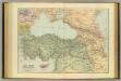
Asia Minor, Caucasus, Black Sea.
1 : 3220177 Stanford, Edward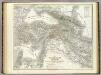
Turkei.
1 : 3600000 Kiepert, Heinrich, 1818-1899
Türkisches Reich und Südrußland
1 : 5000000 Blízký východ Velhagen & Klasing
Die asiatische Türkei die Kaukasusländer u. West-Persien
1 : 3600000 Kavkaz-oblast Kiepert, Heinrich Wibel, E. Geographisches Institut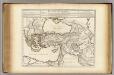
Retraite des Dix Mille Tabula.
1 : 5000000 L'Isle, Guillaume de, 1675-1726
Turkey in Asia and the Caucasian Provinces of Russia.
1 : 6000000 Colton, G.W.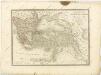

Grece. Caucase et Crimee.
1 : 2000000 Jouvet et Cie.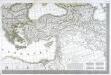
Carte d'Europe ou sont tracées les limites des empires, royaumes, et etats souverains, feuille 6
1 Blatt : 63 x 93 cm Semen etc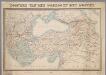
Tooneel van den oorlog in het Oosten / Top. Bureau, Min. van Oorlog
1 : 3000000 Annotatie geografische gegevens: Met 2 schaalstokken Ministerie van Oorlog. Topographisch Bureau ['s-Gravenhage : Top. Bureau, Min. van Oorlog]
Turkey In Asia And The Caucasian Provinces Of Russia.
1 : 6019200 Colton, G.W.
Osmanisches Reich
1 : 10000000 osmanská říše F.A. Brockhaus Geogr.-artist. Anstalt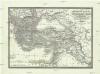
General Karte des Türkischen Reichs (in Europa und Asien)
1 : 6150000 Evropa jihovýchodní Artaria
General Karte des Türkischen Reichs (in Europa und Asien)
1 : 6150000 Asie západní Fried, Franz Artaria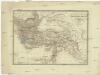
General Karte des Türkischen Reichs in Europa und Asien
1 : 6150000 Asie západní Fried, Franz Artaria
Retraite des dix mille
1 Karte : Kupferdruck ; 37 x 55 cm, Bildgrösse 45 x 57 cm L'Isle; Buache apud auctorem in ripâ vulgo dictâ la rue des Noyers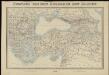
Tooneel van den oorlog in het Oosten
1 : 3000000 Top. Bureau, Min. van Oorlog ['s-Gravenhage] : Top. Bureau, Min. van Oorlog
Turcia Asiatica exhibens Natoliam modernam
1 : 4900000 Arménie impensis Homannianorum Heredum
Turcia asiatica exhibens Natoliam modernam
1 : 4900000 Arménie impensis Homannianorum Heredum
Uebersichts Karte des russisch - türkischen Kriegsschauplatzes in Europa und Asien

Karte des Küstenlandes von Aegypten, Syrien und Kleinasien
1 : 4750000 Egypt