Maps of okres Kladno

[Kladensko-slánská uhelná pánev a její první železnice]
Kladno (Česko : oblast)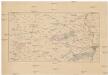
[Kladno, Rakovník a okolí]
Kladno-oblast (Česko)
[Umgebung von Prag]
Praha-oblast (Česko)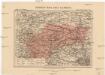
Generální mapa okolí slanského
1 : 220000 Slaný-oblast (Česko) Wagner, Jan Eduard Koch F. Kytka
Umgebungen von Prag
1 : 750000 Praha (Česko : oblast) K. k. militär-geographisches Institut
Umgebung von Prag
Praha-oblast (Česko) Berra, Marco Marco Berra
Trigonometrisches Netz zur geographischen Ortsbestimmung von Rotenhaus
1 : 340000 Rotava (Česko) Morstadt, Josef Pluth, C.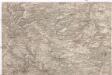
[Praha - západní okolí]
Praha-oblast (Česko)
Charte der zwischen der K. Hauptstadt Prag und der K. Kreisstadt Pilsen beabsichtigten Eisenbahn
1 : 75000 Ost-Blatt [Verlagsname nicht ermittelbar]
Umgebung von Prag
1 : 144000 Praha-oblast (Česko) Knorr, A. Gargani, Ludwig
II. vojenské mapování 13
1 : 144000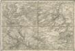
Special - Karte des Koenigreiches Boehmen
Generální mapa okresního hejtmanství Slánského [sic]
1 : 220000 Slaný-oblast (Česko) Wagner, Jan Eduard F. Kytka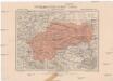
Generální mapa okresního hejtmanství Slánského [sic]
1 : 220000 Slaný-oblast (Česko) Wagner, Jan Eduard F. Kytka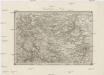
Umgebungen von Prag
1 : 144000 Praha-oblast (Česko) Gargani, Ludwig K. u. k. Militärgeographisches Institut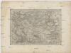
Umgebungen von Prag
Praha-oblast (Česko) Gargani, Ludwig K. u. k. Militärgeographisches Institut
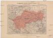
Mapa hradů, zámků a tvrzí v Rakovnicku a Slánsku
1 : 200000 Rakovník (Česko : oblast) Král z Dobré Vody, Vojtěch Šimáček
Generální mapa okolí pražského
1 : 220000 Praha-oblast (Česko) Wagner, Jan Eduard F. Kytka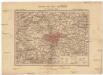
Generální mapa okolí pražského
1 : 220000 Praha-oblast (Česko) Wagner, Jan Eduard F. Kytka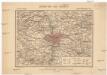
Generální mapa okolí pražského
1 : 220000 Praha-oblast (Česko) Wagner, Jan Eduard F. Kytka
Die Gegend um Prag, oder der alte Prager Kreys, nebst den angrenzenden Landschafften des Rakonizer, Boleslawer u. Kaurzimer Cr.
1 : 137000 Mollova mapová sbírka Homann, Johann Baptist Homann, Johann Baptista - dědici
Zeměznalecká mapa okolí pražského
Čechy střední (Česko) Krejčí, Jan
Zeměznalecká mapa okolí pražského
Čechy střední (Česko) Krejčí, Jan Schwarzenberg, Bedřich nákladem českého Museum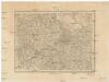
[Střední Čechy.
Čechy střední (Česko) Scheiner, Josef Anděl, Bedřich im Verlage des Geograph. Instituts
Verkehrs - Karte von Böhmen, Mähren, Schlesien, Erzh. Oesterreich...

[Praha a okolí]
1 : 144000 Praha-oblast (Česko)
Die Gegend um Prag, nebst den angränzenden Landschaften des Rakonizer, Boleslawer u. Kaurzimer Cr
1 : 200000 Praha-oblast (Česko) Müller, Johann Christoph Hom. Erb.
Die Gegend um Prag, oder der alte Prager Kreys nebst den angränzenden Landschafften des Rakonizer, Boleslawer u. Kaurzimer Cr
1 : 140000 Praha-oblast (Česko) Müller, Johann Christoph Hom. Erb.
Die Gegend um Prag, oder, der alte Prager Kreys nebst den angränzenden Landschaften des Rakonizer, Boleslawer u. Kaurzimer Cr
1 : 200000 Praha-oblast (Česko) Müller, Johann Christoph HomanErb
![[Kladensko-slánská uhelná pánev a její první železnice]](https://images-2.georeferencer.com/images/iiif/947561928541/full/,300/0/native.jpg)

