Maps of Azerbaijan

[Westküste des Kaspischen Meeres]
Kaspické moře (oblast)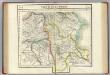
Partie, la Perse. Asie 52.
1 : 1641836 Vandermaelen, Philippe, 1795-1869
Kaukasus 2.
1 : 2050000 Berghaus, Heinrich; Flemming, Carl; Handtke, Friedrich H.; Sohr, Karl
Albania, Iberia, Colchis, Armenia, Mesopotamia, Babylonia, Assyria.
1 : 3700000 Menke, Th.
Carte internationale du monde au 1,000,000 E
1 : 1000000 Tabríz (Írán) War Office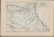
Operacīonnaja karta voennych dějstvīj A. P. Ermolova na Kavkazě
Russland Dagestan Ermolov, Alexej Petrovič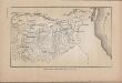
Lěvyj flang Kavkazckoj linīi v 1848 godu.
Aserbaidschan
[Střední Kavkaz]
Kavkaz Mare, Carl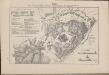
Plan kreposti Ganži
Aserbaidschan Gäncä
Plan osady Achul'go
Russland Dagestan Ashil'ta Belagerung
Feuille 35 (G V), uit: Carte géologique internationale de l'Europe : la carte, votée au congrès géologique international de Bologne en 1881, est exécutée conformément aux décisions d'une commission internationale, avec le concours des gouvernements, sous le dir. de M.M. Beyrich et Hauchecorne
Annotatie: Blad 48 gamme des couleurs; blad 49: bladwijzer en titelblad Heinrich Ernst Beyrich 1815-1896; Wi. Hauchecorne Berlin : Reimer / (Berlin: Institut lithographique)
[Tertia Asie tabula] [Karte], in: Clavdii Ptholomei Viri Alexandrini Cosmographie, S. 170.
1 Karte aus Atlas Nicolaus Germanus [und Ptolemaeus, Claudius]
Friedensdislokation im europäischen Russland
1 : 3125000 Kavkaz-oblast
[XX], uit: Geognostische Karte des Oesterreichischen Kaiserstaates mit einem grossen Theile Deutschland's u. Italien / hauptsachlich nach ... Haidinger's geognostischer Karte dieses Staates bearb. von Josef Scheda
1 : 3000000 titelvariant: General-Karte von Europa in 25 Blättern; Annotatie: Bijlage bij: General-Karte von Europa in 25 Blättern. - 1:2.592.000. - 1845-1847 Scheda, Joseph Wien : K.K. Militär. Geografisch. Institut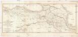
CARTE DES PAYS COMPRIS ENTRE CONSTANTINOPLE ET TÉHÉRAN
1 : 2230000 Arménie Lapie, Pierre Flahaut
Charte générale du pays entre les mers Noire et Caspienne
1 : 2300000 Kaspické moře-oblast Darmet, J. M. T. Mollo
Provinciarum persicarum Kilaniae nempe Chirvaniae Dagestaniae aliarumque vicinarum regionum partium
1 : 2000000 1 Karte : Kupferdruck ; 47 x 56 cm Homann, Johann Christoph [Homann]
Byzantinische Reich, ostliches Blatt.
1 : 3800000 Spruner von Merz, Karl
Geologičeskaja karta Evropejskoj Rossii
1 : 2500000 Südost-Blatt Karpinskij, A.P. (Aleksandr Petrovič) Kartografičeskoe zavedenie A.Il'ina
Karta Kaspijskago morja
1 Karte : Kupferdruck ; 24 x 14 cm Güldenstädt; Maksimov s.n.
Carte des Caspischen Meeres
1 Karte : Kupferdruck ; 24 x 14 cm Güldenstädt s.n.
Nova et accuratissima maris Caspii hactenus maximam partem nobis non satis cogniti ac regionum adjac
1 : 2100000 1 Karte : Kupferdruck ; 48 x 56 cm Seutter, Matthäus [Seutter]
Nova et accuratissima maris Caspii hactenus maximam partem nobis non satis cogniti ac regionum adjac
1 : 2100000 1 Karte : Kupferdruck ; 48 x 56 cm [Seutter]
Karte von dem Caspischen Meer
1 : 3100000 Kaspické moře-oblast Wussin, I. Güldenstädt, Johann Anton F.A. Schraembl
Die politischen Grenzen in Kaukasien von 1856 bis 1918
1 : 1500000 Kavkaz (pohoří : oblast) Kartogr. Abteilung der Kgl. Preuß. Landesaufnahme
Karte der Kaukasus-Länder und der angränzenden Türkischen und Persischen Provinzen Armenien, Kurdistan, und Azerbeidjan
1 : 1500000 Kiepert, Heinrich, 1818-1899 Bei Dietrich Reimer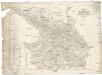
Karte des Kaukasus
Kavkaz-oblast Mahlmann, H. bei F.H. Morin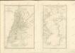

No.29. Karta Evropeyskaia Rossiia. Sheet 15
1 : 2000000 Shokalskago,Iu. M.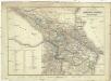
![[Westküste des Kaspischen Meeres]](https://images-2.georeferencer.com/images/iiif/838113541801/full/,300/0/native.jpg)

