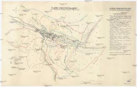
Maps of Trenčianske Teplice
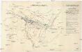
Plánok turistických cest pri lázňoch Trenčianských Tepliciách
1 : 10000 Trenčianské Teplice (Slovensko) Došlík, Alois Odbor Klubu čs. turistov
III. vojenské mapování 4460/2
1 : 25000
[Gradkartenblatt]
1 : 25000 Slovensko
Trenčín
1 : 75000 Slovensko Vojenský zeměpisný ústav
Trenčín
1 : 75000 Slovensko Vojenský zeměpisný ústav
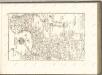
Trentschin.; Spezialkarte der osterreichisch-ungarischen Monarchie.
from Spezialkarte der osterreichisch-ungarischen Monarchie. Austro-Hungarian Monarchy. Militärgeographisches Institut.,
III. vojenské mapování 4460
1 : 75000
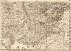
Trentschin
1 : 75000 Trenčín, Umland Geripp: Objgr. A. Spaczek. Terrain: Hptm. Paul Smeu
III. vojenské mapování 4460
1 : 75000
II. vojenské mapování 19
1 : 144000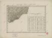
II. vojenské mapování 19
1 : 144000
Mapa okresu uh. brodského
1 : 150000 Uherský Brod-oblast (Česko) Křivánek, K. Růžička, V.

Marchionatûs Moraviae Circulus Hradistiensis
1 : 233000 Mollova mapová sbírka Müller, Johann Christoph Homann, Johann Baptista - dědici
Die Markgraftschaft Mähren
1 : 22000 Uherské Hradiště-oblast (Česko) Schenkl, Conrad Philipp Carl Winiker
Die Markgraftschaft Mähren
1 : 22000 Uherské Hradiště-oblast (Česko) Schenkl, Conrad Philipp Carl Winiker
Carte Topographique d'Allemagne.
1 : 220000 Mollova mapová sbírka Jaeger, Johann Wilhelm Abraham Berndt, Johann Christoph Jäger, Johann Wilhelm Abraham
Marchionatus Moraviae circulus Hradistiensis
1 : 150000 Uherské Hradiště-oblast (Česko) Müller, Johann Christoph Homann, Johann Baptist Ioh. Baptista Homanno
MARCHIONATUS MORAVIAE CIRCULUS HRADISTIENSIS
1 : 150000 Uherské Hradiště-oblast (Česko) Müller, Johann Christoph Homann, Johann Baptist Ioh. Baptista Homanno
MARCHIONATUS MORAVIAE CIRCULUS HRADISTIENSIS
1 : 150000 Uherské Hradiště-oblast (Česko) Müller, Johann Christoph Homann, Johann Baptist Ioh. Baptista Homanno
Marchionatus Moraviae circulus Hradistiensis
1 : 150000 Uherské Hradiště-oblast (Česko) Müller, Johann Christoph Homann, Johann Baptist Ioh. Baptista Homanno
Marchionatus Moraviae circulus Hradistiensis
1 : 150000 Uherské Hradiště-oblast (Česko) Müller, Johann Christoph Homann, Johann Baptist editore Ioh. Baptista Homanno
Marchionatus Moraviae circulus Hradistiensis
1 : 150000 Uherské Hradiště-oblast (Česko) Müller, Johann Christoph Homann, Johann Baptist Ioh. Baptista Homanno
Marchionatus Moraviae circulus Hradistiensis
1 : 150000 Uherské Hradiště-oblast (Česko) Müller, Johann Christoph Homann, Johann Baptist Ioh. Baptista Homanno
Marchionatus Moraviae circulus Hradistiensis
1 : 150000 Uherské Hradiště-oblast (Česko) Müller, Johann Christoph Homann, Johann Baptist Ioh. Baptista Homanno
Generální mapa Protektorátu Čechy a Morava

Trenčín
1 : 75000 Slovensko Vojenský zeměpisný ústav
C. Nitriensis. Tab. I
Slowakei Komitat Neutra