Maps of powiat głubczycki

Maps of powiat głubczycki

$title$

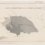
Carte ethnographique de la région de Ratiboř

Ratiboř (Polsko : oblast) Service cartographique de l'Armée Tchécoslovaque
$title$

$title$

$title$

Sbírka map a diagramů použitých na mírových konferencích v Paříži v letech 1919 - 1920

$title$

Principatus Silesiae Rattiboriensis

1 : 111000 Ratiboř-oblast (Polsko) Wieland, Johann Wolfgang Heredibus Homannianis
$title$

Karta przeglądowa polskiego zagłębia węglowego

1 : 300000 Polsko Sarjusz-Makowski, Arnold
$title$

Theil von Schlesien.

Slezsko (Polsko) Weiland, Karl Ferdinand Bürck, A. im Verlage des Geograph. Instituts
$title$

Umgebungen von Jägerndorf und die statistische Uebersicht

1 : 144000 K.K. Militärisches Geographisches Institut
$title$

Principatvs Silesiae Karnoviensis nova et exactissima Tabula geographica, commonstrans insimul districtus ac Statvs Minores Frevdenthal Olbersdorf et Stevberndorf.

1 : 1125000 Mollova mapová sbírka Wieland, Johann Wolfgang Homann, Johann Baptista - dědici
$title$

Marchionatus Moraviae circulus Preroviensis

1 : 150000 Morava (Česko) Müller, Johann Christoph Homann, Johann Baptist Io. Baptista Homanno
$title$

Marchionatus Moraviae circulus Preroviensis

1 : 150000 Morava (Česko) Müller, Johann Christoph Homann, Johann Baptist Io. Baptista Homanno
$title$

Marchionatus Moraviae circulus Preroviensis

1 : 150000 Morava (Česko) Müller, Johann Christoph Homann, Johann Baptist editore Io. Baptista Homanno
$title$

$title$

Principatvs Silesiae Karnoviensis nova et exactissima tabula geographica commonstrans insimul districtus ac statvs minores Frevdenthal, Olbersdorf et Stevberndorf

1 : 100000 Bruntál-oblast (Česko) Wieland, Johann Wolfgang Schubarth, Matthäus Homannianos Heredes
$title$

Principatvs Silesiae Karnoviensis nova et exactissima tabula geographica commonstrans insimul districtus ac statvs minores Frevdenthal Olbersdorf et Stevberndorf

1 : 100000 Bruntál-oblast (Česko) Wieland, Johann Wolfgang Schubarth, Matthäus ab Haeredibus Homannianis
$title$

Principatvs Silesiae Karnoviensis nova et exactissima tabula geographica commonstrans insimul districtus ac Statvs minores Frevdenthal, Olbersdorf et Stevberndorf

1 : 100000 Bruntál-oblast (Česko) Wieland, Johann Wolfgang Schubarth, Matthäus Homannianos Heredes
$title$

147. Beuthen, uit: Topographische Uebersichtskarte des Deutschen Reiches / herausgegeben v. d. Kartogr. Abt. d. Königl. Preuß. Landesaufnahme

1 : 200000 titelvariant: Topogr. Übersichtskarte des Deutschen Reiches; Annotatie: Titel boven bladen ook: Topogr. Übersichtskarte des Deutschen Reiches; Annotatie geografische gegevens: Op elk blad twee maatstokken: 10 Kilometer = 5,5 cm; 1 geogr. Meile = 3,6 cm; Legenda onder op elk blad Königlich Preußische Landesaufnahme. Kartographische Abtheilung [S.l : Königlich Preußische Landesaufnahme, Kartographische Abtheilung]
$title$

Marchionatus Moraviae Circulus Preroviensis.

1 : 233300 Mollova mapová sbírka Müller, Johann Christoph Homann, Johann Baptista
$title$

146. Ratibor, uit: Topographische Uebersichtskarte des Deutschen Reiches / herausgegeben v. d. Kartogr. Abt. d. Königl. Preuß. Landesaufnahme

1 : 200000 titelvariant: Topogr. Übersichtskarte des Deutschen Reiches; Annotatie: Titel boven bladen ook: Topogr. Übersichtskarte des Deutschen Reiches; Annotatie geografische gegevens: Op elk blad twee maatstokken: 10 Kilometer = 5,5 cm; 1 geogr. Meile = 3,6 cm; Legenda onder op elk blad Königlich Preußische Landesaufnahme. Kartographische Abtheilung [S.l : Königlich Preußische Landesaufnahme, Kartographische Abtheilung]
$title$

Die Fürstenthümer Troppau und Iaegerndorf in Ober-Schlesien

1 : 420000 Krnov-oblast (Česko) Schleuen, Johann David I.D. Schleuen
$title$

Das Fürstenthum Ratibor in Ober Schlesien

Mollova mapová sbírka Schleuen, Johann David Schleuen, Johann David
$title$

Das Fürstenthum Ratibor in Ober Schlesien

1 : 200000 Horní Slezsko Schleuen, Johann David I.D. Schleuen
$title$

Podrobná mapa Markrabství moravského a Vévodství slezkého

1 : 100000 Krnov (Česko : oblast) Srp, Jan Jos. R. Vilímek
$title$

Carte ethnographique de la partie de la Haute-Silésie cedée a l'etat Tchécoslovaque par le traité de Versailles

1 : 125000 Horní Slezsko Kapras, Jan Hocke, Jan Unie
$title$

Ratibor

1 : 75000 Ratiboř-oblast (Polsko) Ministerstvo národní obrany
$title$

III. vojenské mapování 3960

1 : 75000
$title$

II. vojenské mapování 2

1 : 144000
$title$

II. vojenské mapování 2

1 : 144000
$title$

II. vojenské mapování 2

1 : 144000
$title$

II. vojenské mapování 2

1 : 144000
© MapTiler © OpenStreetMap contributors
How does it work?
These instructions will show you how to find historical maps online.
Getting started
Type the place name in the search box to find the exact location. You can further adjust the search by zooming in and out.
Zoom
Zoom in and out with the buttons or use your mouse or touchpad natively.
Exact Area tool
Click here and draw a rectangle over the map to precisely define the search area.
Set filters
Narrow your search with advanced settings, such as Years (from/to), Fulltext, Publisher, etc.
Results
See the results of your search on the right side. You can scroll down to find more maps of this location.
?

Download OldMapsOnline Mobile