Maps of Vysočina
Neubertova generální automapa Republiky československé
1 : 200000 Brno (Česko : oblast) Soukup, Jan V. Neubert a synové
Tafel der Orts und Berghöhen Böhmens... nach der Höhe der prager Sternwarte

Podrobná nástěnná školní mapa Československé Republiky, část 1.: Čechy
Hydrografische Uibersichtskarte der Flüsse, Bäche und sonstigen Gewässer im Königreiche Boehmen

Koenigreich Boehmen...

General-Karte des Königreiches Böhmen...

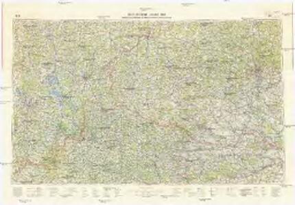
Jihovýchodní [Čechy a západní Morava]
1 : 300000 Morava západní (Česko) Edv. Fastr
Übersichtskarte der Aerarialstrassen, Eisenbahnen, dann der floss... in Böhmen

Theile des Königreichs Böhmen u. der Markgrafs. Maehren
Česko Schorrer, Josef, von Liechtenstern, Joseph Marx von Jos. List
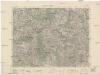
III. vojenské mapování 4354/4
1 : 25000
Přehledná mapa okresních silnic v Království Českém koncem roku 1890

Bohemiae Regnum in XII. Circulos divisum ...

General Karte der Markgrafschaft Mähren und des Herzogthums Schlesien

Markgrafschaft Mähren und Herzogthum Schlesien
III. vojenské mapování 4156/4
1 : 25000
Übersichtskarte des Gebietes der Handels- und Gewerbekammer in Brünn
1 : 200000 Brno (Česko : oblast) Zeměpisný ústav Ministerstva vnitra
Jihovýchodní Čechy
1 : 220000 Jihočeský kraj (Česko) Wagner, Jan Eduard F. Kytka
Tabula Generalis Marchionatus Moraviae in sex circulos divisae
1 : 183000 Mollova mapová sbírka Müller, Johann Christoph Gastl, Jan Jiří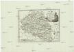
Der Markgrafschaft Maehren
1 : 670000 Jihlava-oblast (Česko)
MARCHIONATUS MORAVIAE CIRCULI ZNOYMENSIS ET IGLAVIENSIS
1 : 150000 Jihlava-oblast (Česko) Müller, Johann Christoph Homann, Johann Baptist Io. Baptista Homanno
MARCHIONATUS MORAVIAE CIRCULI ZNOYMENSIS ET IGLAVIENSIS
1 : 150000 Jihlava-oblast (Česko) Müller, Johann Christoph Homann, Johann Baptist Io. Baptista Homanno
Marchionatus Moraviae circuli Znoymensis et Iglaviensis
1 : 250000 Jihlava-oblast (Česko) Müller, Johann Christoph Homann, Johann Baptist Io. Baptista Homanno
Marchionatus Moraviae circuli Znoymensis et Iglaviensis
1 : 250000 Jihlava-oblast (Česko) Müller, Johann Christoph Homann, Johann Baptist Io. Baptista Homanno
Marchionatus Moraviae circuli Znoymensis et Iglaviensis
1 : 250000 Jihlava-oblast (Česko) Müller, Johann Christoph Homann, Johann Baptist Io. Baptista Homanno
Marchionatus Moraviae circuli Znoymensis et Iglaviensis
1 : 250000 Jihlava-oblast (Česko) Müller, Johann Christoph Homann, Johann Baptist Io. Baptista Homanno
Marchionatus Moraviae circuli Znoymensis et Iglaviensis
1 : 250000 Jihlava-oblast (Česko) Müller, Johann Christoph Homann, Johann Baptist Io. Baptista Homanno
Generální mapa Protektorátu Čechy a Morava
Jihlava
1 : 75000 Jihlava (Česko : oblast) Vojenský zeměpisný ústav