Maps of Romania
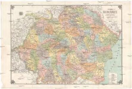
Harta României
1 : 1000000 Rumunsko Moldoveanu, M. D.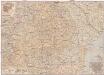
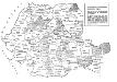
România
1 : 1000000 Brašov (Rumunsko : oblast) Teodorescu, C. Merutiu, Vasile
Carta Rumâniei în relief
1 : 2703000 Rumunsko Bolliac, Cesar Göbl-Rasidescu
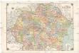
Administrativ-territoriale Gliederung Rumäniens
Rumänien Verwaltungsgliederung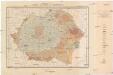
Harta solurilor României
1 : 1500000 Rumunsko Schön, R. Institutul geologic al României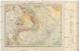
Harta geologică a României
1 : 1500000 Rumunsko Schön, R. Institutul geologic al României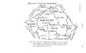
Historische Provinzen Rumäniens
Rumänien Verwaltungseinheit
Übersichtskarte von Rumänien
1 : 750000 Rakousko-Uhersko k. u. k. Hof- und Universitätsbuchhandlung R. Lechner (W. Müller)
Handkarte von Rumänien
1 : 1000000 Rumunsko Klammer, Karl G. Freytag & Berndt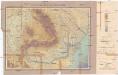
Harta orografică a României
1 : 1500000 Rumunsko Schön, R. Institutul geologic al României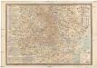
Romania
1 : 1000000 Rumunsko Georgescu, Traian Socec
Harta Basarabiei
1 : 75000 Besarábie (Moldavsko a Ukrajina) Serviciul Geografic al armatei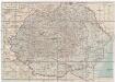
România
1 : 2500000 Rumunsko Kraft &Drotleff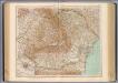
79-80. Romania.
1 : 1500000 Touring club italiano
Geologische-Übersichtskarte des Königreiches Rumänien
1 : 800000 Rumunsko Draghicenu, Mathei M. k. u. k. militär-geographisches Institut
Verwaltungsgliederung 1918-1937
Rumänien Verwaltungsgliederung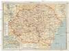
Turistická mapa Rumunska
Rumunsko Fáborský, Jan B. Nipočić, Vasilij Národní turistická kancelář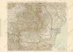
Rumänien

[Siebenbürgen : Oronyme]
Siebenbürgen Bergname, Geografischer Name
Territoriale Veränderungen nach 1920
Rumänien
93-94. Rumania. The World Atlas.
1 : 1250000 USSR (Union of Soviet Socialist Republics).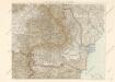
Karte von Rumanien
Die Auflösung der Autonomen Madjarischen Region
Rumänien ethnische Gruppe, Magyaren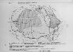
Rumänien 1859/61-1918/20
Rumänien
Siedlungsgebiete der deutschen Minderheit in Rumänien
Rumänien Deutsche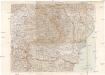
G. Freytags Karte von Rumänien
1 : 1000000 Rumunsko Freytag, Gustav Kartogr. Anstalt G. Freytag & Berndt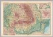
Romania. Pergamon World Atlas.
1 : 1500000 Polish Army Topography Service
Epoca Fanariota
Rumänien Phanarioten
Epoca lui Mihai Viteazul
Rumänien Walachei Mihai