Maps of Austria
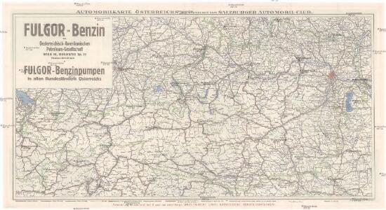
Automobilkarte Österreichs
1 : 600000 Rakousko Automobil Club
81. Austria. The World Atlas.
1 : 1500000 USSR (Union of Soviet Socialist Republics).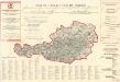
Plan von Wien

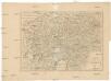
Kronlander Oesterreich.
1 : 1040000 Flemming, Carl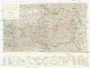
Karte der Mineralquellen und Kurorte von Österreich
1 : 750000 Rakousko Diem, Karl Knett, Josef Kartographisches, früher Militärgeographisches Institut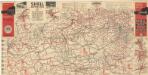
Strassen Zustands-Karte und Stadtpläne mit Durchfahrten von Österreich
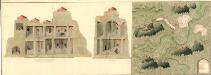
Plann deren Bergwerg Wendelstein, und Stagevoi
Mollova mapová sbírka Geyer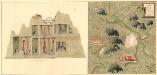
Plan des Bergwergs Weispriach
Mollova mapová sbírka Geyer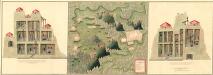
Plan der Bergwerg in der Creitzen
Mollova mapová sbírka Geyer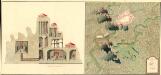
Plan des Bergwergs St. Anna an der Miss
Mollova mapová sbírka Geyer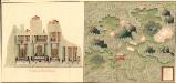
Plan des Bergwergs Wipenstein
Mollova mapová sbírka Geyer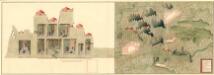
Plan der Bergwerg Schreflhoff, und Theifenegg
Mollova mapová sbírka Geyer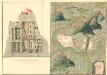
Plan des Bergwergs Serniz
Mollova mapová sbírka Geyer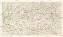
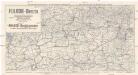
Automobil Übersichtskarte von Österreich
1 : 750000 Rakousko Steyr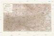
Übersichtskarte der Republik Österreich
1 : 750000 Rakousko
(Order form for) Generalkarte von Europe.
Scheda, Josef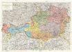
Republik Österreich
1 : 600000 Rakousko Freytag & Berndt A. G.
Oestereichischer Kreis
Allgemeiner Atlas [Walch, Johannes] im Verlag bei Johannes Walch
Karte der Republik Österreich
1 : 1500000 Rakousko Rothaug, Johann Georg Kartogr. Anstalt G. Freytag & Berndt
[Oesterreich]
Neuester Schul-Atlas Walch, Johann im Verlag bei Joh. Walch
Übersichtskarte der evangelischen Kirche Augsb. und Helv. Confession
1 : 864000 Chorvatsko Strehl, Anton k. k. evangel. Oberkirchenrathe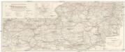
Wintersportverkehr in Österreich
1 : 600000 Rakousko Kartographisches, früher Militärgeographisches Institut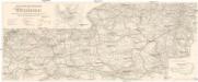
Wintersportverkehr in Österreich
1 : 600000 Rakousko Kartographisches, früher Militärgeographisches Institut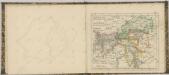

Süd-Östliches Deutschland
Stieler's Hand-Atlas Stieler, Adolf bei Justus Perthes

Teutschlandes Oesterreichischer Creiss
1 : 3700000 Mollova mapová sbírka Weigel, Johann Christoph Weigel, Johann Christoph
Géographie. croquis n4, Entre Pô et Danube
1 : 1000000 Molard, Jules, Commandant [Paris] : Service Géographique de l'Armée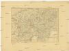
Charte von Oestreich Steyermark, Illyrien und Tyrol
1 : 1600000 Ilýrie