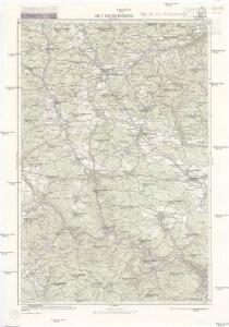
Maps of Gemeinde Alland

Kaltenleutgeben
1 : 25000 Kartographisches Institut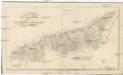
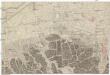
Plan des herrschaftlich Baumgartner Schöpfl-Waldes
Vídeňský les (Rakousko) Zeidler, Pet.
Helenthal bei Baden in N. Oe.
Laab i. W., Hetzendorf, Sittendorf, Mödling
1 : 25000 Mödling (Rakousko) R. Lechner
Freytag & Berndt's Ausflugskarte
1 : 100000 Vídeň (Rakousko : oblast) Kartogr. Anst. Freytag & Berndt
1 Wien
Wien
Wien's Umgebungen
Vídeň-oblast (Rakousko) Bagge, Oluf O. H.F. Müller
Baden und Neulengbach.
from Spezialkarte der osterreichisch-ungarischen Monarchie.
Wien-Melk und St. Pölten - Leobersdorf - Gutenstein mit umgebund
Melk (Rakousko) K. k. Österreichische Staatsbahnen
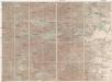
Zusammengestellter Umgebungsplan von Wien
1 : 100000 Vídeň (Rakousko : oblast) Wytlačil, M. Friedrich Schalk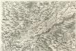
Archiducatus Austriae inferioris Geographica, et Nouiter Emendata Accuratissima Descriptio :
1 : 153333 Mollova mapová sbírka Vischer, Georg Matthaeus Hoffmann, Jakob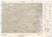
Baden und Neulengbach
1 : 75000 vom Kartographischen, früher Militärgeographischen Institut
Neueste Karte der Gegend um Wien
1 : 190000 Vídeň-oblast (Rakousko) Pauer, Franz X. L. Doll, Aloys bey A. Doll
Freytag & Berndt's Ausflugskarte
1 : 100000 Vídeň (Rakousko : oblast) Kartogr. Anst. Freytag & Berndt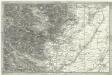
[Umgebung der Baaden]
1 : 43000 Baden (Rakousko)
Umgebung von Baaden
1 : 42000 Baden (Rakousko)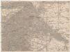
Umgebungs-Karte von Wien
1 : 75000 Vídeň (Rakousko : oblast)
G. Freytag ́s Ausflugskarte
1 : 100000 Vídeň (Rakousko : oblast) Freytag, Gustav Freytag & Berndt
Uebersichtskarte des k. k. nieder. österre. Waldamtes
1 : 80000 Dolní Rakousko (Rakousko) Hoyos, Ernest von
Plan des Übungslagers bei Traiskirchen im Jahre 1828
1 : 38400 Traiskirchen (Rakousko)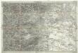
Umgebung von Wien
1 : 42000 Baden (Rakousko)
Plan des Übungslagers bei Traiskirchen im Jahre 1828
[Vídeň-okolí]
Vídeň-oblast (Rakousko)
Karte des Wienerwaldes
1 : 75000 Vídeňský les (Rakousko : pohoří) R. Lechner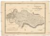
Grundriss der Prädien Hofwiese Mühlwiese und Maulbeer Plantage
1 : 9120 Vídeň-oblast (Rakousko) Kanyo, Michael Cosandier, Ferdinand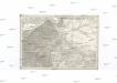
[Umgebungen von Wien]
Vídeň-oblast (Rakousko)
Südwestliche Umgegend von Wien
Vídeň-oblast (Rakousko) Treuenfeld, Ignaz Lenk von Höfel, Blasius
Karte der Umgebung von Wien
1 : 150000 Vídeň (Rakousko : oblast) Rothaug, Johann Georg G. Freytag & Berndt
Topographische Karte der Gegend von Wien
1 : 93700 Vídeň-oblast (Rakousko) Schmidt, Ludwig Schönberg, Johann bei Johann Schönberg