Maps of Styria

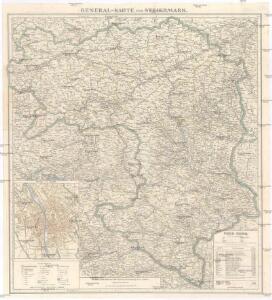
General-Karte von Steiermark
1 : 300000 Štýrsko (Rakousko) R. Lechner
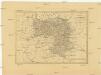
Charte von Steyermark
Štýrsko (Rakousko) Kindermann, Joseph Karl Müller, Franz im Verlage des Kunst- und Industrie- Comptoirs
Charte von Steyermark
Štýrsko (Rakousko) Kindermann, Joseph Karl Müller, Franz im Verlage des Kunst- und Industrie-Comptoirs
Charte von Steyermark
Štýrsko (Rakousko) Kindermann, Joseph Karl Müller, Franz im Verlage des Kunst- und Industrie- Comptoirs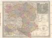
General Post und Strassen Karte des Herzogthums Steiermark
1 : 400000 Mariazell (Rakousko) Schulz, R. A. Peucker, Karl Artaria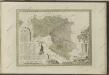

Steyermark.
1 : 705000 Flemming, Carl
General-Karte von Steiermark
Lechner, R.
Charte von Steyermark Kaernthen und Krain nebst der Grafschaft Görz
1 : 540000 Korutansko (Rakousko) Walch, Johann Joh. Walch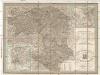
Post und Strassen Karte des Herzogthums Steyermark
1 : 380000 Mariazell (Rakousko) Schulz, R. A. Biller, Dominik Artaria & Comp.
General Post und Strassen Karte des Herzogthums Steyermark
1 : 380000 Mariazell (Rakousko) Schulz, R. A. Artaria & Comp.
Ducatus Styriae novissima tabula
1 : 830000 Mollova mapová sbírka Weigel, Christoph Weigel, Christoph
[Štýrsko]
1 : 600000 Štýrsko (Rakousko) Anker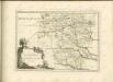


Strassen-Karte des Herzogthums Steyermark
1 : 435000 Štýrsko (Rakousko)
Ducatus Stiriae novissima tabula
1 : 490000 Rakousko Homann, Johann Baptist Vischer, Georg Matthaeus J. B. Homann
Karte von Steiermark und Krain
Charte vom Herzogthum Steyermark
1 : 870000 Štýrsko (Rakousko)
Charte vom Herzogthum Steyermark
1 : 870000 Štýrsko (Rakousko)
Charte von Innerösterreich oder den vereinigten Herzogthümern Steyermark und Kaernten
1 : 733000 Korutansko (Rakousko) in J. Riedl's Kunsthandlung
Vollstaendige Post-Karte des Herzogthums Steuermarks
Charte von Herzogthum Steyermark
1 : 850000 Rakousko
Ducatus Styriae tabula
1 : 925000 Štýrsko (Rakousko) Granelli, Carlo Engelbrecht, Christian Engelbrecht et Pfeffel
General-Karte des Herzogthums Steyermark
1 : 288000 Slovinsko
Karte von Herzogthum Steyermark
1 : 840000 Štýrsko (Rakousko) Tranquillo Mollo
Herzogthum Steyermark
Štýrsko (Rakousko)

Ost-Alpenländer, Östlicher Theil
1 : 700000 Chorvatsko severní Karl Fr. Pfau