Maps of Germany

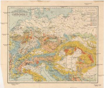
Geologische Übersichtskarte von Mittel-Europa
Evropa střední F. Tempsky
Grossdeutsches Reich und angrenzende Gebiete

Deutschlands geschichtlich geographischer Zeitraum von 158 v. Chr. bis 260 n. Chr
Evropa střední Ehrenkreutz, I. V.
Sbírka map a diagramů použitých na mírových konferencích v Paříži v letech 1919 - 1920
Příruční mapa střední Evropy

Közép-Európa
1 : 5000000 Evropa střední Állami kiadóhivatal
Germania, Dacia.
1 : 13000000 Fenner, Rest.
Eisenbahn-Übersichtskarte von Mittel-Europa
Evropa R. v. Waldheim
Grossdeutsches Reich und angrenzende Gebiete
1 : 4000000 Evropa střední Leixner, František Zentral-Lehrerverlag und Buchhandlung
Geogr.-physik.-statist. Karte von Deutschland mit Einschluss von ganz Oesterreich, Belgien, den Niederlanden, der Schweiz, Italien und einem Theile von Frankreich, England, Russland und der Türkei
1 : 4000000 Evropa střední Haurand, Theodor C. W.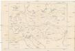
Karte der floss- und schiffbaren Flüsse von Mittel-Europa
1 : 3000000 Evropa střední Jelussig, Othmar Kiepert, Heinrich
Geogr.-physik.-statist. Karte von Deutschland mit Einschluss von ganz Oesterreich, Belgien, den Niederlanden, der Schweiz, Italien und einem Theile von Frankreich, England, Russland und der Türkei
1 : 4110000 Evropa střední a východní Haurand Theobald Grieben
Übersichtskarte der Verbreitung der Deutschen in Europa
Evropa Kiepert, Heinrich Haas, František Dietrich Reimer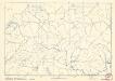
Soubor němých map pro střední školy

Carte élémentaire et statistique de l'Allemagne
1 : 2700000 Brion de La Tour, Louis Brion & Maire
Die Deutschen Bundesstaaten, das Kaiserthum Oesterreich, das Königreich Preussen, die Schweiz, das Kgr. Belgien, das Kgr. der Niederlande u. die angrenzenden Länder von 1792 bis zur Gegenwart
1 : 7350000 Mitteleuropa
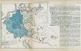
Große Sprachenkarte von Mitteleuropa
1 : 2000000 Lange, Friedrich Reimer
Übersichtskarte der Staaten von Mitteleuropa
Nr. 8a. Die Germanisierung des Ostens
Ostmitteleuropa Deutsche, Siedlung
Skelet zur Übersichtskarte von Mittel-Europa im Masse 1:750 000 und zur Hypsometrischen Karte der österr[isch-] ungar[ischen] Monarchie
1 : 750000 Rakousko-Uhersko R. Lechner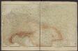
Géographie. croquis n3, Europe centrale
1 : 2500000 Molard, Jules, Commandant [Paris] : Service Géographique de l'Armée
Sbírka map a diagramů použitých na mírových konferencích v Paříži v letech 1919 - 1920

Fluss- u. Gebirgs-Karte, Mittel-Europa.
1 : 4500000 Flemming, Carl

Sbírka map a diagramů použitých na mírových konferencích v Paříži v letech 1919 - 1920

Mitteleuropa
1 : 8000000 Evropa střední Kocen, Blaž Eduard Hölzel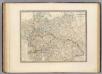
L'Allemagne, l'Europe centrale.
1 : 3460000 Andriveau-Goujon, J.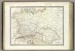
Germanie Ancienne.
1 : 3300000 Lapie, M. (Pierre), 1779-1850
Die Ältesten Karten von Deutschland