Maps of Europe

[Evropa]
1 : 7500000 Evropa
Evropa
1 : 7500000 Evropa Jordán, V. Otto Girgal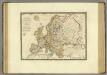
Europe en 1789.
1 : 12300000 Brue, Adrien Hubert, 1786-1832
Europa.
1 : 12000000 Ziegler, J. M.
Accuratissima Europæ tabula
1 Karte : Kupferdruck ; 48 x 56 cm Danckerts Danckerts
Nova et accurata totius Europæ descriptio
1 Karte : Kupferdruck ; 47 x 56 cm Danckerts Danckerts
Accuratissima Europae tabula
1 : 10000000 1 Karte : Kupferdruck ; 48 x 56 cm Danckerts, Justus [Danckerts]
Europa
1 : 10000000 Evropa
Europa
Plastischer Schul-Atlas über alle Theile der Erde : in 24 Karten Woldermann, G Verlag von P. Eckerlein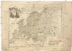
L'Europe
1 : 11930000 Evropa Le Rouge, Georges-Louis Cassini de Thury Le Rouge
Mittelbach's neueste Reise- Hand- und Kontorkarte von Europa
1 : 5500000 Afrika severní Mittelbach's Verlag
48. West Europe, Communications. The World Atlas.
1 : 12500000 USSR (Union of Soviet Socialist Republics).
Europe.
1 : 16500000 Hughes, William
Eduard Gaeblers Verkehrskarte von Europa
1 : 5000000 Evropa Gaebler, Eduard Eduard Gaeblers Geogr. Inst.
L'Evrope
1 Karte : Kupferdruck ; 37 x 49 cm Jaillot; Berey chez H. Iailliot proche les Augustins
Nova Europae descriptio
1 Karte : Kupferdruck ; 44 x 54 cm Danckerts Danckerts
Europa
1 Karte : Kupferdruck ; 33 x 45 cm Merian Matthäus Merian
Europa
Evropa Weiland, Karl Ferdinand im Verlage des Geograph. Instituts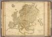
Europe.
1 : 11000000 Playfair, Principal
Eclipseos solis totalis cum mora, d. 12 maji 1706 horis antem: in Europa celebratæ, geographica repræsentatio
1 Karte : Kupferdruck ; 46 x 56 cm Schenk; Doppelmayr; Moolen s.n.
Europa
1 : 14000000 Evropa C. Flemming
Politický přehled Evropy
1 : 5000000 Evropa Machát, František V. Neubert
Versuch einer Übersicht der geographischen Verbreitung der Gewitter
Erster Band, enthaltend in vier Abtheilungen die Erscheinungen der anorganischen Natur: 1. Meteorologie und Klimatographie. 2. Hydrologie und Hydrographie. 3. Geologie. 4. Tellurischer Magnetismus Humboldt, Alexander von Verlag von Justus Perthes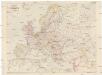
Freytag und Berndts Handkarte von Europa
1 : 6000000 Evropa Freytag und Berndt
Europa
1 : 7500000 Evropa Herrich, Alwin Carl Flemming u. C.T. Wiskott
Europa
1 : 15000000 Evropa Štůla, František Paul Sollors' Nachf.
Accuratissima Europæ tabula
1 Karte : Kupferdruck ; 48 x 56 cm Wit; Ottens; Ottens ex officina R. et I. Ottens
Nova et accurata totius Europæ delineatio vulgata
1 Karte : Kupferdruck ; 48 x 56 cm Sandrart Jakob von Sandrart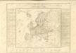

![[Evropa]](https://images-2.georeferencer.com/images/iiif/435922335275/full/,300/0/native.jpg)

