Maps of Krásna Lúka

[Kartenblatt]
1 : 25000 Slovensko Reichsamt für Landesaufnahme
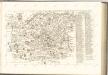
[Gradkartenblatt]
1 : 25000 Slovensko Vojenský zeměpisný ústav
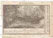
[Gradkartenblatt]
1 : 25000 Slovensko
III. vojenské mapování 4365/2
1 : 25000
Szczawnica SO
1 : 25000 Polsko Reichsamt für Landesaufnahme
Podolinec a okolí
1 : 75000 Podolínec (Slovensko : oblast) Vojenský zeměpisný ústav
Podolinec a okolí
1 : 75000 Podolínec (Slovensko : oblast) Vojenský zeměpisný ústav
Levoča
1 : 75000 Levoča (Slovensko) Vojenský zeměpisný ústav
Levoča a Kežmarok
1 : 75000 Kežmarok (Slovensko : oblast) Vojenský zeměpisný ústav
Levoča a Kežmarok
1 : 75000 Kežmarok (Slovensko : oblast) Vojenský zeměpisný ústav
Kesmark und Locse.; Spezialkarte der osterreichisch-ungarischen Monarchie.
from Spezialkarte der osterreichisch-ungarischen Monarchie. Austro-Hungarian Monarchy. Militärgeographisches Institut.,
III. vojenské mapování 4365
1 : 75000
Késmárk und Leutschau
1 : 75000 Kežmarok, Levoča Geripp: Fwkr. Hübner. Terrain: Hptm. E. v. Bogdanyi
Késmárk und Löcse
1 : 75000 Kežmarok (Slovensko : oblast) Scharre K. u. k. militär-geographisches Institut
Olublo und Szczawnica.
from Spezialkarte der osterreichisch-ungarischen Monarchie.
Jonction du Waag au Poprad
1 : 420000 Poprad-oblast (Slovensko)
Das Zipser Gebiet
1 : 2000000 Zips
Deutsches Volksgebiet in der Zips
Zips ethnische Gruppe, Deutsche
Kirchen, Klöster und Burgen in spätromanischer Zeit (nach V. Mancl)
Zips Baudenkmal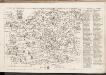
C. Sarosiensis
Slowakei Šariš
Die Central-Karpaten
1 : 200000 Karpaty Sydow, A. von Wolff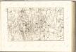

Leutschau 121, uit: Special-Karte von Mittel-Europa / nach amtlichen Quellen bearbeitet von W. Liebenow
1 : 300000 titelvariant: W. Liebenow's Mittel-Europa; Annotatie: Titel boven de bladen: W. Liebenow's Mittel-Europa Johannes Wilhelm Liebenow 1822-1897 Frankfurt a. M. : Ludwig Ravenstein
C. Scepusiensis
Slowakei Komitat Zips
Comitat Sáros
1 : 290000 Šariš (Slovensko : oblast)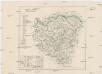
Comitat Sáros
1 : 280000 Šariš-oblast (Slovensko)
Übersichtskarte von Mitteleuropa 1:300 000
1 : 300000 Levoča-oblast (Slovensko) Reichsamt für Landesaufnahme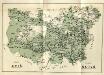
![[Kartenblatt]](https://images-2.georeferencer.com/images/iiif/921112931344/full/,300/0/native.jpg)

