Maps of Grasse

Carte routiere, vélocipédique, kilometrique des Alpes-Maritimes
1 : 100000 Rochemonteix, Adolphe de Erhard Freres
Parte del Piemonte
1 : 230000 Mollova mapová sbírka
[Vence]
1 Blatt : 56 x 89 cm Aldring s.n.
168 Vence.
1 : 86400 Cassini family; Cassini, Cesar-Francois, 1714-1784
Antibes
1 : 5600 Antibes (Francie) Allard, Carel C. Allard
Nice
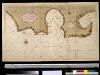
Afteekening van de baije van Villa Franca en Sospes of S. Vesperis in de Middellandsche Zee, aen de kust van Provence
France Gerard van Keulen
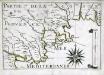
Description dv Cap de la Croix isles St. Margverite et St. Honorat
1 : 10600
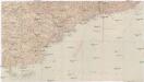
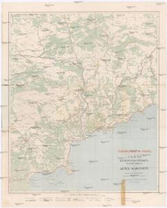
Carte générale du département des Alpes Maritimes
1 : 125000 Alpy francouzské (pohoří) Gavini, M. Conte-Grandchamps, M. E. Andriveau-Goujon
Excursions routières & maritimes au Départ de Nice
Nice Centre d'Excursions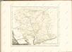
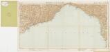
Partie de la coste de Provence
1 Karte : 22 x 33 cm de Fer
[Antibes]
1 Blatt : 56 x 63 cm s.n.
169 Antibes.
1 : 86400 Cassini family; Cassini, Cesar-Francois, 1714-1784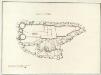
Castello di Savorgio
Mollova mapová sbírka
Pianta di Villa franca con parte della riviera di Gjenova
Mollova mapová sbírka
Carte de la France... Feuille XXVII - 33
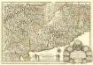
Carte du Piemont et du Monferrat
1 : 350000 Mollova mapová sbírka Placide de Sainte-Hélène
Le Theatre de Bellone :
Mollova mapová sbírka Schenk, Pieter Braakman, Adriaan


Foglio 5, uit: Carta d'Italia alla scala di 1:500.000 / Touring Club Italiano
1 : 500000 Annotatie: Voor aanwezige bladen zie overzichtsblad Touring Club Italiano Milano : Touring Club Italiano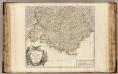
Provence.
1 : 473000 Robert de Vaugondy, Gilles, 1688-1766
Provincia indigenis dicta la Provence divisa in omnes suos vicariatus seu praefecturas et terras adjacentes eidem subjectas
1 : 420000 Provence (Francie) Homann, Johann Baptist Io. Baptista Homanno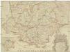
Le comte et gouvernement de Provence
1 : 420500 Provence (Francie) Tralage, Jean-Nicolas de Bouche, Honoré I.B. Nolin
Provincia La Provence. [Karte], in: Gerardi Mercatoris et I. Hondii Newer Atlas, oder, Grosses Weltbuch, Bd. 2, S. 143.
1 Karte aus Atlas Mercator, Gerhard und Hondius, Jodocus Jansson, Jan
Le comté de Provence
1 : 680000 Provence (Francie) Fer, Nicolas de Danet, Guillaume Danet