Maps of Finkenberg

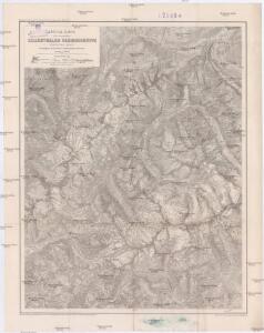
Special-Karte der centralen Zillerthaler Gebirgsgruppe
1 : 50000 Zillertalské Alpy (Itálie a Rakousko : pohoří) Seyerlen, R. Daimer, J. Deutscher und Österreichischer Alpenverein
Zillerthaler Alpen

Matrei.
from Spezialkarte der osterreichisch-ungarischen Monarchie.

Innsbruck 157, uit: Special-Karte von Mittel-Europa / nach amtlichen Quellen bearbeitet von W. Liebenow
1 : 300000 titelvariant: W. Liebenow's Mittel-Europa; Annotatie: Titel boven de bladen: W. Liebenow's Mittel-Europa Johannes Wilhelm Liebenow 1822-1897 Frankfurt a. M. : Ludwig Ravenstein
Sterzing und Franzensfeste (Tirol).
from Spezialkarte der osterreichisch-ungarischen Monarchie.
Hippach und Wildgerlos-Spitze.
from Spezialkarte der osterreichisch-ungarischen Monarchie.
[Innsbruck a okolí]
1 : 144000 Innsbruck-oblast (Rakousko)
Bruneck (Tirol).
from Spezialkarte der osterreichisch-ungarischen Monarchie.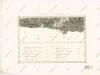
Carte des Herzogthums Salzburg...

Skikarte für das Gebiet von Krimml und des Großvenedigers
1 : 50000 Salcburské Alpy (Rakousko : pohoří) Kartographisches Institut
Special-Karte der centralen Zillerthaler Gebirgsgruppe
1 : 50000 Zillertalské Alpy (Itálie a Rakousko : pohoří) Seyerlen, R. Daimer, J. Deutscher und Österreichischer Alpenverein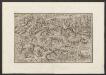
Militair Karte von Süd-Deutschland in 20 Sectionen
1 : 400000 19. Section Coulon, Alois von A. von Coulon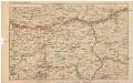
Strecke
Bludenz (Rakousko) K. k. Österreichische Staatsbahnen
Generalkarte von Zentraleuropa

Tirolis
Mollova mapová sbírka Hoffmann, Johannes Hoffmann, Johann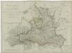
Herzogthum Salzburg

Salzburg und Berchtesgaden
1 : 493000 Berchtesgaden (Německo) Jirasek, F. A. F.A. Jirasek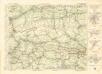
Freytag & Berndt ́s: Auto-Strassenkarten

Das Chur=Fürstenthum Salzburg
1 Karte : Kupferdruck ; 49 x 48 cm Diewald bey den Homännischen Erben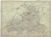
Herzogthum Salzburg nach den besten und zuverlässigsten Hülfsmitteln verfasst
1 : 410000 Salcburk-oblast (Rakousko) Tranquillo Mollo
Atlas Tyrolensis
Mollova mapová sbírka Anich, Peter
Tirol, Samt denen angrenzend- und einverleibten Ländern nach möglichster Richtigkeit
1 : 470000 Mollova mapová sbírka Riegel, Christoph
Das Kurfürstenthum Salzburg
1 Karte : Kupferdruck ; 63 x 45 cm Winckelhofer in der kaiserl. privil. Kunsthandlung Adam Gottlieb Schneider u: Weigels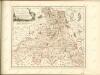
t'Aartsbisdom Saltzburg
1 : 1000000 gelegen na de stelling van de Hr. G. de l'Isle Deventer [etc.] : [by J. de Lat [etc.]
S. R. I. principatvs et archiepiscopatus Salisburgensis
1 Karte : Kupferdruck ; 47 x 57 cm Guetrather; Homann Johann Baptist Homann
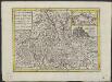
Comitatus Tyrolis Tabula
1 : 1000000 Mollova mapová sbírka Engelbrecht, Christian Pfeffel, Johann Andreas
Comitatus Tyrolis Tabula
1 : 1000000 Mollova mapová sbírka