Maps of Europe

Maps of Europe

$title$

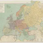
Mittelbach's neueste Reise- Hand- und Kontorkarte von Europa

1 : 5500000 Afrika severní Mittelbach's Verlag
$title$

Europa

1 : 7500000 Evropa Herrich, Alwin Carl Flemming u. C.T. Wiskott
$title$

L'Evrope

1 Karte : Kupferdruck ; 37 x 49 cm Jaillot; Berey chez H. Iailliot proche les Augustins
$title$

Nova Europae descriptio

1 Karte : Kupferdruck ; 44 x 54 cm Danckerts Danckerts
$title$

Europa

1 Karte : Kupferdruck ; 33 x 45 cm Merian Matthäus Merian
$title$

Europa

1 : 10000000 Evropa
$title$

Europa.

1 : 12000000 Ziegler, J. M.
$title$

Accuratissima Europæ tabula

1 Karte : Kupferdruck ; 49 x 58 cm Allard ex officina I. Cóvens et C. Mortier
$title$

Nova et accurate divisa in regna et regiones præcipuas Europæ descriptio

1 Karte : Kupferdruck ; 43 x 53 cm Wit ex officina I. Cóvens et C. Mortier
$title$

Europa excultissima

1 Karte : Kupferdruck ; 48 x 57 cm Schenk Pieter Schenk
$title$

Accuratissima Europæ tabula

1 Karte : Kupferdruck ; 48 x 57 cm Allard Carel Allard
$title$

$title$

[Evropa]

Evropa
$title$

Europa

1 : 44000000 Evropa Biller, Franz
$title$

Europa

$title$

L'Europe

1 : 11930000 Evropa Le Rouge, Georges-Louis Cassini de Thury Le Rouge
$title$

Ewropa

1 : 20600000 Evropa Merklas, Václav V. Merklas
$title$

Ewropa

1 : 20600000 Evropa Merklas, Václav V. Merklas
$title$

Ewropa

1 : 20600000 Evropa Merklas, Václav V. Merklas
$title$

Europa

1 : 14000000 Evropa C. Flemming
$title$

Europa

1 : 10000000 Evropa Weiland, Karl Ferdinand Kiepert, Heinrich im Verlage des geograph. Instituts
$title$

[Evropa]

Evropa Klöden, Karl Friedrich von Simon Schropp et Co.
$title$

[Evropa]

Evropa Klöden, Karl Friedrich von Simon Schropp et Co.
$title$

Europa

Allgemeiner Atlas [Walch, Johannes] im Verlag bei Johannes Walch
$title$

Nova et accurate divisa in regna et regiones praecipuas Europae descriptio

1 : 10000000 per F. de Witt Amstelodami [Amsterdam] : ex officina I. Cóvens et C. Mortier
$title$

Accuratissima Europæ tabula

1 Karte : Kupferdruck ; 48 x 56 cm Danckerts Danckerts
$title$

Nova et accurata totius Europæ descriptio

1 Karte : Kupferdruck ; 47 x 56 cm Danckerts Danckerts
$title$

Accuratissima Europae tabula

1 : 10000000 1 Karte : Kupferdruck ; 48 x 56 cm Danckerts, Justus [Danckerts]
$title$

Carte demonstrative des determinations astronomiques de latitude et d'azimuth

1 : 10000000 Institut topographique militaire
$title$

Europe en 1789.

1 : 12300000 Brue, Adrien Hubert, 1786-1832
© MapTiler © OpenStreetMap contributors
How does it work?
These instructions will show you how to find historical maps online.
Getting started
Type the place name in the search box to find the exact location. You can further adjust the search by zooming in and out.
Zoom
Zoom in and out with the buttons or use your mouse or touchpad natively.
Exact Area tool
Click here and draw a rectangle over the map to precisely define the search area.
Set filters
Narrow your search with advanced settings, such as Years (from/to), Fulltext, Publisher, etc.
Results
See the results of your search on the right side. You can scroll down to find more maps of this location.
?

Download OldMapsOnline Mobile