Maps of Europe
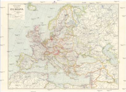
Freytag & Berndts Handkarte von Europa
1 : 6000000 Evropa Freytag & Berndt
Europa
Evropa Weiland, Karl Ferdinand im Verlage des Geograph. Instituts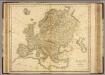
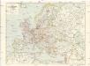
Europe.
1 : 11000000 Playfair, Principal
Politický přehled Evropy
1 : 5000000 Evropa Machát, František V. Neubert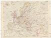
Freytag und Berndts Handkarte von Europa
1 : 6000000 Evropa Freytag und Berndt
Politický přehled Evropy
1 : 5000000 Evropa Machát, František Tiskem a nákladem uměl. ústavu grafického V. Neuberta na Smíchově
Europe.
1 : 16500000 Hughes, William
Carte de l'Europe
Evropa vrais amis de la paix
Europa
1 : 15000000 Evropa Štůla, František Paul Sollors' Nachf.
Europa
1 : 10000000 Evropa Weiland, Karl Ferdinand Kiepert, Heinrich im Verlage des geograph. Instituts
[Evropa]
Evropa Klöden, Karl Friedrich von Simon Schropp et Co.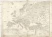
[Evropa]
Evropa Klöden, Karl Friedrich von Simon Schropp et Co.
Eduard Gaeblers Verkehrskarte von Europa
1 : 5000000 Evropa Gaebler, Eduard Eduard Gaeblers Geogr. Inst.
Europa nach dem Weltkriege
1 : 7500000 Evropa Carl Flemming und C. T. Wiskott Aktiengesellschaft für Verlag und Kunstdruck
Politická mapa Evropy
1 : 15000000 Evropa Wolf, R.
Evropa
1 : 15000000 Evropa Kuchař, Karel Komenium
Eclipseos solis totalis cum mora, d. 12 maji 1706 horis antem: in Europa celebratæ, geographica repræsentatio
1 Karte : Kupferdruck ; 46 x 56 cm Schenk; Doppelmayr; Moolen s.n.
Accuratissima Europæ tabula
1 Karte : Kupferdruck ; 48 x 56 cm Danckerts Danckerts
Nova et accurata totius Europæ descriptio
1 Karte : Kupferdruck ; 47 x 56 cm Danckerts Danckerts
Accuratissima Europae tabula
1 : 10000000 1 Karte : Kupferdruck ; 48 x 56 cm Danckerts, Justus [Danckerts]
Europa
1 : 10000000 Evropa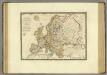
Europe en 1789.
1 : 12300000 Brue, Adrien Hubert, 1786-1832
Evropa
1 : 7500000 Evropa Jordán, V. Otto Girgal
Europa
1 : 10000000 Evropa Weiland, Karl Ferdinand Kratz, W. im Verlage des geograph. Instituts
Europe.
1 : 23000000 Lucas, Fielding Jr.
Europa.
1 : 12000000 Ziegler, J. M.
Europa
1 : 7500000 Evropa Herrich, Alwin Carl Flemming u. C.T. Wiskott
Politická mapa Evropy
1 : 17500000 Evropa Ryšavý, Jaroslav Vydavatelský odbor Ústř. sp. učit. na Moravě
F. Umlaufta a J.G. Rothauga školní nástěnná mapa Evropy
1 : 3000000 Evropa Umlauft, Friedrich Krejčí, Josef Freytag a Berndt
Karte von Europa
1 Karte auf 4 Blatt : Kupferdruck ; 100 x 118 cm Walch zufinden bei J. Walch