Maps of Germany

Karte von Central-Europa bis Paris, Mailand, Triest, Pesth, Krakau, Königsberg, Schleswig
1 : 1800000 Budapešť (Maďarsko) Justus Perthes
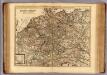
Neu vermehrte Post Charte durch gantz Teutschland nach Italien, Franckreich, Niederland, Preußen, Polen, und Ungarn & c
1 : 2600000 Evropa střední Nell, Johann Peter Homann, Johann Baptist Iohann Baptist Homann
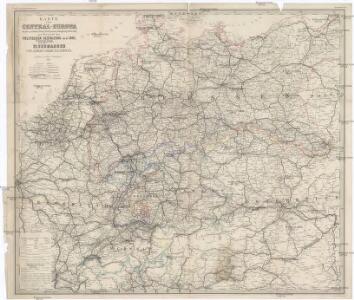
Eisenbahnen in Deutschland und dessen Grenzlaendern
1 : 6200000 Evropa střední Radefeld Zipter, J. geographischen Anstalt des Bibliographischen Instituts
Germany.
1 : 6000000 Carey, Mathew
Germany.
1 : 6000000 Carey, Mathew
Deutschland's kirchliche Eintheilung bis in das XVIte. Jahrhundert.
1 : 3800000 Spruner von Merz, Karl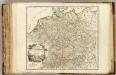
Allemagne postes.
1 : 2300000 Robert de Vaugondy, Gilles, 1688-1766
Neueste Generalkarte von Deutschland nach den zehn Kreisen und ihren Unterabtheilungen
1 : 2845000 Evropa střední
Eisen-Bahn-Atlas von Deutschland, Belgien, Elsass und dem nördlichsten Theile von Italien
Stülpnagel, Friedrich von ; Bär, J.C. Justus Perthes
Historia Imperii Romano-Germanici, nec non finitimarum Regionum In Mappa exhibita, ac aeri incisa
1 : 2500000 Mollova mapová sbírka Seutter, Matthäus Seutter, Matthäus
Neu-vermehrte Post-Charte durch gantz Teutschland nach Italien, Franckreich, Niederland, Preußen, Polen und Ungarn &c.
1 : 2500000 Mollova mapová sbírka Nell, Johann Peter Homann, Johann Baptista
Charte von Deutschland

Societas Iesu Germana Sive Assistentia Germaniae
1 : 2600000 Mollova mapová sbírka Seutter, Matthäus Seutter, Georg Matthäus Seutter, Matthäus

General Karte vom Deutschen Reich
1 Karte : Kupferdruck ; 57 x 63 cm Carmine zu finden bei Joseph Carmine
Charte das Deutsche Reich nach seinen Kreisen und deren Unterabtheilungen vorstellend
1 : 2660000 Francie Güssefeld, Franz L. von den Homännischen Erben
Charte das Deutsche Reich nach seinen Kreisen und deren Unterabtheilungen vorstellend
1 : 2660000 Evropa střední Güssefeld, Franz L. von den Homännischen Erben
Germaniae nova et accurata delineatio [Karte], in: Gerardi Mercatoris et I. Hondii Newer Atlas, oder, Grosses Weltbuch, Bd. 1, S. 142.
1 Karte aus Atlas Mercator, Gerhard und Hondius, Jodocus Jansson, Jan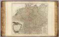
Allemagne.
1 : 2250000 Robert de Vaugondy, Gilles, 1688-1766
Neueste Post- und Eisenbah-Charte von Deutschland und der angränzenden Ländern für Extraposten, Couriere, Diligengen, u. Eilwägen
Belgie Bauer & Raspe
Deutschland und anliegende Länder zur Übersicht, d Hauptstr. u. Entfernungen zw. Paris, Mailand, Warschau u. Königsberg
1 : 3800000 Evropa střední Stieler, Adolf Justus Perthes
Karte von Teutschland
Německo Ritter, C.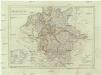
Deutschland nach den letzten Friedenschlüssen
1 : 3600000 Evropa střední Mollo, Tranquillo bey Tranquillo Mollo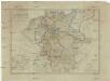
Deutschland nach den letzten Friedenschlüssen
1 : 3600000 Evropa střední Mollo, Tranquillo Tranquillo Mollo
Karte von Deutschland
1 : 1880000 Evropa střední Reilly, Franz Johann Josef von Benedicti, Hieronymus Franz Joh. Jos. von Reilly
Karte von Deutschland
1 : 1880000 Evropa střední Reilly, Franz Johann Josef von Benedicti, Hieronymus Franz Joh. Jos. von Reilly
Karte von Deutschland nach Sotzmann
1 : 1880000 Německo Reilly, Franz Johann Josef von Benedicti, Hieronymus Franz Joh. Jos. von Reilly
Imperium Romano-Germanicum in suos circulos electorat. et status
1 : 5100000 Evropa střední Seutter, Matthäus Lotter, Tobias Conrad apud Matth. Seutter
Neue und vollstandige Postkarte durch ganz Deutschland
1 : 1480000 Německo Bors zu Overen, Johann Jakob Breidbach zu Bürresheim, Emmerich Joseph von bey dennen Homaennischen Erben