Maps of Germany

GERMANIA secundum X Circulos
Evropa střední
Germany.
1 : 9000000 Fenner, Rest.
Deutschland.
1 : 4800000 Reichard, C. G.
Carte generale di lutta l Alemagna, e paesi circonuicini
Evropa střední
Karte von Central-Europa bis Paris, Mailand, Triest, Pesth, Krakau, Königsberg, Schleswig
1 : 1800000 Budapešť (Maďarsko) Justus Perthes
Nova totius Germaniae descriptio
1 : 3640000 Evropa střední Hofmann, Johann Johann Hofman[n]
Germania magna ausser der Cimbrischen Halbinsel
Německo Kruse, Friedrich Leidenfrost, E. in Ernst Kleins literarischem und geographishem Comptoir
Neu vermehrte Post Charte durch gantz Teutschland nach Italien, Franckreich, Niederland, Preußen, Polen, und Ungarn & c
1 : 2600000 Evropa střední Nell, Johann Peter Homann, Johann Baptist Iohann Baptist Homann
Bibliopolische Charte von Deutschland
1 : 2420000 Evropa střední Herder, Bartholomä J.J. Weber
Reise Karte von Deutschland
Evropa střední Julius, E. Vieweg, Friedrich Friedrich Vieweg
Eisenbahnen in Deutschland und dessen Grenzlaendern
1 : 6200000 Evropa střední Radefeld Zipter, J. geographischen Anstalt des Bibliographischen Instituts
Neuste Post Karte von Deutschland und dessen angrenzenden Laender
Evropa střední Walch, Johann bey Ioh. Walch
Novissima Germaniae Descriptio
1 : 3300000 Mollova mapová sbírka Le Roy, Henry
Germany.
1 : 6000000 Carey, Mathew
Germany.
1 : 6000000 Carey, Mathew
Neueste Generalkarte von Deutschland nach den zehn Kreisen und ihren Unterabtheilungen
1 : 2845000 Evropa střední
Deutschland.
1 : 3400000 Radefeld, Carl Christian Franz, 1788-1874
Historia Imperii Romano-Germanici, nec non finitimarum Regionum In Mappa exhibita, ac aeri incisa
1 : 2500000 Mollova mapová sbírka Seutter, Matthäus Seutter, Matthäus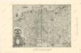
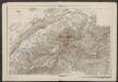
Die Ältesten Karten von Deutschland
Germaniae nova et accurata delineatio [Karte], in: Gerardi Mercatoris et I. Hondii Newer Atlas, oder, Grosses Weltbuch, Bd. 1, S. 142.
1 Karte aus Atlas Mercator, Gerhard und Hondius, Jodocus Jansson, Jan
Carte générale de l'Allemagne en 1789
1 : 2750000 Německo Thiers, Adolphe
Eisen-Bahn-Atlas von Deutschland, Belgien, Elsass und dem nördlichsten Theile von Italien
Stülpnagel, Friedrich von ; Bär, J.C. Justus Perthes
Charte das Deutsche Reich nach seinen Kreisen und deren Unterabtheilungen vorstellend
1 : 2660000 Francie Güssefeld, Franz L. von den Homännischen Erben
Charte das Deutsche Reich nach seinen Kreisen und deren Unterabtheilungen vorstellend
1 : 2660000 Evropa střední Güssefeld, Franz L. von den Homännischen Erben

Deutschland und anliegende Länder zur Übersicht, d Hauptstr. u. Entfernungen zw. Paris, Mailand, Warschau u. Königsberg
1 : 3800000 Evropa střední Stieler, Adolf Justus Perthes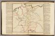
(Dignites des Electeurs)
1 : 2900000 Dangeau, abbe de, 1643-1723
(Principautes divisees)
1 : 2900000 Dangeau, abbe de, 1643-1723
(Traitte de Munster)
1 : 2900000 Dangeau, abbe de, 1643-1723
(Villes Imperiales)
1 : 2900000 Dangeau, abbe de, 1643-1723
(Villes forestieres)
1 : 2900000 Dangeau, abbe de, 1643-1723
(Prerogatives)
1 : 2900000 Dangeau, abbe de, 1643-1723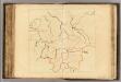
(Rivieres d'Allemagne)
1 : 2900000 Dangeau, abbe de, 1643-1723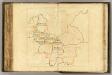
(Principautes divisees)
1 : 2900000 Dangeau, abbe de, 1643-1723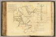
(Chambre Imperiale)
1 : 2900000 Dangeau, abbe de, 1643-1723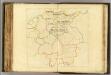
(Principautes divisees)
1 : 2900000 Dangeau, abbe de, 1643-1723
(Villes, rivieres d'Allemagne)
1 : 2900000 Dangeau, abbe de, 1643-1723
(Source des rivieres d'Allemagne)
1 : 2900000 Dangeau, abbe de, 1643-1723
(Cercles)
1 : 2900000 Dangeau, abbe de, 1643-1723
(Eveches)
1 : 2900000 Dangeau, abbe de, 1643-1723
(Universites)
1 : 2900000 Dangeau, abbe de, 1643-1723
(Capitales de la maison d'Autriche)
1 : 2900000 Dangeau, abbe de, 1643-1723
(Chambre Imperiale)
1 : 2900000 Dangeau, abbe de, 1643-1723
(Villes, rivieres d'Allemagne)
1 : 2900000 Dangeau, abbe de, 1643-1723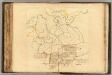
(Histoire)
1 : 2900000 Dangeau, abbe de, 1643-1723