Maps of Stará Turá

[Gradkartenblatt]
1 : 25000 Nové Mesto nad Váhom-oblast (Slovensko) Vojenský zeměpisný ústav
III. vojenské mapování 4459/4
1 : 25000
Nové Mesto n. Váhom
1 : 75000 Nové Mesto nad Váhom-oblast (Slovensko) Vojenský zeměpisný ústav
Nové Mesto n. Váhom a Uherský Ostroh
1 : 75000 Morava (Česko) Vojenský zeměpisný ústav
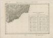
Nové Mesto n. Váhom a Uherský Ostroh
1 : 75000 Morava (Česko) Vojenský zeměpisný ústav
Karte des Gemeindegrenzen

III. vojenské mapování 4459
1 : 75000
Ungostra und Waag-Neustadtl.
from Spezialkarte der osterreichisch-ungarischen Monarchie.
II. vojenské mapování 19
1 : 144000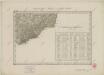
II. vojenské mapování 19
1 : 144000
Ung. Ostra und Waag-Neustadtl
1 : 75000 Uherský Ostroh, Nové Mesto nad Váhom Geripp: Assist. Jersche. Terrain: Hptm. Platenik
Podrobná mapa Markrabství moravského a Vévodství slezského
1 : 100000 Moravské markrabství Srp, Jan Jos. R. Vilímek
Podrobná místopisná mapa Království Českého
II. vojenské mapování 19
1 : 144000
Pöstyén u. Umgebung

Neu Lhotta - m2020-1-008 - Kaiserpflichtexemplar der Landkarten des stabilen Katasters
1 : 2880
Neu Lhotta - m2020-1-010 - Kaiserpflichtexemplar der Landkarten des stabilen Katasters
1 : 2880
Neu Lhotta - m2020-1-009 - Kaiserpflichtexemplar der Landkarten des stabilen Katasters
1 : 2880
Neu Lhotta - m2020-1-007 - Kaiserpflichtexemplar der Landkarten des stabilen Katasters
1 : 2880
Neu Lhotta - m2020-1-004 - Kaiserpflichtexemplar der Landkarten des stabilen Katasters
1 : 2880
Neu Lhotta - m2020-1-011 - Kaiserpflichtexemplar der Landkarten des stabilen Katasters
1 : 2880
Neu Lhotta - m2020-1-005 - Kaiserpflichtexemplar der Landkarten des stabilen Katasters
1 : 2880
Neu Lhotta - m2020-1-014 - Kaiserpflichtexemplar der Landkarten des stabilen Katasters
1 : 2880
Neu Lhotta - m2020-1-012 - Kaiserpflichtexemplar der Landkarten des stabilen Katasters
1 : 2880
Neu Lhotta - m2020-1-002 - Kaiserpflichtexemplar der Landkarten des stabilen Katasters
1 : 2880
Neu Lhotta - m2020-1-003 - Kaiserpflichtexemplar der Landkarten des stabilen Katasters
1 : 2880
Neu Lhotta - m2020-1-006 - Kaiserpflichtexemplar der Landkarten des stabilen Katasters
1 : 2880
Neu Lhotta - m2020-1-001 - Kaiserpflichtexemplar der Landkarten des stabilen Katasters
1 : 2880
Neu Lhotta - m2020-1-013 - Kaiserpflichtexemplar der Landkarten des stabilen Katasters
1 : 2880
![[Gradkartenblatt]](https://images-2.georeferencer.com/images/iiif/985198871049/full/,300/0/native.jpg)

