Maps of Sečovce

[Mapový list]
1 : 25000 Slovensko Vojenský zeměpisný ústav
III. vojenské mapování 4567/2
1 : 25000
III. vojenské mapování 4567
1 : 75000
Trebišov
1 : 75000 Maďarsko Vojenský zeměpisný ústav
Trebišov
1 : 75000 Maďarsko Vojenský zeměpisný ústav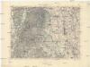
Trebišov
1 : 75000 Maďarsko Vojenský zeměpisný ústav
Toketerebes und Nagyszalancz.
from Spezialkarte der osterreichisch-ungarischen Monarchie.
Michalovce a okolí
1 : 75000 Michalovce (Slovensko : oblast) Vojenský zeměpisný ústav
Varanno.
from Spezialkarte der osterreichisch-ungarischen Monarchie.
[Gradkartenblatt]
1 : 25000 Michalovce-oblast (Slovensko) Vojenský zeměpisný ústav
[Mapový list]
1 : 25000 Slovensko Vojenský zeměpisný ústav
[Mapový list]
1 : 25000 Košice-oblast (Slovensko) Vojenský zeměpisný ústav
III. vojenské mapování 4568/1
1 : 25000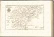

Kaschau 122, uit: Special-Karte von Mittel-Europa / nach amtlichen Quellen bearbeitet von W. Liebenow
1 : 300000 titelvariant: W. Liebenow's Mittel-Europa; Annotatie: Titel boven de bladen: W. Liebenow's Mittel-Europa Johannes Wilhelm Liebenow 1822-1897 Frankfurt a. M. : Ludwig Ravenstein
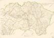
Zemplén vármegye térképe
1 : 470000 Zemplín (Slovensko a Maďarsko) Kogutowicz, Manó Magyar Földrajzi Intézet
Stolice Zemplín a Užhorod
Komitat Zemplín, Komitat Uschgorod, ethnische Gruppe
Stolice Zemplín a Užhorod
Užhorod (Ukrajina)
Comitat Abaúj-Torna
1 : 290000 Košice (Slovensko : oblast)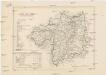
Comitat Abaúj-Torna
1 : 288000 Košice-oblast jižní (Slovensko)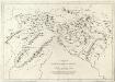
Appendix ad Mappam Mineralographicam
Mollova mapová sbírka Marsili, Luigi Ferdinando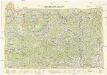
Neubertova generální automapa Republiky československé
1 : 200000 Košice (Slovensko : oblast) Soukup, Jan V. Neubert a synové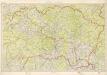
Kraj Košický a Prešovský
Bez titulu: mapy slovenských krajů

Siedlungsgebiet der Slowaken nach dem Nachbarschaftsindex für Nordost-Ungarn 1941
Ungarn (Nordost) Slowaken, Siedlung Bottlik, Zsolt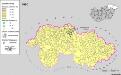
Siedlungsgebiet der Slowaken nach dem Nachbarschaftsindex für Nordost-Ungarn 1980
Ungarn (Nordost) Slowaken, Siedlung Bottlik, Zsolt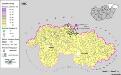
Siedlungsgebiet der Slowaken nach dem Nachbarschaftsindex für Nordost-Ungarn 1880
Ungarn (Nordost) Slowaken, Siedlung Bottlik, Zsolt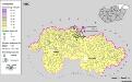
A szlovákok településterülete a szomszédsági mutató alapján Északkelet-Magyarországon 1880-ban
Ungarn (Nordost) Slowaken, Siedlung Bottlik, Zsolt
A szlovákok településterülete a szomszédsági mutató alapján Északkelet-Magyarországon 1980-ban
Ungarn (Nordost) Slowaken, Siedlung Bottlik, Zsolt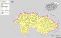
![[Mapový list]](https://images-2.georeferencer.com/images/iiif/347266304425/full/,300/0/native.jpg)

