Maps of Carpathian Mountains
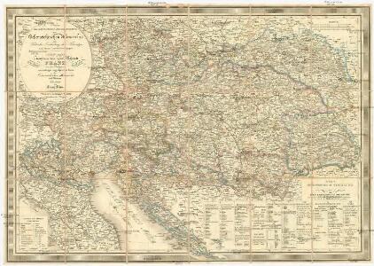
Neueste General-Post-& Strassen-Karte der Oesterreichischen Monarchie
1 : 1910000 Evropa jihovýchodní Fried, Franz List, Joseph Artaria
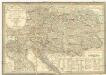
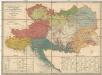
Erb-Kaiserthum Oesterreich
Evropa jihovýchodní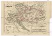
Císařství rakouské
1 : 6000000 Rakousko (1804-1867) Wagner, Jan Eduard Jaroslav Pospíšil
General-Karte von dem Oesterreichischen Kaiserstaate
1 : 2350000 Evropa střední a východní Weiland, Karl Ferdinand Jungmann, C. im Verlage des geographischen Instituts
General-Karte von dem Oesterreichischen Kaiserstaate
Rakousko (1804-1867) Weiland, Karl Ferdinand Jungmann, C. im Verlage des geographischen Instituts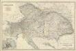
Composite: Austria.
1 : 1642000 Johnston, Alexander Keith, 1804-1871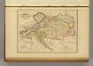
Empire d'Autriche.
1 : 2000000 Malte-Brun, Conrad, 1775-1826
Austria. Hungary.
1 : 4000000 Colton, G.W.
Versuch einer Sprachenkarte der Österreichischen Monarchie
Rakousko (1804-1867) Haeufler, J. V. Riegel, Christoph Gustav Emich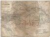
Das Kaiserthum Oesterreich
1 : 2310000 Evropa střední Holle, L. L. Holle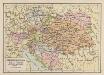
Österreich-Ungarn
1 : 6900000 Österreich-Ungarn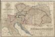
Neueste General- Post-und Strassen Karte der Oesterreichischen Monarchie
1 : 1480000 Evropa střední a východní Traux, Maximilian de Fried, Franz bei Artaria & Compag.ie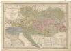
Neueste General-Post- & Strassen- Karte der Oesterreichischen Monarchie
1 : 1950000 Evropa střední a východní Fried, Franz List, Joseph Artaria & Comp.
Neueste General- Post- und Strassen Karte der OEsterreichischen Monarchie
1 : 1440000 Evropa střední a východní Traux, Maximilian de Fried, Franz bei Artaria & Compag.ie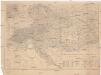
Der Österreichische Kaiser-Staat
1 : 1863880 Evropa jihovýchodní Handtke, Friedrich Adler, C. C. Flemming
Osterreich.
1 : 2400000 Steinhauser, A.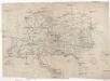
Národní zeměvid Rakouské říše
Rakousko-Uhersko Weiland, Karl Ferdinand Šafařík, Pavel Josef
Národní zeměvid Rakouské říše
Rakousko-Uhersko Hanuš, Ignác Jan wydán od Helceleta a Hanuše
Národní zeměvid Rakouské říše
Rakousko-Uhersko Hanuš, Ignác Jan wydán od Helceleta a Hanuše
Národní zeměvid Rakouské říše
Rakousko-Uhersko Stieler, Adolf Šafařík, Pavel Josef wydán od Helceleta a Hanuše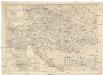
Politisch-statistische Karte vom österreichischen Staate
1 : 2000000 Rakousko Mahlmann, H. Dietrich Reimer
Az Austriai birodalom
1 : 3080000 Rakousko (1804-1867) Karacs, Ferentz Lassú István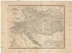
Mocnářství rakouské
1 : 2400000 Rakousko (1804-1867) Wagner, Jan Eduard Jaroslav Pospíšil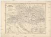
Mocnářství rakouské
1 : 2400000 Rakousko (1804-1867) Wagner, Jan Eduard Jaroslav Pospíšil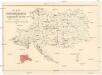
Karte der Thonwaaren-Industrie des Oesterreichischen Monarchie
Rakousko (1804-1867) K. k. Direction der administrativen Statistik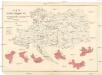
Karte der Glaswaaren-Industrie der Oesterreichische Monarchie
Rakousko (1804-1867) K. k. Direction der administrativen Statistik
Mapa mocnářství Rakousko - Uherského
Etnographische Karte der Oesterreichischen Monarchie
1 : 1584000 Rakousko (1804-1867) Czörnig, Karl von
Eisenbahnkarte von Oesterreich-Ungarn
1 : 1900000 Rakousko-Uhersko Bomsdorff, Th. von Karl Prochaska