Maps of Metropolitan France
LA FRANCE en 1812
Francie Las Cases, Emmanuel-Auguste-Dieudonné Didot, Pierre Jules Didot Ainé
Francie, Belgie, Nizozemí, Lucembursko

Le royaume de France
1 Karte : Kupferdruck ; 46 x 55 cm Seutter Matthäus Seutter
Gallia
1 : 4250000 Francie Plancius, Petrus Petrus Plancius
Charte von Frankreich
1 : 2400000 Francie Streit, Friedrich Wilhelm Geograph. Instituts
Charte von Frankreich
1 : 2400000 Francie Streit, Friedrich Wilhelm Geograph. Instituts
30-31. Francia, France.
1 : 3000000 Touring club italiano
Carte générale de l'Empire Français et du Royaume d'Italie suivant les nouvelles divisions : avec les chefs-lieux de préfecture et l'indication des principales routes
1 : 2000000 par C.F. Delamarche Barriere sculpsit. À Paris : chez l'auteur
Nouvelle carte de poste de tout l'empire Français, de l'Anglettere, de l'Italie, d'une partie de l'Espagne et de l'Allemagne etc
Anglie Hinrichs, Johann Conrad J.C. Hinrichs
Frankreich mit Piemont, Schweiz, Baden, Württemberg, Rhein-Provinz, Hessen und Belgien
1 : 1200000 Belgie Geographisches Institut
[Frankreich]
Historisch-genealogisch-geographischer Atlas von Le Sage Las Cases, Emmanuel Auguste Dieudonné Marius Joseph de Johann Velten, Kunsthändler
France.
1 : 4550000 Darton, William
Nouvelle carte de poste de tout l'empire Français, de l'Angleterre, de l'Italie, d'une partie de l'Espagne et de l'Allemagne, etc. = Neueste Post Karte vom ganzen Französischen Reiche, England, Italien, und einem Theile von Spanien und Deutschland uzw. / hrsg. und verlegt von J.C. Hinrichs
1 : 2800000 Hinrichs, J. C. Leipzig : Hinrichs
Galliae Regni Potentiss: Nova Descriptio. [Karte], in: Theatrum orbis terrarum, S. 30.
1 Karte aus Atlas Ortelius, Abraham
Galliae Regni Potentiss: Nova Descriptio [Karte], in: Theatrum orbis terrarum, S. 110.
1 Karte aus Atlas Ortelius, Abraham Vrients, Jan Baptista
Galliae Veteris Typus. [Karte], in: Theatrum orbis terrarum, S. 374.
1 Karte aus Atlas Ortelius, Abraham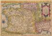
Galliae Regni Potentiss: Nova Descriptio [Karte], in: Theatrum orbis terrarum, S. 63.
1 Karte aus Atlas Ortelius, Abraham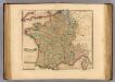
France, departments.
1 : 2900000 Lizars, Daniel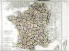
Carte de la France
1 Karte : Kupferdruck ; 54 x 64 cm Poirson; Jean chez Jean M.d d'estampes rue Jean de Beauvais n.o 32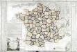
Carte de la république de France
1 Karte : Kupferdruck ; 49 x 64 cm Poirson; Glot; Esnault; Rapilly; Besançon chez Esnauts et Rapilly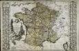
Nouvelle carte de la France
1 Karte : Kupferdruck ; 50 x 60 cm, Bildgrösse 52 x 76 cm Brion de la Tour; Esnault; Rapilly chez Esnauts et Rapilly rue Saint Jacques à la ville de Coutance
Gallia
1 Karte : Kupferdruck ; 46 x 55 cm Seutter; L'Isle excusa et venales exhibita à M. Seutter sac. c. Maj. geogr. Aug
Gallia
1 Karte : Kupferdruck ; 46 x 55 cm Seutter; L'Isle excusa et venales exhibita à Matth: Seutter calc
La France
1 Karte : Kupferdruck ; 44 x 59 cm Simonneau; L'Isle chéz l'auteur sur le quai de l'Horloge a l'aigle d'or
Gallia [Karte], in: Gerardi Mercatoris Atlas, sive, Cosmographicae meditationes de fabrica mundi et fabricati figura, S. 213.
1 Karte aus Atlas Mercator, Gerhard Montanus, Petrus
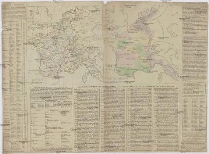
[Historisch-geographischer Atlas zu den allgemeinen Geschichtswerken von C. v. Rotteck, Pölitz u. Becker] : Frankreich eine Uebersicht der Bildung und der Hauptbegebenheiten dieses Staates
von Julius Loewenberg Lithographie von B. Herder in Freiburg im Breisgau [Freiburg im Breisgau] : [Herder]
Gallia Antiqua.
1 : 2500000 Anville, Jean Baptiste Bourguignon d, 1697-1782
Neue Orientierungkarte [von] Frankreich u[nd] Mittelmeerlä[nder]
Francie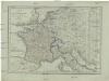
Karte von Frankreich
1 : 4500000 Belgie Mollo, Tranquillo Tranquillo Mollo