Maps of Castelnuovo del Garda

Plan der Gegend am obern Mincio
1 : 20000 Gardské jezero-oblast (Itálie)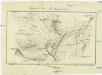
Gegend bei Monzambano
Monzambano (Itálie) Mathievich, Alexander
Plan des Schlachtfeldes von Custozza am 24. Juni 1866
1 : 20000 Blatt 2 [k.k. Generalstabs-Bureau für Kriegsgeschichte]
Plan des Schlachtfeldes von Custozza am 24. Juni 1866
1 : 20000 Blatt 1 [k.k. Generalstabs-Bureau für Kriegsgeschichte]
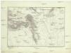
Schlacht bei Solferino

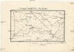
Landesstrich zwischen der Chiese und der Etsch 1837
1 : 21600 Blatt 3 [s.n.]
Brescia im Jahre 1842
Brescia-oblast (Itálie) Sertić, Ludwig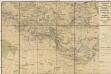
Gegend zwischen Volta, Guidizzolo, Solferino, Cavriana und Monzambano zum Behuf der Manoeuvrir-Rayons der Division des F.M.L. Baron Paumgarten im Jahre 1834
1 : 31500 Cavriana (Itálie)
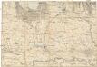
[Castelnuovo del Garda a okolí]
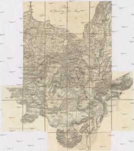
Gardské jezero-oblast (Itálie)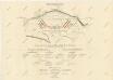
Umgebung von Vallegio
Valeggio sul Mincio (Itálie) Stanich, Eugen Simonyi

Landesstrich zwischen der Chiese und der Etsch 1837
1 : 21600 Blatt 2 [s.n.]
Landesstrich zwischen der Chiese und der Etsch 1837
1 : 21600 Blatt 4 [s.n.]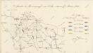

Gegend zwischen Verona, Peschiera, und Mantova
1 : 43200 Mantova (Itálie)
Schlacht bei Solferino

Territorio di Verona
1 : 300000 Mollova mapová sbírka Magini, Fabio Magini, Fabio
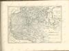
Verona e dintorni
1 : 100000 Verona (Itálie : oblast) Instituto geografico militare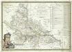
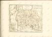
Carta topografica della provincia di Mantova
1 : 120000 Mantova (Itálie) Raineri, Giuseppe Raineri, Giuseppe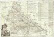
Carta topographica della provincia di Mantova
1 : 126000 Mantova (Itálie) Raineri, Giuseppe Raineri, Giuseppe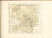
Verona, Mantova
Mantova (Itálie)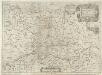
Territorio di Cremona
1 : 220000 Mollova mapová sbírka Magini, Giovanni Antonio Magini, Giovanni Antonio
Carte d'une Partie du Mantouan, du Veronois, et des Campanems de l'Armée Imperiale
Mollova mapová sbírka Rebein, J. D.
Nova et Esatta Descrizione Topografica della Riviera di Salo posta in Luce da un suo Cittadino dilettante
Mollova mapová sbírka Filosi, Giuseppe