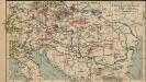
Maps of Carpathian Mountains
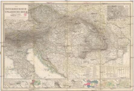
Das Österreichisch-Ungarische Reich
1 : 1850000 Rakousko-Uhersko Berghaus, Hermann Eulenstein, F. Justus Perthes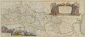
Danubius, Fluvius Europae Maximus, A Fontibus Ad Ostia. Cum omnibus Fluminibus, ab utroque latere, in illum defluentibus. [Karte], in: Theatrum orbis terrarum, sive, Atlas novus, Bd. 1, S. 310.
1 Karte aus Atlas Blaeu, Joan Blaeu, Willem Janszoon
Danubius, Fluvius Europae Maximus. A Fontibus Ad Ostia, Cum omnibus Fluminis, ab utroque latere, in illum fluentibus. [Karte], in: Gerardi Mercatoris et I. Hondii Newer Atlas, oder, Grosses Weltbuch, Bd. 1, S. 233.
1 Karte aus Atlas Mercator, Gerhard und Hondius, Jodocus Jansson, Jan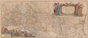
Danubius. Fluvius Europae Maximus. A Fontibus Ad Ostia. Cum omnibus Fluminib. ab utroque latere, in illum fluentibus. [Karte], in: Novus atlas absolutissimus, Bd. 2, S. 238.
1 Karte aus Atlas Janssonius Offizin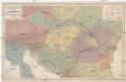
Völker und Sprachen Karte von Österreich und den Unter-Donau-Ländern
1 : 3000000 Rakousko-Uhersko Kiepert, Heinrich Dietrich Reimer
Völker und Sprachen Karte von Österreich und den Unter-Donau-Ländern
1 : 3000000 Evropa střední Kiepert, Heinrich D. Reimer
Völker und Sprachen Karte von Österreich und den Unter-Donau-Ländern
Rakousko-Uhersko Kiepert, Heinrich Riegel, Christoph Dietrich Reimer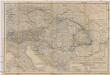
Oesterreichisch-ungarische Monarchie
1 : 2500000 Rakousko-Uhersko Geographisches Institut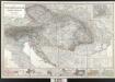
Der österreichische Kaiserstaat
Berghaus, Hermann; Stülpnagel, Friedrich von; Petermann, August; Habenicht, Hermann Perthes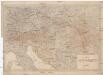
Karta Avstro-Vengrii
1 : 520000 Rakousko-Uhersko Il'jin, A.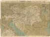
Prochaska ́s Neue Eisenbahnkarte von Österreich-Ungarn für 1898
Composite: Austro-Hungarian Monarchy.
1 : 1642000 Johnston, W. & A.K.
Danubius, Fluvius Europae Maximus, A Fontibus Ad Ostia, Cum omnibus Fluminibus, ab utroque latere, in allum defluentibus. [Karte], in: Le théâtre du monde, ou, Nouvel atlas contenant les chartes et descriptions de tous les païs de la terre, Bd. 1, S. 222.
1 Karte aus Atlas Blaeu, Willem Janszoon und Blaeu, Joan Blaeu, Willem Janszoon
Austria.
1 : 5000000 Finley, Anthony
Karte der politischen Justiz- und Militär- Verwaltungsbezirke im Kaiserthume Oesterreich
Evropa jihovýchodní Schnabel, Jiří Norbert Machek, A.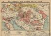
Österreich-Ungarn. Landwirtschaft und Fischerei
1 : 9000000 Österreich-Ungarn Landwirtschaft, Fischerei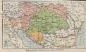
Österreich-Ungarn. Staaten
1 : 9000000 Österreich-Ungarn Verwaltungsgliederung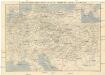
Eisenbahn-Routen-Karte von Mittel-Europa
Budapešť (Maďarsko) Ritter, Julius Broditzky, Joseph R. v. Waldheim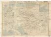
Eisenbahn-Routen-Karte von Mittel-Europa
Budapešť (Maďarsko) Ritter, Julius Broditzky, Joseph R. v. Waldheim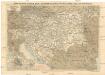
Eisenbahn-Routen-Karte von Mittel-Europa
Budapešť (Maďarsko) Ritter, Julius Broditzky, Joseph R. v. Waldheim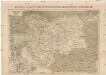
Eisenbahn-Karte der Österreichisch-Ungarischen Monarchie
Rakousko-Uhersko Broditzky, Joseph R. v. Waldheim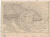
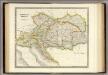
Kaiserthum Oesterreich
1 : 2500000 Rakousko-Uhersko Gräf, Carl Geographisches Institut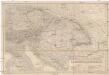
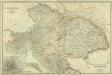
Kaiserthum Oesterreich
1 : 2500000 Rakousko-Uhersko Gräf, Carl Geographisches Institut
Kaiserthum Oesterreich
1 : 2500000 Evropa jihovýchodní Gräf, C. Geographisches Institut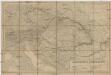
Kaiserthum Oesterreich
1 : 2500000 Evropa jihovýchodní Gräf, C. Geographisches Institut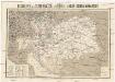
Reisekarte der Oesterreich. Ungarischen Monarchie
1 : 2250000 Evropa střední Moritz Perles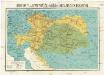
Reisekarte der Oesterreich. Ungarischen Monarchie
1 : 2250000 Evropa střední Moriz Perles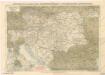
Eisenbahnkarte der österreichisch-ungarischen Monarchie
Austrian Empire.
1 : 2050000 Teesdale, Henry