Maps of Península Ibérica
Karte von dem Iberischen Halbinsellande oder den Königreichen Spanien und Portugal
1 : 1500000 Portugalsko Berghaus, Heinrich Karl Wilhelm Brose, Heinrich J.G. Cotta's geographischer Anstalt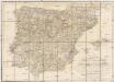
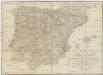
Karte von dem Iberischen Halbinsellande oder den Königreichen Spanien und Portugal
1 : 1500000 Portugalsko Berghaus, Heinrich Karl Wilhelm Brose, Heinrich J.G. Cotta's geographischer Anstalt
Mapa general de caminos de España y de Portugal con las nuevas divisiones de provincias sirve de continuación al Atlas nacional de España
1 : 1800000 por A.H. Dufour la geografía grabada por Desbuissons y Leclercq ; la letra grabada por Bénard Paris : Bulla
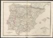
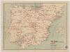
Spain & Portugal
A new general atlas of modern geography, consisting of a complete collection of maps of the four quarters of the globe Wyld, James James Wyld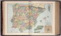
Spain and Portugal 20
1 : 2500000 Appleton, D. & Co.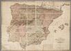
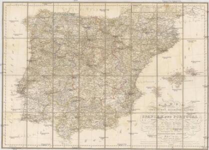
A new map of Spain and Portugal : exhibiting the chains of mountains with their passes, the principal & cross roads, with other details requisite for the intelligence of military operations / comp. by Jasper Nantiat
1 : 850000 Annotatie: Met afstandentabel Nantiat, Jasper London : W. Faden
Hispania antiqua in tres præcipuas partes
1 Karte : Kupferdruck ; 46 x 64 cm Sanson; Remondini; Robert de Vaugondy; Santini apud Franc.m Santini chez Mr. Remondini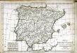
Mappa Hispaniæ antiquæ descripta
1 Karte : Kupferdruck ; 21 x 31 cm Bonne; Perrier; André s.n.
Hispania antiqua in tres præcipuas partes
1 Karte : Kupferdruck ; 46 x 56 cm Robert de Vaugondy; Sanson; Delahaye G. et D. Robert de Vaugondy
Carte de l'Espagne ancienne
1 Karte : Kupferdruck ; 39 x 49 cm Robert de Vaugondy G. Robert de Vaugondy
Hispania antiqua
1 Karte : Kupferdruck ; 40 x 52 cm Sanson; Robert de Vaugondy chés le Sr. Robert geog. ord. du roy sur le quay de l'horloge du palais
Hispania vetvs
1 Karte : Kupferdruck ; 31 x 38 cm Weigel Christoph Weigel
Hispaniae veteris descriptio
1 Karte : Kupferdruck ; 36 x 47 cm Ortelius s.n.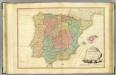
Spain, Portugal.
1 : 2050000 Faden, William, 1750?-1836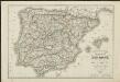
Carte routière des royaumes d'Espagne et de Portugal : réduite d'après la Carte itinéraire publiée par le Dépôt de la Guerre
1 : 1850000 par L. H. Berthe A Paris : Berthe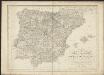
Karte von dem Iberischen Halb-Insellande, oder den Königreichen Spanien und Portugal
1 : 1500000 entworfen und in den Jahren 1826-1829 bearb. von Heinrich Berghaus gestochen von Heinrich Brose ; Schrift von Wilhelm Brose München : Cotta
España: comunicaciones terrestres
Datat al 1950 aproximadament. 0 Seix y Barral
Hispania : ex archetypo Roderici Mendez Silvae et variis relationibus et chartis manu scriptis et impressis hujus regni rectificatis per Observationes Sociorum Academiae Scientiarum quae est Parisiis
1 : 3200000 per G. De L'Isle Matth. Seutter sculp. Aug. Vind : in officina Tobiae Conr. Lotter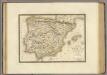
Espagne ancienne.
1 : 2700000 Brue, Adrien Hubert, 1786-1832
Espagne et Portugal.
Andriveau-Goujon, J.
Spanien und Portugal
Geographischer Atlas über alle Theile der Erde Ziegler, Jakob Melchior Verlag von Joh. Wurster um Comp.
Spain and Portugal.
1 : 3380000 Sharpe, J.
Carta itineraria de España
1 : 1500000 Depósito Central de Planos de la Dirección General de Obras Públicas
L'Espagne
1 : 2600000 Aragonie (Španělsko) Sanson, Guillaume Cordier, Louis chez H. Jaillot
Hispania
1 : 3800000 Španělsko Spruner, Karl von Alt Justus Perthes
Espagne ancienne.
1 : 2800000 Picquet, C.
A new map of the Kingdoms of Spain and Portugal.
1 : 2230000 Kitchin, Thomas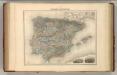
Espagne et Portugal.
1 : 3375000 Migeon, J.