Maps of Atafu

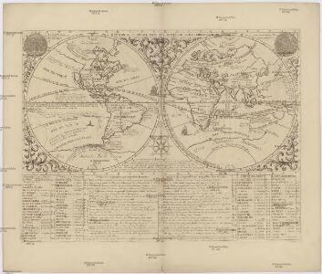
Mappe monde ou description generale du globe terrestre
země světa Chatelain, Henri-Abraham Chatelain
Savaii
1 : 100000 Samojské ostrovy (Polynésie : souostroví) Airey, R. C. Marcus F. Marks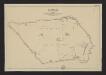
Savaii
1 : 100000 Department of Lands and Survey
Seguam
1 : 250000
Seguam
1 : 250000
Seguam
1 : 250000
St Matthew
1 : 250000
St Matthew
1 : 250000
Archipel des Navigateurs.
1 : 670000 La Perouse, Jean-Francois de Galaup, comte de, 1741-1788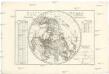
Mappe-monde sur le plan de l'equateur
severní polokoule André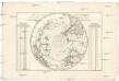
Mappe-monde sur le plan de l'equateur
jižní polokoule André
Samoan or Navigator Islands.
1 : 2200000 United States Exploring Expedition (1838-1842)
Chart of the Archipelago of Navigators (Samoa)
1 : 880000 La Perouse, Jean-Francois de Galaup, comte de, 1741-1788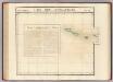
Iles des Navigateurs. Oceanique no. 41.
1 : 1641836 Vandermaelen, Philippe, 1795-1869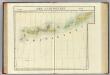
Iles Aleutiennes. Asie 39.
1 : 1641836 Vandermaelen, Philippe, 1795-1869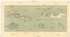
Karte der Samoa-Inseln
1 : 850000 Samojské ostrovy (Polynésie : souostroví) Herkt, Otto Carl Flemming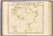
Partie, Russie d'Asie. Asie 20.
1 : 1641836 Vandermaelen, Philippe, 1795-1869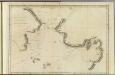
Norton Sound, Bherings Strait.
1 : 4400000 Cook, James, 1728-1779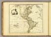
America.
1 : 50000000 Faden, William, 1750?-1836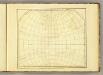
America (blank)
1 : 50000000 Faden, William, 1750?-1836
World East.
1 : 42000000 Stanford, Edward
Western Hemisphere.
1 : 95000000 Finley, Anthony
W. Hemisphere.
1 : 100000000 Tanner, Henry S.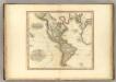
America.
1 : 43000000 Tanner, Henry S.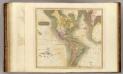
America.
1 : 43000000 Thomson, John
Western Hemisphere.
1 : 100000000 Lucas, Fielding Jr.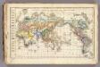
Distribution primitive du genre humain.
1 : 95000000 Vincent
Mapa světa
1 : 40000000 země světa Machát, František V. Neubert
Mapa světa
1 : 40000000 země světa Machát, František V. Neubert