Maps of Carpathian Mountains

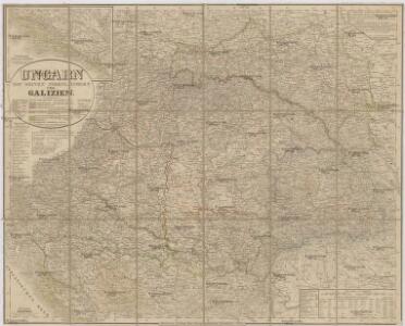
Ungarn mit seinen Nebenländern und Galizien
1 : 1600000 Dalmácie jižní (Chorvatsko) Kiepert, Heinrich Eulenstein, F. Geographisches Institut
Ungarn mit seinen Nebenländern und Galizien
1 : 1600000 Dalmácie jižní (Chorvatsko) Kiepert, Heinrich Blaschnek Verlag des Geographischen Institut
Ungarn mit seinen Nebenländern und Galizien
1 : 1600000 Dalmácie jižní (Chorvatsko) Kiepert, Heinrich Blaschnek Verlag des Geographisches Institut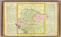
Hongrie.
1 : 2550000 Clouet, J. B. L. (Jean-Baptiste Louis), b. 1730
OCTAVA EUROPE TABULA / [Kartograph: Nicolaus Germanus ; Stecher: Johannes von Armsheim]
1 : 5100000 1 Karte : Holzschnitt ; 40 x 57 cm Ptolemaeus, Claudius [Johann Reger?]
Carte ethnographique historique et stratégique des contrées Hongroises, Slaves, Moldo-Valaques et Allemandes de l'Empire Autrichien impliquées dans la guerre actuelle
Evropa jihovýchodní Bourgoing, Paul Charles Amable de imprimerie Gerdes
Galizien, Ungarn und Nebenländer
Neuer Handatlas über alle Theile der Erde Kiepert, Heinrich Verlag von Dietrich Reimer
Místopisná mapa Rakousko-Uherska
1 : 2000000 Rakousko-Uhersko Brunclík, Josef Jos. Švíkal
Místopisná mapa Rakousko-Uherska
1 : 2000000 Rakousko-Uhersko Brunclík, Josef Jos. Švíkal
Etats Orientaux De L'Empereur a partir De La Baviere Et De La Boheme : pour l'Ouvrage intitulé: De la Monarchie Prussienne
Mentelle, Edme

Etats orientaux de l'empereur a partir de la Baviere et de la Boheme
1 : 3170000 Evropa jihovýchodní Mentelle, Edme Tardieu, Pierre François

Le Royaume de Hongrie
1 : 2400000 Mollova mapová sbírka Valk, Gerhard Valck, Gerard
Ungarn und Galizien
Allgemeiner Atlas [Walch, Johannes] im Verlag bei Johannes Walch
[Ungarn, Galizien, Schlavonien, Croatien und Siebenbürgen]
Neuester Schul-Atlas Walch, Johann im Verlag bei Joh. Walch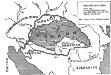
Ungarn 1938-1944
Ungarn Weltkrieg <1939-1945>, Grenze
Karpatenländer, politische Übersicht
1 : 6000000 Donau-Karpaten-Gebiet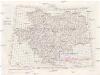
[Jugoslávie 1:200 000]
1 : 25000 Jugoslávie K. u. k Militärgeographisches Institut
Karpatenländer, Flusz- & Gebirgskarte
1 : 6000000 Donau-Karpaten-Gebiet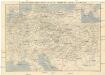
Eisenbahn-Routen-Karte von Mittel-Europa
Budapešť (Maďarsko) Ritter, Julius Broditzky, Joseph R. v. Waldheim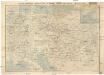
Eisenbahn-Routen-Karte von Mittel-Europa
Budapešť (Maďarsko) Ritter, Julius Broditzky, Joseph R. v. Waldheim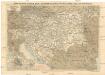
Eisenbahn-Routen-Karte von Mittel-Europa
Budapešť (Maďarsko) Ritter, Julius Broditzky, Joseph R. v. Waldheim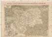
Eisenbahn-Karte der Österreichisch-Ungarischen Monarchie
Rakousko-Uhersko Broditzky, Joseph R. v. Waldheim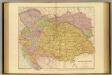
Austria-Hungary.
1 : 1774080 Stanford, Edward
Hvngaria Magna In Regna et Prouincias diuisa
1 : 7400000 Mollova mapová sbírka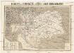
Reisekarte der Oesterreich. Ungarischen Monarchie
1 : 2250000 Evropa střední Moritz Perles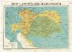
Reisekarte der Oesterreich. Ungarischen Monarchie
1 : 2250000 Evropa střední Moriz Perles
Volkerkarte v. Oesterreich-Ungarn.
1 : 4000000 Andree, Richard