Maps of Skikda
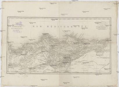
Carte d'une partie de la province de Constantine
1 : 680000 Alžírsko Wenng, Gustav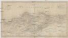
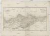
Carte d'une partie de la province de Constantine
1 : 680000 Alžírsko Wenng, Gustav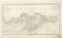
Carte d ́une partie de la province de Constantine

Constantine
1 : 200000 Maumias; Algérie. Service cartographique Alger : Adolphe Jourdan
Sétif
1 : 200000 Maumias; Algérie. Service cartographique Alger : Adolphe Jourdan
Porto Bona int groodt
Algeria Gerard van Keulen
Croquis de la ville de Constantine
1 : 8300 Saint Hypolite J. Schwegerle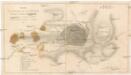
Croquis de la ville de Constantine
1 : 8300 Constantine (Alžírsko) Schnegerle, J.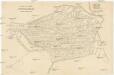
Plan der Stadt Constantine
Alžírsko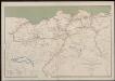
Département de Constantine. Carte des voies de communication
1 : 400000 Calléja; Algérie. Direction de l'agriculture et de la colonisation Alger : lith. Adolphe Jourdan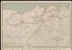
Département de Constantine. Carte des voies de communication
1 : 400000 Calléja; Algérie. Direction de l'agriculture et de la colonisation Alger : lith. Adolphe Jourdan
Carte des étapes de la province de Constantine
1 : 1000000 E. Corny Alger : A. Jourdan
Dépt. De Constantine carte politique
Vidal de La Blache, Paul
Dépt. De Constantine carte physique
Vidal de La Blache, Paul
Carte géologique provisoire de la province de Constantine et du Cercle de Bou-Saada
1 : 800000 Tissot, Jules 1838-1883 Alger : A. Jourdan
Algier
Alžírsko Weiland, Karl Ferdinand Mansfeld, Sebastian Geograph. Institut
Spanien und Portugal
Španělsko Votésky, Michael Berra, Marco Marco Berra
Typvs Hispaniae
Španělsko Hessel, Gerard Almada, Andrea d' sumptibus Iudoci Hondii
Spanien und Portugal
Španělsko Weiland, Karl Ferdinand Jaeger, I. G. im Verlage des Geograph. Instituts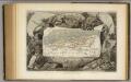
Algeria Colonie Francaise.
1 : 4000000 Levasseur, Victor.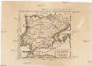
L'Espagne
Španělsko Stanich, Eugen Hinrichs, J. C.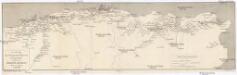
Carte des chemins de fer Algériens et Tunisiens
Alžírsko Adolphe Jourdan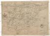
Totivs descriptio Hispaniae
Španělsko Renner Kleinknecht
Hispaniae et Portugalliae regna
Španělsko Visscher, Nicolaus Almada, Andrea d' per Nicolaum Visscher
Carte agricole et industrielle de l'Algérie
1 : 1600000 Adolphe Jourdan Alger : Adolphe Jourdan
Carte agricole et industrielle de l'Algérie
1 : 1600000 Adolphe Jourdan Alger : Adolphe Jourdan
Algier.
1 : 400000 Theinert, A.
Carte de la région de l'Halfa : et des voies de communication, routes ou chemins de fer existants ou à créer, qui peuvent la desservir
1 : 1500000 Mac Carthy, Oscar 1815-1894 Paris : Erhard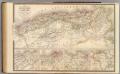
L'Algerie, Tunis.
1 : 1720000 Andriveau-Goujon, J.
Algerie
1 : 3500000 Alžírsko Gouvernement général de l'Algérie, Service cartographique
Algerie
1 : 3500000 Alžírsko Gouvernement général de l'Algérie, Service cartographique
Algerie
1 : 3500000 Alžírsko Gouvernement général de l'Algérie, Service cartographique
Algerie
1 : 3500000 Alžírsko Gouvernement général de l'Algérie, Service cartographique