Maps of Czech Republic
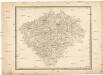
[Čechy]
Česko
Statistické mapy Království českého
Čechy (Česko) Kořistka, Karel František Edvard vydané Centralním komitétem pro hosp. a lesnick. statistiku Čech
Statistické mapy Království českého
Čechy (Česko) Kořistka, Karel František Edvard vydané Centralním komitétem pro hosp. a lesnick. statistiku Čech
Statistické mapy Království českého
Čechy (Česko) Kořistka, Karel František Edvard vydané Centralním komitétem pro hosp. a lesnick. statistiku Čech
Statistické mapy Království českého
Čechy (Česko) Kořistka, Karel František Edvard vydané Centralním komitétem pro hosp. a lesnick. statistiku Čech
Statistické mapy Království českého
Čechy (Česko) Kořistka, Karel František Edvard vydané Centralním komitétem pro hosp. a lesnick. statistiku Čech
Statistické mapy Království českého
Čechy (Česko) Kořistka, Karel František Edvard vydané Centralním komitétem pro hosp. a lesnick. statistiku Čech
Statistické mapy Království českého
Čechy (Česko) Kořistka, Karel František Edvard vydané Centralním komitétem pro hosp. a lesnick. statistiku Čech
Příruční mapa království Českého

Übersichtts und Distanzen - Karte des k.k. Landes - Gendarmerie-Commando No 2 für Böhmen

Mapa království Českého
1 : 800000 Čechy (Česko) Krečmar, Bedřich tisk a sklad Bedř. Krečmara
Karte des landtäflichen Grossgrund-Besitzes im Königreiche Böhmen nach der ehem. Domanial-Umgrenzung mit Angabe der positiven Grösse des Besitzes
1 : 600000 Čechy (Česko) Hickmann, Anton L. A.L. Hickmann
Karte der Kreisgerichts-Sprengel und Gerichts-Bezirke des Königreiches Böhmen nebst den fertigen und projectirten Eisenbahn-Linien
1 : 600000 Čechy (Česko) Hickmann, Anton L. A.L. Hickmann
Haec tabvla Regni Boemiae
1 : 512000 Česko Vusín, Kašpar Zachariáš Casparus Wussin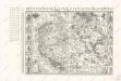
Bez titulu: Soubor reprintů starých map

Mapa Království českého pro cestující, turisty, cyklisty a. t. d
1 : 500000 Praha-oblast (Česko) Wagner, Jan Eduard Mareš, František Alois Hynek
Čechy
1 : 1000000 Praha (Česko) Semík, Matěj nákladem Ústředního nakladatelství a knihkupectví učitelstva českoslovanského
Generální mapa Království českého
1 : 220000 Čechy (Česko) Wagner, Jan Eduard Mareš, František F. Kytka
Archeologická mapa Čech
1 : 700000 Horák, Fr. Niederle, Lubor Lad. Horák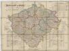
Generalkarte von Böhmen
1 : 560000 Česko Hennig, C. A. F. J.G. Calvesche Buchhandlung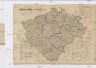
Generalkarte von Böhmen
1 : 560000 Česko Hennig, C. A. F. J.G. Calvesche Buchhandlung
Cestovní mapa království Českého

Karte der Volks-Schul-Bezirke, der Mittelschulen, Lehrer-Bildungsanstalten und gewerblichen Fachschulen des Königreiches Böhmen
1 : 600000 Česko Hickmann, Anton L. A.L. Hickmann
Karte der Bezirks-Hauptmannschaften (politischen Bezirke) und der Eisenbahn-Linien im Königreiche Böhmen
1 : 600000 Česko Hickmann, Anton L. A.L. Hickmann
Karte der Volks-Schul-Bezirke, der Mittelschulen, Lehrer-Bildungsanstalten und gewerblichen Fachschulen des Königreiches Böhmen
1 : 600000 Česko Hickmann, Anton L. Steyrer, Fr. C. A.L. Hickmann
Sprachen-Karte des Königreiches Böhmen nebst Angabe des Landtags-Wahlbezirke
1 : 600000 Česko Hickmann, Anton L. A.L. Hickmann
Geologisch-Montanistische Karte des Königreiches Böhmen
1 : 600000 Česko Hickmann, Anton L. A.L. Hickmann
Karte der Bewölkerungsdichte (relative Bevölkerung) des Königreiches Böhmen
1 : 600000 Česko Hickmann, Anton L. A.L. Hickmann
Forst-Karte des Königreiches Böhmen nebst Angabe der Zuckerfabriken, Bierbrauereien und Mahlmühlen
1 : 600000 Česko Hickmann, Anton L. A.L. Hickmann
![[Čechy]](https://images-2.georeferencer.com/images/iiif/316849298810/full/,300/0/native.jpg)

