Maps of okres Trutnov

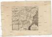
Karte der Bezirkshauptmannschaft Trautenau
1 : 100000 Trutnov-oblast (Česko) Erben, Josef Karl Janský
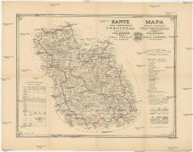
Mapa okresního hejtmanství Trutnovského

Generální mapa okresních hejtmanství

Generalkarte der Bezirkshauptmannschaft Trautenau
1 : 220000 Trutnov-oblast (Česko) Wagner, Jan Eduard F. Kytka
Umgebung von Trautenau
1 : 75000 Trutnov (Česko : oblast) Militärgeographisches Institut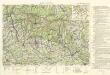
Krkonoše

Trautenau und Politz.
from Spezialkarte der osterreichisch-ungarischen Monarchie.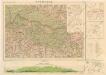
Krkonoše

[Trautenau, Königinhof und Umgebung]
1 : 243000 Králův Dvůr (Česko)
Trutnov a okolí

Trutnov a okolí
1 : 75000 Trutnov (Česko : oblast) Vojenský zeměpisný ústav
Trutnov a okolí
1 : 75000 Trutnov (Česko : oblast) Vojenský zeměpisný ústav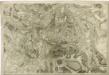
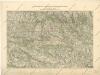
Topographische und Militairische Carte desienigen Theils von Boehmen...

Östliche Riesengebirge und die Adersbach-Wekelsdorfer Felsen
1 : 100000 Adršpašsko-teplické skály (Česko) G. Freytag & Berndt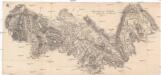
Gegend zwischen Schatzlar Golden-Else und Wekelsdorf
Žacléř-oblast (Česko)
Uebersichtsblatt zum Kriegsspielplan der Umgebung von Trautenau
Uebersichtsblatt zum Kriegsspielplan der Umgebung von Trautenau

Neueste Wegekarte vom Riesengebirge und Situationsplan von Johannsbad
1 : 75000 Janské Lázně (Česko : oblast) Vatter, Alfred Alfred Vatter
Podrobné mapy zemí Koruny české v měřítku 1:75.000 a mapa vzdáleností všech míst při silnici ležících - Krkonoše - Vrchlabí - Žacléř. Průvodce statisticko-historický po všech místech na těchto mapách uvedených a rejstřík věcný názvů hor, potoků, řek, rybníků atd. Sešit 9. List 88,
1 : 75000
Krkonoše
1 : 100000 Krkonoše (Česko a Polsko : pohoří) Srp, Jan Jos. R. Vilímek
Podrobná mapa Království českého
1 : 100000 Jilemnice (Česko : oblast) Srp, Jan Jaroslav Bursík
Übersichts- und Terrainkarte der gräflich Czernin-Morzin'schen Domainen Hohenelbe und Marschendorf im Riesengebirge
1 : 50000 Horní Maršov (Česko) R. Mittelbach
Trautenau und Politz
1 : 75000 Broumov (Náchod, Česko : oblast) Fenzl K. u. k. Militärgeographisches Institut
Trautenau und Politz
1 : 75000 Police nad Metují (Česko : oblast) K. u. k. Militärgeographisches Institut
Mittelbach ́s neueste Spezialkarte des Riesengebirskammes mit näheren Umgebung

Trutnov
1 : 75000 Trutnov (Česko : oblast) Vojenský zeměpisný ústav
Trutnov
1 : 75000 Trutnov-oblast (Česko) Vojenský zeměpisný ústav
Trutnov
1 : 75000 Trutnov (Česko : oblast) Vojenský zeměpisný ústav
Petrographische Charte eines Theils des böhmischen Riesengebirges an der schlesischen Gränze
1 : 82600 Krkonoše (Česko a Polsko) Jirasek, Johann