Maps of Botswana

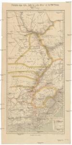
Přehledná mapa k dílu "Sedm let v Jižní Africe" od Dra. Em. Holuba
1 : 7200000 Afrika jižní Holub, Emil J. Otta
Oorlogskaart van Zuid-Afrika 1899-1900 / bew. te Pretoria naar officieele gegevens
1 : 1250000 Rotterdam : Nijgh & Van Ditmar
Jesuit mission of northern Rhodesia
1 : 1500000 Zambie Dittrich, Reinhold
Specialkarte der Südafrikanischen- (Transvaal) Republik

Südafrikanische (Transvaal-) Republik, Oranje-Freistaat und angrenzende Gebiete
1 : 3000000 Afrika jižní Carl Flemming
W. H. Smith & Son's War map of the Transvaal and adjoining countries in South Africa
1 : 2700000 J. Bartholomew London : Smith
Union of South Africa Special Map Accompanying Richmond's South African All Mining Year Book (Sheet 2)
Union of South Africa. Special map accompanying Richmond's South African All Mining Year Book illustrating the location of Mines, Quarries and Works. Johannesburg : Hortors
Colony of Good Hope.
1 : 9500000 Fenner, Rest.
Südafrikanische Republik (Transvaal) und Oranje-Freistaat
1 : 5000000 G. Freytag & Berndt
South African Republic (Transvaal) and the surrounding territories
1 : 1850000 Jeppe, F. Londres : S. W. Silver & Co.
Recto, uit: W. & A. K. Johnston's pictorial bird's-eye map of the Transvaal, Orange Free State, Natal, &c
1 : 1175000 titelvariant: Johnston's pictorial bird's-eye map of the Transvaal, Orange Free State, Natal, &c; Annotatie: Omslagtitel: Johnston's pictorial bird's-eye map of the Transvaal, Orange Free State, Natal, &c Edinburgh [etc.] : W. & A.K. Johnston
Carte du théatre de la guerre Sud Africaine
1 : 6000000 Favre, Camille Schlumpf
Charte der Südspize von Africa oder des Hottentotten und Caplands
Afrika jižní
CHARTE der SÜDSPIZE von AFRICA oder des HOTTENTOTTEN und CAPLANDS
Afrika jižní
Oorlogskaart : spoorlijn De Aar-Mafeking en westelijke districten der Zuid-Afrikaansche Republieken
1 : 1000000 titelvariant: Kaart der spoorlijn De Aar-Mafeking en westelijke districten der Z.A. Republieken tot Naauwpoort-Bloemfontein-Potchefstroom-Rustenburg; Annotatie: Omslagtitel: Kaart der spoorlijn de Aar-Mafeking en westelijke districten der Z.A. Republieken tot Naauwpoort-Bloemfontein-Potchefstroom-Rustenburg : Oorlogskaart No. 3; Annotatie geografische gegevens: Legenda Amsterdam : Seyffardt / (Amsterdam : Senefelder)
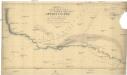
Podrobná mapa cest D.ra Holuba (čís. 1.) po střední části země východních Bamankvatův a západních Matabelův
1 : 500000 Botswana Holub, Emil nákladem J. Otty
Pays des Hottentots. Afrique 51.
1 : 1641836 Vandermaelen, Philippe, 1795-1869
Paris Evangelical Missionary Society. Zambesi Mission.

172. Central Africa Mining Region. The World Atlas.
1 : 2500000 USSR (Union of Soviet Socialist Republics).
Zuid-Afrikaansche Republiek, Oranje-Vrijstaat, Natal, enz
1 : 2500000 titelvariant: Kaart der Zuid-Afrikaansche Republiek, (Transvaal) Oranje-Vrijstaat, Natal enz; Annotatie: Omslagtitel: Kaart der Zuid-Afrikaansche Republiek, (Transvaal) Oranje-Vrijstaat, Natal enz. (met de spoorwegen); Annotatie geografische gegevens: Legenda Amsterdam : Seyffardt's Boekhandel / ([S.l. : Mij. voor photolithogr & zincographie, procédé mr. F.J. Asser])
Cazembes. Afrique 45.
1 : 1641836 Vandermaelen, Philippe, 1795-1869
Cape Colony.
1 : 3801600 Tallis, J. & F.
Haute Luapula secteur, Katanga district, Congo State (1906)
Map showing explorations and discoveries to June 1906, [...] Haute Luapula secteur, Katanga district, Congo State, TSGS 2354. Lithogravure of the Tanganyika Concessions (Mr Geo Grey's). Shows copper and tin mines. Great Britain. General Staff. Topographical Section. [London] : [TSGS, War Office]
Cape Province, Transvaal, &c. - eastern section.
1 : 2500000 John Bartholomew and Son
Kaart van de Zuid-Afrikaansche Republiek (Transvaal)
1 : 1500000 Den Haag : J. Smulders
Angola
1 : 500000 Angola jižní Ministério das colonias comissao de cartografia
International 1:1,000,000 Map
1 : 1000000 Geographical Section
Oranje-Freistaat, Kimberley, Colesberg, Dordrecht, Sterkstrom, u. s. w
1 : 800000 Afrika jižní Dietrich Reimer (Ernst Vohsen)
Ba-Souto mission area based on information provided by the missionaries of the Society of Evangelical Missions of Paris.