Cataloged map
Železniční a národopisná mapa Zemí koruny České a Rakouska-Uherska s vyznačením hranic diecésáních [sic] a obvodů obchodních komor


Full title:Železniční a národopisná mapa Zemí koruny České a Rakouska-Uherska s vyznačením hranic diecésáních [sic] a obvodů obchodních komor
Depicted:1904
Pubdate:1904
Publisher:F.B. Batovec
Physical Size:20 x 30 cm
Specielle Telegrafen- und Eisenbahnkarte von Böhmen
1875
Hollmann, Jos.
Sprachenkarte der Tschechoslovakien Republik.
1918
Sobota, Emil
Zeměznalecký přehled Čech, Moravy a částí Slezska
1855
Hollmann, Jos.

Tschechische Republik 2001. Schlesier (slezská národnost)
2001
Hofinger, Veronika
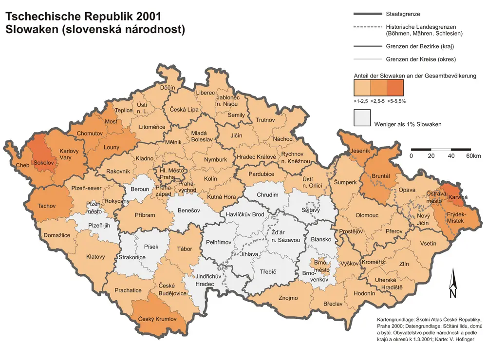
Tschechische Republik 2001. Slowaken (slovenská národnost)
2001
Hofinger, Veronika
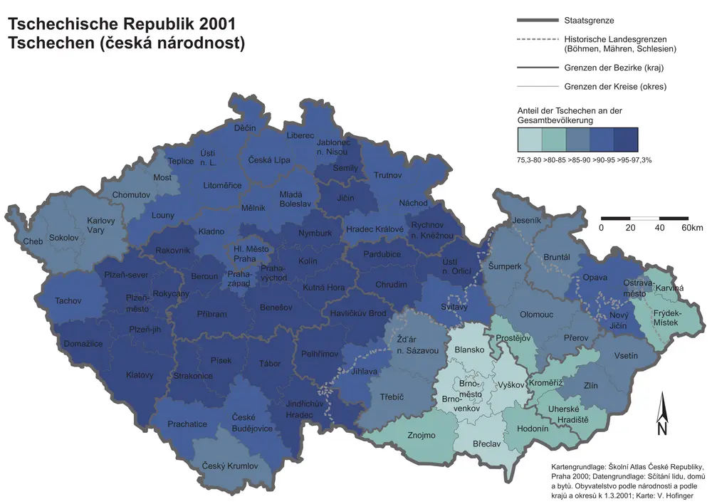
Tschechische Republik 2001. Tschechen (česká národnost)
2001
Hofinger, Veronika
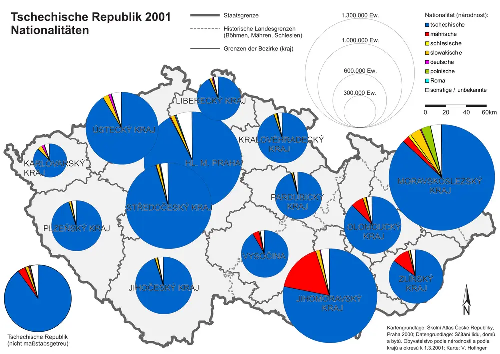
Tschechische Republik 2001. Nationalitäten
2001
Hofinger, Veronika
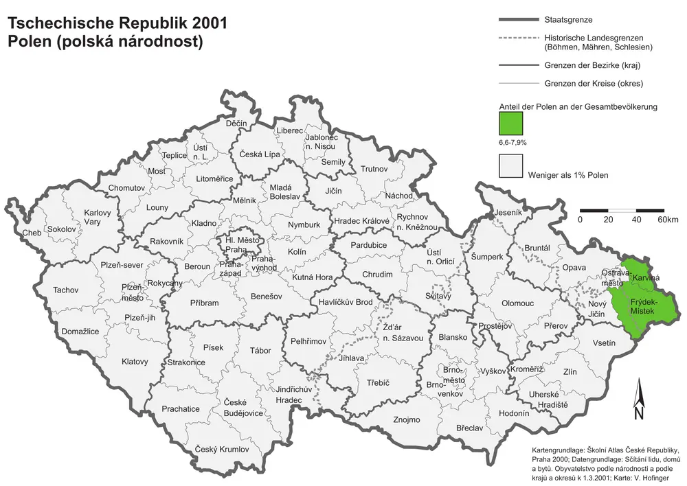
Tschechische Republik 2001. Polen (polská národnost)
2001
Hofinger, Veronika
Montanistische Geschäftskarte von Böhmen, Mähren und Öster. Schlesien
1840
Schmidt, Johann Ferdinand
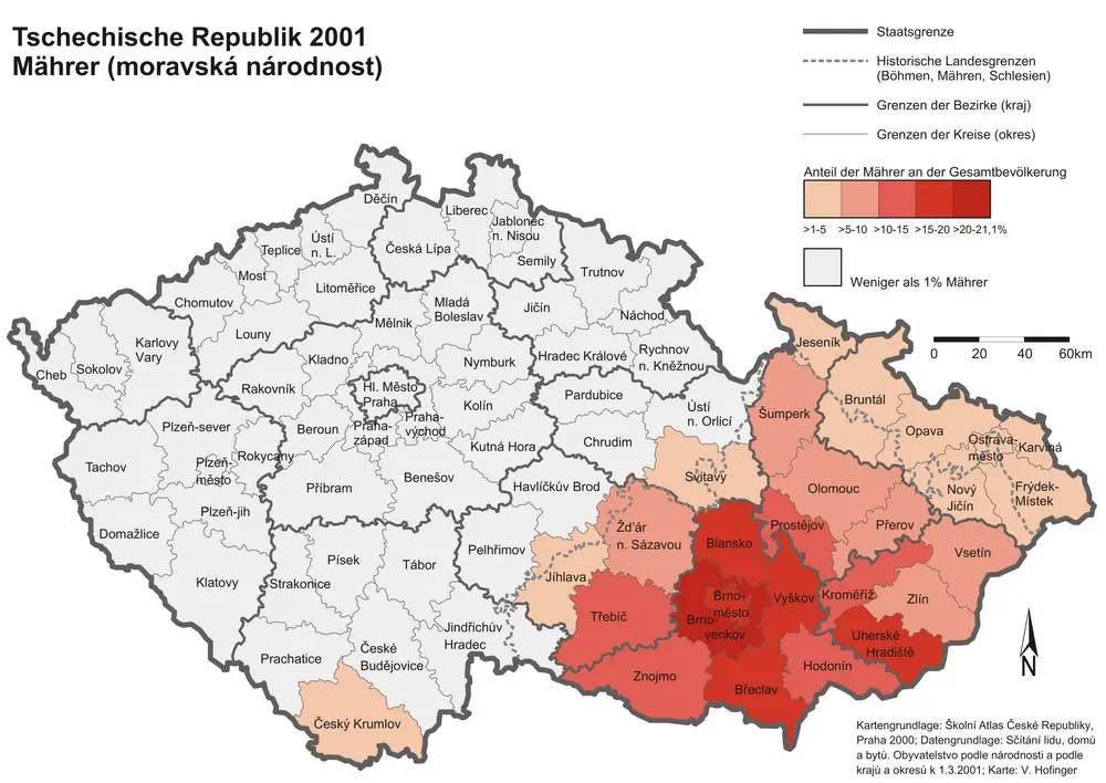
Tschechische Republik 2001. Mährer (moravská národnost)
2001
Hofinger, Veronika