Maps of Península Ibérica

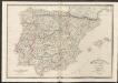
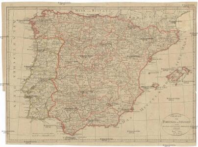
CHARTE von PORTUGAL u. SPANIEN
1 : 3150000 Portugalsko
Charte von Portugal u. Spanien
1 : 3150000 Portugalsko
Spain, Portugal and Andorra.
1 : 3576000 Hammond, C.S.
L'Espagne 756 a 1030.
1 : 4800000 Houze, Antoine Philippe
Spain and Portugal.
1 : 1900000 Schonberg & Co.
Spain and Portugal. Pergamon World Atlas.
Polish Army Topography Service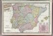
Spain and Portugal.
1 : 2930000 Rand McNally and Company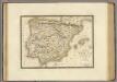
Espagne ancienne.
1 : 2700000 Brue, Adrien Hubert, 1786-1832
La Spagna e Portogallo
Portugalsko Zatta, Antonio A. Zatta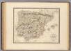
Espagne, Portugal.
1 : 2700000 Andriveau-Goujon, J.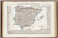
Regni di Spagna e Portogallo, e Repubblica di Andorra.
1 : 2850000 Marzolla, Benedetto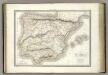
L'Iberie ou Espagne ancienne.
1 : 2500000 Lapie, M. (Pierre), 1779-1850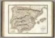
Espagne, Portugal.
1 : 2500000 Lapie, M. (Pierre), 1779-1850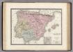
Espagne Ancienne.
1 : 3815000 Levasseur, E.
SPANIEN und PORTUGAL 1847
1 : 4440000 Madrid (Španělsko) Bornmüller, H. Bibliographisches Institut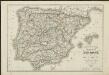
Carte routière des royaumes d'Espagne et de Portugal : réduite d'après la Carte itinéraire publiée par le Dépôt de la Guerre
1 : 1850000 par L. H. Berthe A Paris : Berthe
L'Espagne 1027 a 1212.
1 : 4800000 Houze, Antoine Philippe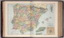
Spain and Portugal 20
1 : 2500000 Appleton, D. & Co.
Spain and Portugal.
1 : 3279000 Colton, G. Woolworth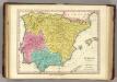
Hispania Antiqua. (1826)
1 : 4400000 Tanner, Henry S.
Spain and Portugal.
1 : 3000000 Tanner, Henry S.
Espagne et Portugal
1 Karte : Kupferdruck ; 31 x 42 cm Mentelle; Tardieu Mentelle
Carte des routes de postes et itinéraires d'Espagne et de Portugal
1 : 2440000 Portugalsko Lapie, Pierre Picquet, Ch. Artaria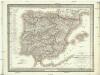
Carte des routes de postes et itinéraires d'Espagne et de Portugal
1 : 2440000 Portugalsko Picquet, Ch. Lapie, Pierre Artaria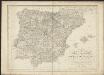
Karte von dem Iberischen Halb-Insellande, oder den Königreichen Spanien und Portugal
1 : 1500000 entworfen und in den Jahren 1826-1829 bearb. von Heinrich Berghaus gestochen von Heinrich Brose ; Schrift von Wilhelm Brose München : Cotta
Mapa de Espana
1 : 2000000 Kanárské ostrovy Instituto geográfico
Composite: Spanien, Portugal.
1 : 1800000 Theinert, A.
Espagne
1 Karte : Kupferdruck ; 31 x 41 cm Mentelle; Tardieu Mentelle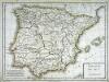
Hispanie Betique et Lusitanie
1 Karte : Kupferdruck ; 31 x 41 cm Mentelle; Tardieu Mentelle