Maps of Czech Republic
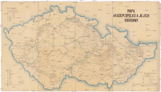
Mapa akadem. spolků a jejich knihovny
Česko Amler, J. Horák, F.
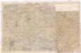
Protektorat Böhmen-Mähren
1 : 500000 Praha (Česko) Edvard Fastr
Mapa o stavu vozovek československých silnic
1 : 650000 Česko Autoklub RČS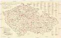
Mapa o stavu vozovek československých silnic
1 : 650000 Česko Autoklub R.Č.S.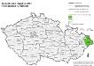
Tschechische Republik 2001. Polen (polská národnost)
Tschechische Republik ethnische Gruppe, Polen Hofinger, Veronika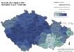
Tschechische Republik 2001. Tschechen (česká národnost)
Tschechische Republik ethnische Gruppe, Tschechen Hofinger, Veronika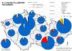
Tschechische Republik 2001. Nationalitäten
Tschechische Republik ethnische Gruppe Hofinger, Veronika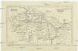
Čechy, Morava a Slezsko
Česko Wagner, Jan Eduard sklad Jaroslava Pospíšila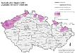
Tschechische Republik 2001. Deutsche (německá národnost)
Tschechische Republik ethnische Gruppe, Deutsche Hofinger, Veronika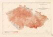
Isotermy v zemi České a Moravskoslezské
Grossdeutsches Reich Sudetenländer
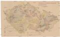
Mechanisch-physikalische Bodenkarte der Sudetenländer
1 : 750000 Česko Niethammer, A.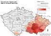
Tschechische Republik 2001. Mährer (moravská národnost)
Tschechische Republik ethnische Gruppe, Mährisch Hofinger, Veronika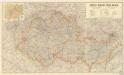
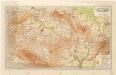
Čechy - Morava Příruční a cestovní mapa
Přehled sokolských jednot českoslovanských v roce 1886
Česko Scheiner, Josef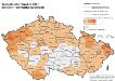
Tschechische Republik 2001. Slowaken (slovenská národnost)
Tschechische Republik ethnische Gruppe, Slowaken Hofinger, Veronika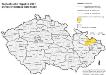
Tschechische Republik 2001. Schlesier (slezská národnost)
Tschechische Republik ethnische Gruppe, Schlesier Hofinger, Veronika
Isotermy v zemi České a Moravskoslezské
Montanistische Geschäftskarte von Böhmen, Mähren und Öster. Schlesien
1 : 650000 Česko Schmidt, Johann Ferdinand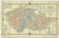
Montanistische Geschäftskarte von Böhmen, Mähren und Öster. Schlesien
1 : 660000 Česko Schmidt, Johann Friedrich Julius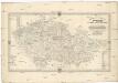
Montanistische Geschäftskarte von Böhmen, Mähren und Öster. Schlesien
1 : 650000 Česko Schmidt, Johann Ferdinand Taafe, Ludvík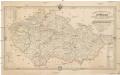
Montanistische Geschäftskarte von Böhmen, Mähren und Öster. Schlesien
Česko Schmidt, Johann Ferdinand Taafe, Ludvík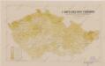
Sbírka map a diagramů použitých na mírových konferencích v Paříži v letech 1919 - 1920
[Protektorát Čechy a Morava]
1 : 400000 Protektorát Čechy a Morava Machát, František
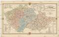
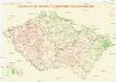
Vilímkovy místopisné mapy zemí Koruny České
Mapa relativních přebytků a nedostatků normálních srážek
Česko Státní ústav hydrologický T. G. Masaryka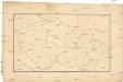
[Slepá mapa Česka]
1 : 752000 Česko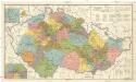
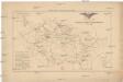
Česká obec sokolská před vzplanutím světové války v r. 1914
1 : 170000 Dolní Rakousko (Rakousko) Musil, Ladislav V. Neubert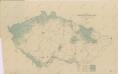
Mapa poněmčování zemí koruny České