Maps of Pontic Steppe

Imperii Romani distracta
1 : 55500000 Asie západní Bonne, Rigobert André
Imperii Romani.
1 : 9850000 Vivien de St Martin, L.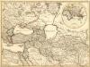
Theatrum Historicum :
1 : 8500000 Mollova mapová sbírka Delisle, Guillaume Desrosiers, F. L'Isle, Guillaume de
Evropa, 4
1 Blatt : 50 x 57 cm Homännische Erben
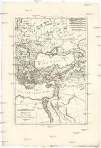
Orbis Romani Pars Orientalis.
1 : 10137600 Lucas, Fielding Jr.
Orbis Romani, pars orientalis.
1 : 4300000 Anville, Jean Baptiste Bourguignon d, 1697-1782
Der orientalische Kriegsschauplatz aus der Vogelschau
Tableau historique de l'Empire d'Oriens.
1 : 18500000 Duval, Henri
Imperium Romanum
1 : 11300000 Evropa východní Bonne, Rigobert André
Turkey, in Europe and Hungary, from the best authorities.
from Carey's general atlas, improved and enlarged : being a collection of maps of the world and quarters, their principal empires, kingdoms, &c.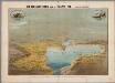
Het oorlogsterrein aan de Zwarte Zee : (vogelperspectief)
Annotatie: Onder de kaart: De toeschouwer stelle zich geplaatst te zijn 300 k.m. boven den Hellespont met het gezicht naar het Noord-Oosten Arnhem : Van Egmond & Heuvelink
Turcia Asiatica : exhibens Natoliam modernam, in suos beglirbegatus divisam, itemque reliquos beglirbegatus, sive gubernationes et Prœfecturas generales, in regionibus Georgiæ, Armeniæ, Mespotamiæ, Syriæ et Arabiæ sitos, una cum Mari Nigro, Mari Azowiensi, Mari di Marmora, et Mari Ægeo, atque adiacentibus Insulis : C. P. S. C. M. = Carte de la Turquie asiatique contenant la Natolie moderne divisée en les beglerbeys &
1 : 4800000 Homann Erben (Firm) Homannianorum Heredum
[Ethnographische Karte von Europa]
Zweiter Band, enthaltend in vier Abtheilungen die Vertheilung der Organismen: 5. Pflanzen-Geographie, 6. Thier-Geographie, 7. Anthropographie, 8. Ethnographie Humboldt, Alexander von Verlag von Justus Perthes
Říše turecká
1 : 5000000 Asie jihozápadní V. Neubert
Střední Evropa a Přední Asie za časů III. války křížové

[Des Mittelländischen Meeres öestliches Blatt. Zur Uebersicht des Türkischen Reichs und als Pecial-Karte der Asiatischen u. Afrikanischen Türkey]
Stieler's Hand-Atlas Stieler, Adolf bei Justus Perthes
Tableau l'historie de l'Empire des Califes et de l'Empire de Turquie.
1 : 20000000 Duval, Henri
Carte générale des provinces européennes et asiatiques de l'Empire Ottoman, uit: Carte générale des provinces européennes et asiatiques de l'Empire Ottoman (sans l'Arabie) / dressée par Henri Kiepert ; le trait et la lettre gravés chez L. Kraatz ; le figure du terrain gravé par J. Sulzer
1 : 3000000 Annotatie: Op omslag ook: Deuxième édition entièrement corrigée et augmentée d'un index alphabétique (quatrième édition de la 'Carte générale de l'Empire Ottoman en Europe et en Asie'); Met: Index alfabétique. - 40 p; Annotatie geografische gegevens: Legenda Johann Samuel Heinrich Kiepert 1818-1899; Leopold Kraatz; J. Sulzer Berlin : Dietrich Reimer (Hoefer u. Vohsen) / ([S.l. : L. Kraatz])
Europe 3.
1 : 2800000 Anville, Jean Baptiste Bourguignon d, 1697-1782
Orbis Romani, orientalis.
1 : 11500000 Anville, Jean Baptiste Bourguignon d, 1697-1782; M'Dermut, Robert
Das osmannische Reich, XVIIten Jahrhundert.
1 : 9200000 Spruner von Merz, Karl
Das Osmanische Reich nebst seinen Schutzstaaten nach seiner grössten Ausdehnung 1682
Osmanisches Reich
Das Osmanische Reich nebst seinen Schutzstaaten nach seiner grössten Ausdehnung 1682
Osmanisches Reich
Turquia asiàtica / Ramon Alabern lo grabó
1 mapa. Datat al 1850 aproximadament. Alaber, Ramon
[Recto], uit: Midden-Oosten (Nabije-Oosten) / [aardrijksk. medew. G.J. de Vries]
1 : 13700000 Annotatie: Verso: namen van de landen van het Midden-oosten met aanduiding van de oppervlakte en het aantal inwoners,de hoofdsteden met vermelding van het het aantal inwoners, en informatie over het Suezkanaal; Annotatie geografische gegevens: Inzet: Suez Kanaal Gerben Johannes de Vries 1886-1968 Sneek : Tonnema
Übersichts - Karte des Türkischen Reichs in Europa und Asien
A new map of Turky in Europe and parts adjoyning shewing their principal divisions and chief cities, towns, rivers, mountains &c.
from A new sett of maps both of antient and present geography : wherein not only the latitude and longitude of many places are corrected according to the latest observations, but also the most remarkable differences of antient and present geography may be quickly discern'd by a bare inspection or comparing of correspondent maps, which seems to be the most natural and easy method to lead young students (for whose use the work is principally intended) unto a competent knowledge of the geographical science : together with a geographical treatise particularly adapted to the use and design of these maps / by Edward Wells, M.A. and student of Christ-Church, Oxon.
Europa befolkningskarta

Südeuropa
1 : 2500000 Blízký východ Gea Verlag