Maps of Metropolitan France
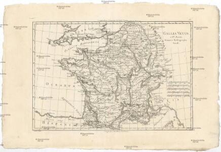
Gallia vetus
1 : 4630000 Galie Bonne, Rigobert André
Carte de France
1 : 2060000 Francie Dezauche, Jean-André Delisle, Guillaume Dezauche

Post-Charte von Frankreich mit Bezeichnung aller neuen Strassen
1 : 2100000 Francie im Verlage des geograph. Instituts
France Provinces en 1789
Vidal de La Blache, Paul
France relief du sol
Vidal de La Blache, Paul
France Chemins de Fer Principales lignes de navigation
Vidal de La Blache, Paul
France Villes
Vidal de La Blache, Paul
Tres nouvelle carte du royaume de France
1 Karte : Kupferdruck ; 43 x 55 cm Cassini de Thury; Rizzi-Zannoni; Dorn Homännische Erben
France Villes
Vidal de La Blache, Paul
France relief du sol
Vidal de La Blache, Paul
France cours d'eau
Vidal de La Blache, Paul
France divisions militaires
Vidal de La Blache, Paul
Frankreich, mit besonderen Rücksicht auf die Unebenheiten
1 : 2000000 Francie Berghaus, Heinrich Karl Wilhelm Brose, Heinrich Simon Schropp
Regni Galliae seu Franciae et Navarrae...

France Chemins de Fer Principales lignes de navigation
Vidal de La Blache, Paul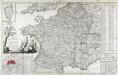
Carte routière de la France
1 Karte auf 2 Blättern : Kupferdruck ; 56 x 76 cm, Bildgrösse 56 x 90 cm Basset; Chaumier chez Basset rue St. Jacques au coin de celle des Mathurins
France, departments.
1 : 4500000 Tanner, Henry S.
France cours d'eau
Vidal de La Blache, Paul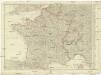
[Francie]
1 : 2100000 Francie Müller, Franz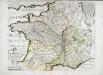
Carte des rivieres de la France
1 Karte : Kupferdruck ; 41 x 51 cm Sanson; Mariette chez P. Mariette rue Sainct Iacques a l'Esperance
Le royaume de France et les conquetes de Louis de Grand
1 : 3100000 Alžír (Alžírsko) Steinberger, Johann Christoph Wolf, Jeremias Ieremias Wolf
Le royaume de France et les conquetes de Louis de Grand
1 : 3100000 Francie Inselin, Charles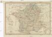
CHARTE von FRANKREICH
Elba (Itálie)
Carte de la France
1 : 3200000 Francie Poirson Jean M.d d'Estampes
Gallia antiqua exaevi Romani monumentis eruta et serenissimi Carnutum ducis
1 : 2500000 Francie Anville, Jean-Baptiste Bourguinon d' Bek., I. Officina Weigelio-Schneideriana
Carte physique et routiere de la France, de la Suisse.
1 : 2000000 Brue, Adrien Hubert, 1786-1832
Galliae seu Franciae tabula
1 : 2500000 Francie Visscher, Nicolaus per Nicolaum Visscher
Galliae veteris typus
Francie Hondius, Jodocus Judocus Hondius