Maps of Netherlands
[Nizozemsko]
Nizozemsko
Descriptio Frisiae sub Francorum reditum qua hodie VII Foederator est
1 : 550000 Mollova mapová sbírka Alting, Menso
Holland.
1 : 1300000 Lucas, Fielding Jr.
Charte des Königreichs Holland
1 : 650000 Nizozemsko Stieler, Adolf Streit, Friedrich Wilhelm
Charte des Königreichs Holland
1 : 650000 Nizozemsko Stieler, Adolf Streit, Friedrich Wilhelm
Charte des Königreichs Holland
1 : 650000 Nizozemsko Stieler, Adolf Streit, Friedrich Wilhelm
CHARTE des KÖNIGREICHS HOLLAND
1 : 640000 Nizozemsko Stieler, Adolf Streit, Friedrich Wilhelm
Charte des Königreichs Holland
1 : 650000 Nizozemsko Stieler, Adolf Streit, Friedrich Wilhelm
Charte des Königreichs Holland
1 : 650000 Nizozemsko Stieler, Adolf Streit, Friedrich Wilhelm
Descriptio Frisiae sub Francorum reditum qua hodie VII Foederator. est
1 : 950000 auctore Mensone Alting Ger. de Broen fec. Amstel. [Amstelaedami] : [apud Henricum Wetstenium]
Carte des sept provinces unies des Pays-Bas connues sous le nom général de Hollande
1 : 700000 dressée par Hérisson ... A Paris : chez Basset
Nieuwe aardrykskundige kaart van het Koningryk Holland in deszelfs geheel grondgebied met het voormalig Oost-Friesland, Jeverland, Kniphuisen en Varel
1 : 700000 naar de jongste Staats-verdragen door Jacob de Gelder A Zürcher sculp. Te Amsterdam : by Johs. Allart en Jacs. Ruis
Holland.
1 : 1457280 Lucas, Fielding Jr.
Nouvelle carte des departements de Hollande et des départemens circonvoisins de l'Empire Francais = Nieuwe kaart der departementen van Holland, en die der omliggende van het Fransche keizerrijk
1 : 760000 W.C. van Baarsel del. et sc. A Amsterdam : chez E. Maaskamp
Descriptio Agri Frisii antiqui aliorumque trans Rhenum qui hodie sunt in dicione VII Foederatorum
1 : 700000 auctore Mensone Alting. [Amstelaedami] : [apud Henricum Wetstenium]
5me [Driehoeksnet], uit: Nouvelle carte de la Hollande, d'après Kraijenhoff et les meilleures cartes connues / Établissement Géographique de Bruxelles, fondé par Ph. Vander Maelen
1 : 117000 Annotatie: De bladen zijn genummerd 1-24. De bladen 2 t/m 24 hebben elk een afzonderlijke titel. Blad 5 bevat: Triangulations et positions. Blad 9 bevat: Plan d'Amsterdam; De kaartbladen 1, 5, 9 en 24 zijn niet ingekleurd; Van kaartblad 24 is een extra (ingekleurd) exempl. aanwezig; Annotatie geografische gegevens: 2 schaalstokken: 5 Echelle de 5 lieues de 20 au degré ... (= 23,2 cm) en 7380 Echelle de 5 lieues de 20 au degré ... (= 23,2 cm); Legenda; Met indexkaart: Carte d'assemblage Philippe Marie Guillaume Vander Maelen 1795-1869; Établissement Géographique de Bruxelles Bruxelles : Établissement Géographique
United Provinces.
1 : 590000 Cary, John, ca. 1754-1835

Caerte vande VEREENICHDE NEDERlanden
1 : 720000 Belgie Visscher, Claes Jansz. gedruckt by Claes Ianß Visscher inde Calverstraet inde Visscher
Caerte vande Vereenichde Nederlanden
1 : 750000 Mollova mapová sbírka Visscher, Claes Janszoon
Holland.
1 : 1300000 Darton, William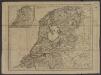
[ République Batave]
1 : 750000 Tardieu, Jean Baptiste Pierre 1746-1816 [Paris] : [Edme Mentelle
Belgium foederatum
1 : 650000 Belgie Marianus, Joseph
Belgii pars septentrionalis communi nomine vulgo Hollandia nuncupata continens statum potentissimae Batavorum reipublicae sev provincias VII foederatas
1 : 630000 Belgie Homann, Johann Baptist exhibente Io. Baptista Homanno
Belgii pars septentrionalis communi nomine vulgo Hollandia nuncupata continens statum potentissimae Batavorum reipublicae sev provincias VII foederatas
1 : 630000 Belgie Homann, Johann Baptist exhibente Io. Baptista Homanno
Provincie Vnite De Paesi Bassi
1 : 780000 Mollova mapová sbírka Sanson, Nicolas De Rossi, Giovanni Giacomo
Carte de la Hollande comprenant le Limbourg Hollandais et le Gd. Duché de Luxembourg.
1 : 450000 [Bruxelles] : Etablissement Géographique, fondé par Ph. Vandermaelen
Charte der Hollaendischen départemens
Nizozemsko Kipferling, Karl Joseph Krayenhoff, Cornelius Rudolphus Theodorus J. Riedl's Kunsthandung
Charte der Hollaendischen départemens
Nizozemsko Krayenhoff, Cornelius Rudolphus Theodorus Verlage des Kunst und Industrie
![[Nizozemsko]](https://images-2.georeferencer.com/images/iiif/329163913114/full/,300/0/native.jpg)

