Maps of Czech Republic

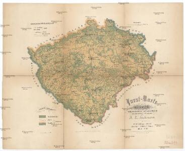
Forst-Karte von Bohmen
1 : 880000 Čechy (Česko) Hickmann, Anton L. Stumper, Č. Heinrich Mercy
Mapa výšek s vrstvami království Českého

Uibersichts-Karte der Rübenzuckerfabricken in Böhmen
1 : 910000 Česko Friedrich, Ernst Koráb, Emil
Uebersichts-Karte der Rübenzucker-Production im Königreiche Böhmen
Evropa Bernat, Josef Statist. úřad pro království České
Karte über den industriellen Betrieb mit Metallen im Königreiche Böhmen
1 : 840000 Česko Hickmann, Anton L. Heinrich Mercy
Karte über den industriellen Betrieb mit Nicht-metallischen-Mineralien so wie über das Fluss-Strassen-Eisenbahn & Telegrafennetz des Königreiches Böhmen
1 : 840000 Česko Hickmann, Anton L. Heinrich Mercy
Karte über die Leinen-Waaren-Jndustrie im Königreiche Böhmen
1 : 840000 Česko Hickmann, Anton L. Heinrich Mercy
Königreich Böhmen
1 : 1300000 Česko Carl André
Königreich Böhmen
1 : 1300000 Česko Carl Andre
Cestovní mapa království Českého

Národnostní mapka království Českého dle politických a soudních okresů 1910
Čechy (Česko) Schmidt, Eduard Steyrer, Fr. C. Národní rada česká
Sprachenkarte von Böhmen
1 : 500000 Nová Bystřice-oblast (Česko) Rauchberg, Heinrich R. Lechner (Wilh. Müller)
Karten zur Statistik des Königreiches Böhmen
Bez titulu: Soubor statistických map Čech

Uibersichts Post und Strassen-Karte des Königreichs Böhmen

Böhmen
Čechy (Česko) Trausel, W. Steyrer, Fr. C.
Koenigreich Boehmen
1 : 360000 Čechy (Česko) Kummersberg, Carl von Schönfelder z Feuersfeldu, František Carl Ritter von Kummersberg
Schulkarte des Königreiches Böhmen
Česko F. Fischer
Uebersichts-Karte über die Verbreitung der Spar- und Darlehenscassen-Vereine, landw. Lagerhäuser, und Molkerei-Genossenschaften im deutschen Sprachgebiete Böhmens
Sudety (Česko) A. Haase
Vodopisná mapka Čech
1 : 902000 Česko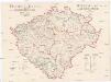
Fischerei-Karte des Königreiches Böhmen
České království Frič, Antonín Subvention des Landtages und des Comités für Landesdurchforschung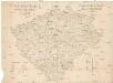
Fischerei-Karte des Königreiches Böhmen
Česko Frič, Antonín vydána pomocí sl. sněmu a komitétu pro výzkum Čech
Železniční a silniční mapa Království Českého
1 : 525000 Česko Wagner, Jan Eduard F. Kytka
Národnostní mapa Království českého
Čechy (Česko) Waraus, E. Wagner, Jan Eduard F. Kytka
Karte des oesterreichischen Kronlandes Böhmen
Čechy (Česko) Adam, Jakob Friedr. Kretzschmar
Karte des oesterreichischen Kronlandes Böhmen
Čechy (Česko) Fils Kretzschmar, Friedrich Friedr. Kretzschmar
Karte des Königreiches Böhmen

Mapa příruční Království českého
1 : 600000 Česko Kocen, Blaž Erben, Josef sklad Eduarda Hölzela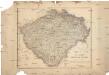
Mapa příruční Království českého
1 : 600000 Čechy (Česko) Kocen, Blaž Erben, Josef sklad Eduarda Hölzela