Maps of Central Serbia

Maps of Central Serbia

$title$

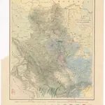
Carte d'une partie de la Servie et de l'Albanie

1 : 800000 Albánie Lapie, Pierre Schwaerzlé, J. Société géologique de France
$title$

La triangulation trigonometrique de I ere classe

1 : 1500000 Srbsko Bošković, S. P. L'institut Géographique de l'Armée
$title$

Serbisch-Österreichisch-Ungarische Grenzländer

1 : 864000 Serbien Grenze
$title$

Theatre de la Guerre dans le Royaume de Servie en Originale

Mollova mapová sbírka Weingartner, Johann Heckenauer, August Ferdinand
$title$

Serbisch-österreichisch-Ungarische Grenzländer

1 : 864000 Albánie Peucker, Karl Scheda, Joseph von Artaria
$title$

Das Königreich Bosnien, und die Herzegovina (Rama)

Bosnien, Herzegowina
$title$

Serbien und Montenegro

1 : 600000 Srbsko Carl Flemming
$title$

G. Freytags Karte von Serbien

1 : 600000 Albánie Freytag, Gustav G. Freytag & Berndt
$title$

G. Freytags Karte von Serbien

1 : 600000 Srbsko Freytag, Gustav G. Freytag & Berndt
$title$

Serbien und Montenegro

1 : 1000000 Srbsko von Velhagen & Klasing
$title$

Karte von Serbien

$title$

Südöstlicher Kriegsschauplatz. Serbien

1 : 5000000 Serbien Weltkrieg <1914-1918>
$title$

Territoriale Entwicklung Serbiens seit 1815

Serbien
$title$

Serbien und Montenegro

1 : 600000 Srbsko Handtke, Friedrich Carl Flemming
$title$

Sheet XIX: Karte Des Oesterreichischen Kaiserstaates.

1 : 576000 Scheda, Josef
$title$

Geologishe Übersichtskarte der Österreichischen Monarchie...

$title$

Zemljepis od Serbije

1 : 822000 Srbsko Nipočić, Vasilij u c. k. Politechničeskoj inščotugu
$title$

Das Sandschak Novi Bazar, Nord-Albanien, Neu-Serbien u[nd] Montenegro

1 : 864000 Albánie Steinhauser, Anton Artaria
$title$

La Serbie de 1913

Serbien Geschichte
$title$

Bevölkerungsdichte 1900 (administrative Gliederung von 1902)

Serbien Bevölkerungsdichte
$title$

[Balkánský poloostrov]

balkánské země
$title$

Serbien

1 : 800000 Srbsko Kiepert, Heinrich Bugarski Geographisches Institut
$title$

Administrative Gliederung Serbiens in Kreise und Bezirke 1902

Serbien Verwaltungsgliederung
$title$

Administrative Gliederung Serbiens in Kreise und Bezirke 1890 (1891)

Serbien Verwaltungsgliederung
$title$

Strassen- und Eisenbahnkarte des oesterreichischen Kaiserthumes

1 : 864000 Blatt 15 Schaller, G. K.K. Militärisch-Geografisches Institut, Karten-Evidenthaltungs-Abteilung
$title$

$title$

Servia

Mollova mapová sbírka Hoffmann, Johannes Hoffmann, Johann
$title$

G. Freytags Karte des nördlichen Serbien

1 : 600000 Bosna a Hercegovina Freytag, Gustav G. Freytag & Berndt
$title$

Rascien

1 : 800000 Sandschak Novi Pazar , Kosovo
$title$

Veles, Priština, Scutari

1 : 750000 Priština (Kosovo) Konrad, A. Erben, Fr. K. u. k. Militärgeographisches Institut
© MapTiler © OpenStreetMap contributors
How does it work?
These instructions will show you how to find historical maps online.
Getting started
Type the place name in the search box to find the exact location. You can further adjust the search by zooming in and out.
Zoom
Zoom in and out with the buttons or use your mouse or touchpad natively.
Exact Area tool
Click here and draw a rectangle over the map to precisely define the search area.
Set filters
Narrow your search with advanced settings, such as Years (from/to), Fulltext, Publisher, etc.
Results
See the results of your search on the right side. You can scroll down to find more maps of this location.
?

Download OldMapsOnline Mobile