Maps of Caucasus Mountains
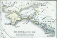
Uebersichts-Karte des russisch-türkischen Kriegsschauplatzes
Kavkaz-oblast Ludwig, J. von J. Ludwig und A. Zang
Charte der Laender am Caucasus
1 : 2100000 Kavkaz (pohoří : oblast) Reinecke, Johann Christoph Matthias
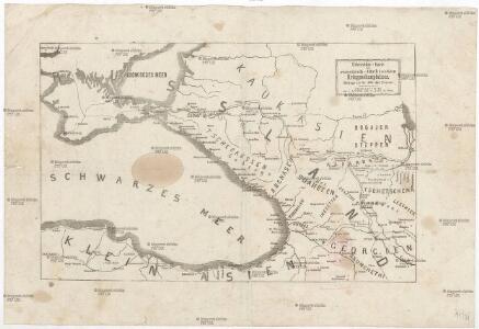
CHARTE der LAENDER AM CAUCASUS
1 : 2100000 Kavkaz-oblast Reinecke, Johann Christoph Matthias
Oorlogskaart van Turkije, Zuid-Rusland en grenslanden
1 : 2250000 Annotatie: Westelijk deel van de kaart ontbreekt Amsterdam : Seyffardt

Feuille 34 (F V), uit: Carte géologique internationale de l'Europe : la carte, votée au congrès géologique international de Bologne en 1881, est exécutée conformément aux décisions d'une commission internationale, avec le concours des gouvernements, sous le dir. de M.M. Beyrich et Hauchecorne
Annotatie: Blad 48 gamme des couleurs; blad 49: bladwijzer en titelblad Heinrich Ernst Beyrich 1815-1896; Wi. Hauchecorne Berlin : Reimer / (Berlin: Institut lithographique)
Die Völker des Kaukasus u.s.w. / gezeichnet u. gestochen in der geogr. Kunstschule zu Potsdam
1 : 2900000 1 Karte : Kupferdruck ; 31 x 39 cm Berghaus, Heinrich Karl Wilhelm J. Perthes
Karta teatra vojny s Turcieju
1 : 350000 1 Karte : mehrfarbig ; 56 x 80 cm Kartograf. zavod A. Ilʹina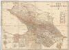
Karta Kavkazskago kraja
1 : 1080000 Baku (Ázerbájdžán) izdanie Kartografičeskago zavedenija A. Il'jina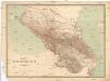
Karta Kavkazskago kraja
1 : 1080000 Kavkaz (pohoří : oblast) Kartografičeskago zavedenija A. Il'jina
Charte der Laender am Caucasus
1 : 2700000 Kavkaz-oblast Reinecke, Johann Christoph Matthias im Verlage des Geograph. Institut
Charte der Laender am Caucasus
1 : 2700000 Kavkaz-oblast Reinecke, Johann Christoph Matthias Geograph. Institut
Sbornyje list 5-ti verstnoj karty Kavkaza
1 : 1778000 Kavkaz (pohoří : oblast)
Geographisch historische Karte des Kriegsschauplatzes in Asien in den Jahren 1828 u. 1829
Asie Ehrenkreutz, Br. von Biergans, R. von C. V. Sommerlatt
K dějstvījam Černomorskago flota i Dunajskoj flotilīi 1806 - 1812 gg.
Schwarzes Meer Seeschlacht
Die Volker des Kaukasus U.S.W.
1 : 3000000 Berghaus, Heinrich
Charte der Laender am Caucasus
1 : 2200000 Kavkaz-oblast Reinecke, Johann Christoph Matthias
Charte der Laender am Caucasus
1 : 2200000 Kavkaz-oblast Reinecke, Johann Christoph Matthias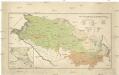
Mapa ruské národnosti na severním Kavkazsku
1 : 1080000 Kavkaz-oblast Chotek, Karel Česká společnost zeměvědná
Ice Chart Black Sea, January, February.
U.S. Navy
Black Sea, Index Chart for Ice Data Tables.
U.S. Navy
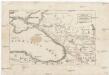
Karta Černago morja
Schwarzes Meer
Karte des Maeotischen Sees und des Pontus Euxinus
1 : 5200000 Azovské moře-oblast (Ukrajina a Rusko) Barbié du Bocage, Jean Denis Anville, Jean-Baptiste Bourguinon d'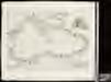
Pontus Euxinus of Niewe en naaukeurige paskaart van de Zwarte Zee / uyt verscheydene stucken van die
1 : 2100000 1 Karte : Kupferdruck ; 40 x 58 cm Ottens, Reinier apud R. & I. Ottens
[Östl. Schwarzmeerküste]
1 : 1500000 Osmanisches Reich, Mingrelien
Die Haefen des Schwarzes Meeres an der asiatischen Küste
Asie západní Flemming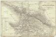
Carte des possessions russes au-dela du Caucase et des provinces turques limitrophes
1 : 1700000 Kavkaz-oblast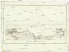
Plan des nivellirten Landstrichs zwischen dem schwarzen und caspischen Meere
1 : 1760000 Kaspické moře-oblast Reisen, E. Ramberg, F.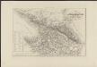
Carte des possessions russes au-delà du Caucase indiquant les frontières actuelles de la Russie, de la Turquie et de la Perse, dressée sur des documents officiels
1 : 750000 gravé sur pierre [par Alex. Zakrzewski] Imp. Lith. de Thierry Paris : A. Leneveu