Maps of Czech Republic
Mapa zemí Koruny české
Česko Kolisko, Hugo Theodor Schwihlik, F.
Mapa zemí Koruny české
Česko Kolisko, Hugo Theodor Schwihlik, F. Julius Grégr
Mapa zemí Koruny české
Česko Kolisko, Hugo Theodor Schwihlik, F.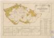
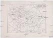
Přehled sokolských jednot česko-moravských počátkem července 1869
Bez titulu: Slepá mapa horstev Čech a Moravy
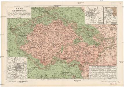
Mapa zemí koruny České
Země Koruny české
země Koruny české Hercík, Emanuel Mikuláš & Knapp
Älteres Neolithikum
Böhmen, Mähren, Archäologie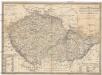
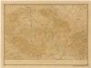
Karte vom Königreich Boehmen der Markgraschaft Maehren und des Herzogthumes Schlesien
1 : 980000 Česko Fried, Franz Artaria
Karte vom Königreiche Boehmen der Markgrafschaft Maehren und des Herzogthumes Schlesien
1 : 991000 Česko Fried, Franz Artaria und Compag.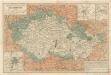
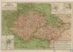
Železniční a národopisná mapka zemí koruny české

Carte de la Boheme, et de la Moravie
1 : 1200000 Česko Mentelle, Edme Tardieu, Pierre François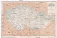
Železniční mapka zemí koruny české [sic]
země Koruny české F.B. Batovec
Äneolithikum
Böhmen, Mähren, Archäologie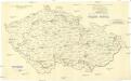
[Andere Metalle]
1 : 750000 Protektorát Čechy a Morava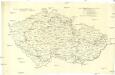
Administrative Gliederung der Sudetenländer 1930
1 : 750000 Protektorát Čechy a Morava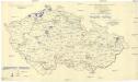
[Andere Metalle]
1 : 750000 Protektorát Čechy a Morava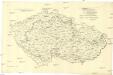
[Eisen- und Stahlindustrie]
1 : 750000 Protektorát Čechy a Morava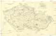
[Eisen- und Stahlindustrie]
1 : 750000 Protektorát Čechy a Morava
Železniční a národopisná mapka zemí koruny České a Rakouska-Uherska s vyznačením diecésáních hranic...

Čechy, Morava a Slezsko též i země pohraničné [sic]
Česko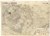
Böhmen und Mähren
1 : 750000 Česko
Jüngeres Neolithikum
Böhmen, Mähren, Archäologie
Äneolithikum
Böhmen, Mähren, Archäologie
Administrative Gliederung der Sudetenländer 1930
1 : 625000 Protektorát Čechy a Morava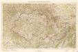
Übersichtskarte des Protektorats Böhmen und Mähren

Erste Hälfte des 1. Jahrtausends n. Chr.
Böhmen, Mähren, Archäologie
Železniční a národopisná mapa Zemí koruny České a Rakouska-Uherska s vyznačením hranic diecésáních [sic] a obvodů obchodních komor
Česko Schnizer, E. von Jungmann, Carl F.B. Batovec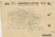
Übersichtskarte von Böhmen, Mähren und Schlesien